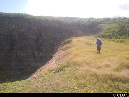
Marie-Galante cliff 'trace'
8 points of interest
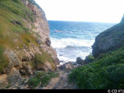
Anse Piton - CD971  Viewpoint
Anse Piton
Anse Piton offers a first open view of the ocean.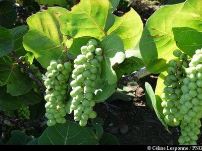
raisinier bord de mer - PNG  Flora
FloraGrove of seagrapes
The seagrape Coccoloba uvifera is prolific among the plants around the Anse Piton.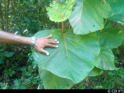
Raisinier grandes feuilles - CD971 FloraBig-leaf seagrape
The big-leaf seagrape Coccoloba pubescens, of which the diameter of the leaves can reach more than 40 cm, is a close relative of the seagrape. It is characteristic of the dry coastal forests.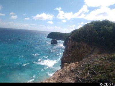
Vue sur la Pointe Saragot et le rocher la Frégate - CD971 ViewpointAnse Chapelle
Anse Chapel offers a panoramic view over Pointe Cavalle to the north and Pointe Saragot to the south.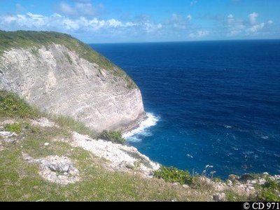
Vue sur la Pointe Pisiou - CD971 ViewpointAnse Raquette
Anse Raquette is bordered on the north by the promontory of Pointe Pisiou.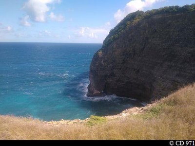
Vue sur la Pointe Abraham depuis l'Anse Ballet - CD971 ViewpointAnse Ballet
Panoramic view of the Désirade (in clear weather), the sea and Pointe Abraham.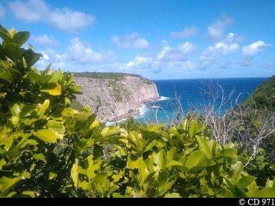
Vue sur la Grosse Pointe depuis l'Anse Bois d'Inde - CD971 ViewpointAnse Bois d'Inde
View over Anse Bois d'Inde, flanked by Grosse Pointe and the Pointe à Nègre.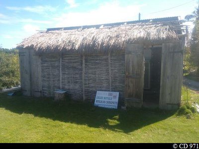
Case en gaulette - CD971  Cultural and architectural heritage
Case en gaulette
The survival of a typical dwelling in rural areas.
Here the 'case' has been converted for the sale of local produce.
Description
Carry on, taking the path through the sugar cane fields (Point 1) and join the D201; follow this to the right for 150 m. Leave the road (Point 2) for a path to the left which crosses a field of cane. Take a path carved into the limestone, on the left; it turns and drops sharply into a ravine. Continue straight on until you reach a junction.
Turn left (Point 3) on a trail which winds through the forest (notice the red gum and Savonnette trees) and reach an intersection with the East Coast trail.
Turn left (Point 4) and reach Anse Piton. To the left, the trail goes back up a ravine (be careful, steep path). Then continue straight on, along a track through a forest of acacias.
The path opens on to a meadow (Point 5): turn your back to the meadow by taking a right-angled turn to the right and take the path which climbs through the undergrowth for a few metres then, keeping the same direction, crosses the meadows and the savannah (notice a pond and the hollow tower of a ruined mill). Reach a junction on a bend beside the Pointe Cavalle. Fork right (Point 6). At Anse Raquette, bear right to go along the coast. The path turns sharply to the left (copses), then passes a pool on the left.
Turn right (Point 7) and walk along the fields for 400 m. Descend to Anse Ballet (viewpoint; do not go near the edge). Go down the valley on the left, taking a stony trail through the undergrowth, and turn right in the ravine. The trail climbs back up on the opposite side (steep slope). At the junction (Point 8), turn right in the direction of Anse Bois d'Inde. Continue along the coastline to the path which leads to Caye Plate. At the parking area, go straight on.
When you reach the crossing for Anse du Coq; take the path on the left and return to the road.
Follow this to the right, passing the des Coqs residences, then reach the Chapelle Sainte-Thérèse by a trail to the left.
- Departure : "Borée"", 7km north of Capesterre de Marie-Galante on the D201.
- Arrival : Chapelle Sainte-Thérèse.
- Towns crossed : Capesterre-de-Marie-Galante and Saint-Louis
Altimetric profile
Recommandations
The terrain is slippy and muddy if it has been raining.
Straight walk: leave a second vehicle at the Chapelle Sainte-Thérèse (arrival).
Information desks

rue Pierre Leroy, ancien Palais de justice, 97112 Grand-Bourg (Marie-Galante)
Access and parking
Starting point : Lat : 15,95249°N - Long : 61,22582°W.
---
At Capesterre de Marie-Galante, RD201 heading north, marked Borée.
Parking :
Source
Report a problem or an error
If you have found an error on this page or if you have noticed any problems during your hike, please report them to us here: