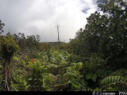
Trail of poles
Please note, there is a new route leaving from the end of Route de Moscou (since April 2021).
Description
From the end of Route de Moscou, take the track up and follow the new markings (made in 04.2021). Walk up to the edge of the gully, then take the track again at the edge of the Park. Then follow the power line through the forest, which gradually thins out. Go up the steep path to the summit of La Citerne, still following the electricity poles.
From there are links to other trails: L'Echelle, La Soufrière, L'Armistice, etc. Plan to have a vehicle at the planned point of arrival in Les Bains Jaunes or else follow the Trace des Poteaux on the way back, too (Please note, difficult descent).
---
NB: this route is a section of a variation on the "Trace des Alizés" GR trail (a shortcut to La Citerne refuge, avoiding the Trace des Etangs and going up the RD4 Carbet road).
- Departure : End of the Route de Moscou (access from Gourbeyre, Palmiste plateau)
- Arrival : La Citerne (old road)
- Towns crossed : Trois-Rivieres and Capesterre-Belle-Eau
Altimetric profile
Recommandations
In this natural setting, you should be particularly careful and alert, since Guadeloupe is subject to natural risks. It is vital to act in a responsible way, so that everyone can enjoy the hike!
Please note: unsupervised car park.
Information desks
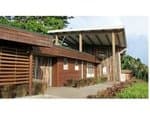
Headquarters of the National Park of Guadeloupe
Montéran, 97120 Saint-Claude
The reception and shop are open to the public :
- Monday, Tuesday and Thursday : 8 am to 12.30 pm and 2 pm to 5 pm.
- Wednesday : from 8 am to 1 pm.
- Friday : 8 am to 12.30 pm.
Services : reception, shop, toilets, free parking. Building accessible to people with reduced mobility.
Localisation GPS : Lat: 16,01634 N - Lng: 61,70753 W.
Access and parking
GPS starting point: Lat: 16,01933°N - Long: 61,65057°W.
---
From the town of Gourbeyre, go up towards the "Palmiste" (RD10 road). One kilometre after the water tower (right-hand side of the road), you will arrive at a small crossroads. Turn left towards "Moscou" and the Bassin Bleu. Continue along the road. Go past the access to the Bassin Bleu, then follow the main road. Go past the refuge (SPA), the field of solar panels and the picnic area next to the small bridge. Continue to the end of the road at the entrance to the forest. Park near the road, without obstructing pedestrians and traffic.
Parking :
More information
Source
Report a problem or an error
If you have found an error on this page or if you have noticed any problems during your hike, please report them to us here: