Engraved rocks in Plessis
The engraved rocks are precious records of Guadeloupe's past. They are still quite mysterious but no less fascinating. The River Plessis site is a chance to slake your thirst for discovery and exploration, all in a superb natural site.
4 points of interest
AAMG  Information board
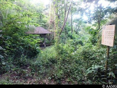
Karbays and panel for the gardens
A sign with karbays on either side shows a plan of the garden (now covered with vegetation).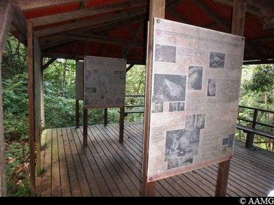
AAMG Information boardInformation panels about native Americans
A large karbay is home to several panels focusing on the life of native Americans in general and information about the engraved rocks to be seen in this site.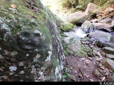
AAMG  Cultural and architectural heritage
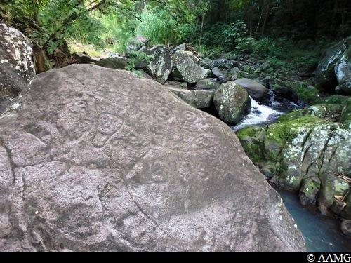
River and engraved rocks
As soon as you arrive at the river bank, you can easily spot this figure, which has been quite deeply engraved in the rock.
The site contains some fifty engravings on around ten different rocks.
Please note: opposite, a pathway (not described here) leads to the Kalinago waterfall, 5 minutes upstream. Take care in bad weather!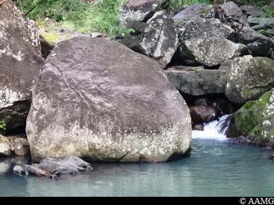
AAMG Cultural and architectural heritageEngraved rocks
Close by the previous rock point (5 metres downstream), you will see this rock, which is remarkable for the quality of the engravings. You have to go round it to see the drawings because the engraved side is facing downstream. There is an attractive pool just in front.
Description
A gently sloping pathway leads you to the river in 15 minutes. The dense vegetation and the trees add a pleasantly refreshing touch. Two sites have been set up with karbays to take a break. The last karbay, close by the river, contains information panels. You then need to cross the river and go down a few yards to see the most remarkable rocks.
You go back the same way.
- Departure : On the Chemin des Avocatiers, near Route St-Robert, in Baillif (follow the roadsigns).
- Arrival : On the Chemin des Avocatiers, near Route St-Robert, in Baillif (follow the roadsigns).
- Towns crossed : Vieux-Habitants and Baillif
Altimetric profile
Recommandations
Caution: River crossing. The route can be dangerous in wet conditions. Do not attempt it if it has rained the day before or if bad weather is forecast. If the water level rises, do not attempt to cross the river; wait until it recedes.
---
In this natural setting, you should be particularly careful and alert, since Guadeloupe is subject to natural risks. It is vital to act in a responsible way, so that everyone can enjoy the hike!
Please note: unsupervised car parks and swimming.
Information desks


46 rue Paul Baudot, 97100 Basse-Terre
Access and parking
GPS starting point: Lat: 16,03813° N - Long: 61,73624° W.
---
On the N2 rock in Baillif, take the D13 (Route de Saint-Robert) and follow the signs. Park at the side of the road (Chemin des Avocatiers).
Parking :
Source
Report a problem or an error
If you have found an error on this page or if you have noticed any problems during your hike, please report them to us here: