Gosier coast (Grand Baie)

Le Gosier Coastal trail
Gosier coast (Grand Baie)
Very easy
1h30
3,3km
+75m
-75m
Return trip
PR (short hike network)
Embed this item to access it offline
6 points of interest
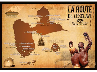
La Route de l'Esclave en Guadeloupe - © CG 971  The Slave Route
Route de l'Esclave: Fort Fleur d'Epée
The fortress was built to defend the Pointe-à-Pitre harbour from English attacks. In 1760, it was only a small fort that was rapidly strengthened to face the English invasion. In 1794, the fort was the scene of fierce fighting between English and French troops. General Grey captured the Fleur-d’Epée and Pointe-à-Pitre fort on 10 April. In June, Victor Hugues, the commissioner from the French National Convention in charge of enforcing the abolition of slavery in the French colonies, retook the fort with the help of 3000 freed slaves who had been recruited as soldiers. The victory was a decisive turning point. In December, the French Republic regained control over Guadeloupe. The abolition of slavery was proclaimed. But Napoleon Bonaparte put an end to abolition by a decree on 16 July 1802.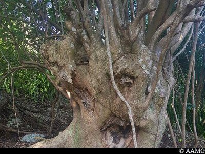
Mapou gris - AAMG  Flora
FloraMapou tree
The mapou is a large but very fragile tree. It is often hollow due to damage by insects.
Take care, since bees sometimes make it their home.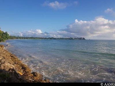
Grand' Baie - AAMG  Viewpoint
Grand Baie
This is the biggest bay in the municipality of Le Gosier.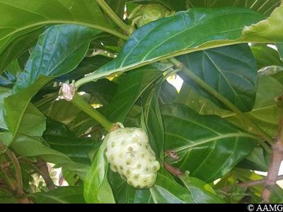
"Corossol à chien" - AAMG FloraSoursop
This fruit was once added to salads during hard times in the history of Guadeloupe Today, it is used for medicinal purposes.
It is known locally as "Noni", as is also the case in Reunion Island.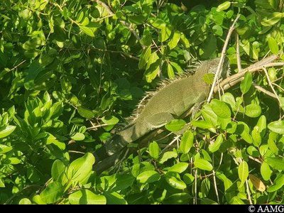
Iguane vert - AAMG  Fauna
FaunaIguana
The lesser Antillean iguana, Iguana delicatissima, is endemic to the Lesser Antilles.
The species is endangered due to the invasion of another species, the green iguana (Iguana iguana).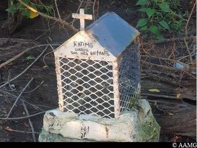
AAMG  Cultural and architectural heritage
chapel
This small chapel is a reminder of the thriving fishing community in the area some years ago.
The chapels are now abandoned and are sometimes used for magical-religious rites.
Description
Head towards the Fort. Follow the yellow markings
Turn right before the Fort gates, go down the steps, follow the path to the ladder. Walk alongside the beach. After passing the wooden bridges, you arrive in the mangrove forest. Follow the coastline. Head right at the intersection with an earth track, pass the chapel. Continue as far as the canal.
The return follows the same route (retrace your steps).
- Departure : Rue du Fort Fleur d'Épée, Le Gosier.
- Arrival : Rue du Fort Fleur d'Épée, Le Gosier.
- Towns crossed : Le Gosier
Altimetric profile
Recommandations
Make sure you're back before 5.30 pm, when the Fort Fleur-d’Epée car park closes.
Be careful coming down the steps.
Take care when crossing the wooden bridges that are quite well worn.
In this natural setting, you should be particularly careful and alert, since Guadeloupe is subject to natural risks. It is vital to act in a responsible way, so that everyone can enjoy the hike!
Please note: unsupervised car parks and swimming.
Information desks
Office du tourisme du Gosier
rue Félix Eboué, 97190 Le Gosier
Access and parking
GPS starting point location: Lat: 16,21624° N - Long: 61,51452°W.
---
Arriving from Pointe à Pitre:
Follow the N4, take the "Bas du Fort" exit, before the shopping centre. Take the Rue de L'Echangeur, Rue Paul Valentino and Rue du Fort Fleur d'Epée.
---
Arriving from Pointe à Pitre:
Follow the N4, take the "Bas du Fort" exit, before the shopping centre. Take the Rue de L'Echangeur, Rue Paul Valentino and Rue du Fort Fleur d'Epée.
Parking :
Fort Fleur d'Épée car park, Le Gosier
Source
Rando Guadeloupehttps://www.randoguadeloupe.gp/
Report a problem or an error
If you have found an error on this page or if you have noticed any problems during your hike, please report them to us here: