Link from 3rd Carbet Fall to 2nd Carbet Fall
The path runs through the rain forest along the Grand Carbet river.
6 points of interest

 History
Foundations of a disused canal
Remains of a canal bringing water to the upper parts of Capesterre-Belle-Eau.
Be careful: tricky section.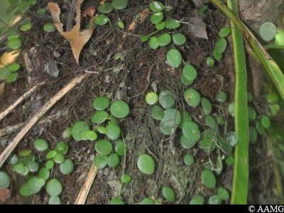
"mouron calebasse" - AAMG  Flora
FloraPeperomia emarginella
This small plant is very useful in healing scar tissue. It generally grows near rivers.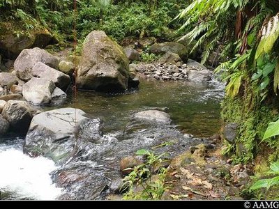
traversée rivière - AAMG  River and waterfall
First river crossing
At this point, take up the trail again slightly to the left on the opposite bank.
Be careful, the rocks are slippery. Water level up to the thighs. Don't cross when water level is rising.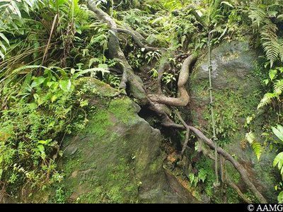
accès rivière (corde) - AAMG River and waterfallSecond river crossing
The crossing is well signposted (make sure you follow the signs).
There is a rope on the other side to help you across the rock.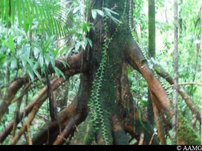
Palétuvier jaune - AAMG FloraBoarwood
A wetland area with boarwood (Symphonia Globulifera). You can recognise the tree with its yellowish aerial roots and its seeds, resembling nutmeg.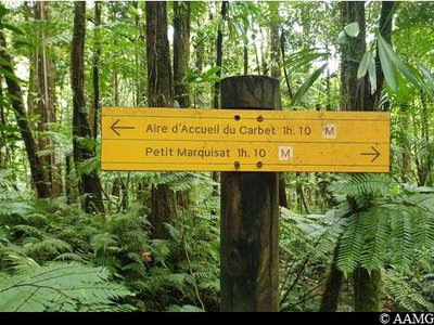
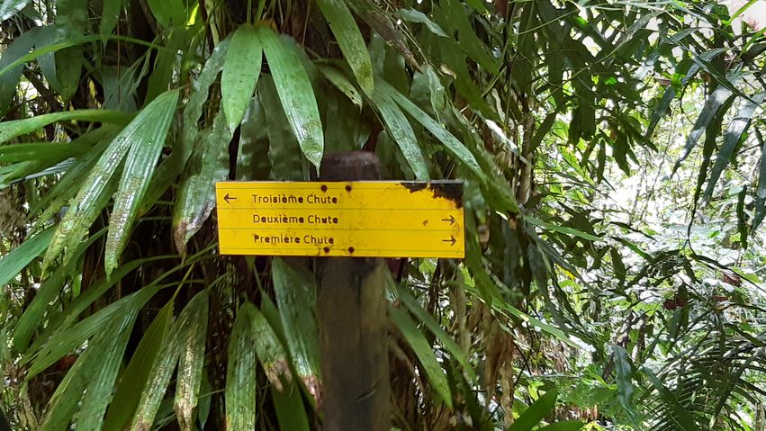
panneau signalétique - AAMG  Information board
Sign
Follow the sign. Please note, it is easy to go the wrong way since the natural waterways sometimes look like tracks. Don't forget to follow the markings shown at the beginning of the track on the introductory sign
Description
When facing the karbay (near the 3rd waterfall), the start of the trail is on the right. Head for the 2nd Carbet Fall by walking alongside the river. Cross the river twice. Climb along the crest as far as the crossroads for the three waterfalls.
Stay alert during river crossing.
- Departure : Path intersection next to the karbay close to the 3rd waterfall
- Arrival : Crossroads between the 1st and 2nd waterfall
- Towns crossed : Capesterre-Belle-Eau
Altimetric profile
Recommandations
NB: this is a non-circular trail, so you should leave your car at the end of the trail (for example at the visitors' area at the 2nd Carbet Fall). Otherwise you can go there and back on foot (the hike will take twice as long in this case).
Caution: River crossings. The route can be dangerous in wet conditions. Do not attempt it if it has rained the day before or if bad weather is forecast. If the water level rises, do not attempt to cross the river; wait until it recedes.
---
In this natural setting, you should be particularly careful and alert, since Guadeloupe is subject to natural risks. It is vital to act in a responsible way, so that everyone can enjoy the hike!
Please note: unsupervised car parks.
Information desks
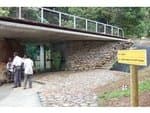
Reception area of Les Chutes du Carbet
terminus de la RD4 , route de l'Habituée, 97130 Capesterre-Belle-Eau
Opening hours : daily from 7.00 am to 5.00 pm.
Services : reception centre, shop, toilets, parking, picnic area.
In exchange for the services provided on the site, a financial contribution is requested to visitors (prices 06/2025 to 05/2028) :
- Adults : 6,00 € / pers.
- Children (- 12 years) : 4,00 € / pers.
- Families (5 pers. ; 1 or 2 adults + 1 or 4 children) : 14,50 €
- Groups adults (from 8 pers.) : 4,50 € / pers.
- Groups children (from 8 pers.) : 2,50€ / pers.
- One-year access card : 16,50 € / pers.
The promontory of the reception area is accessible to people with reduced mobility.
GPS location : Lat: 16,04198° N - Lng: 61,63822° W.
Access and parking
GPS starting point: 16,04628° N - Long: 61,62509° W.
---
No road access (link between two trails).
Source
Report a problem or an error
If you have found an error on this page or if you have noticed any problems during your hike, please report them to us here: