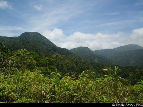
Trois Crêtes from Valley of Beaugendre
4 points of interest
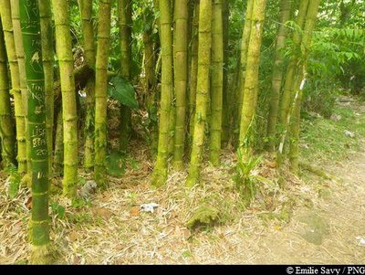
bambous - Emilie Savy / PNG  Flora
FloraBamboo plantations
A member of the Poaceae family, bamboo is more closely related to grasses than to trees. Made up of a woody, hollow stalk, its stem grows extremely quickly. It is both a highly resistant and invasive species in Guadeloupe and concerted efforts are being made to put it to best use in crafts and construction.
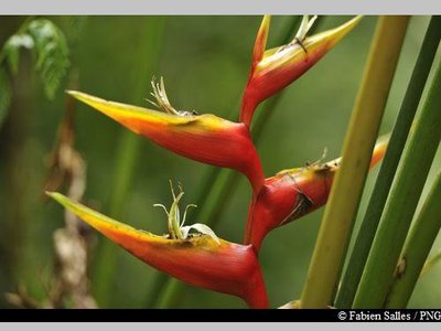
balisier - Fabien Salles / PNG FloraBalisiers
A member of the Musaceae family, Heliconia caribaea is a large grass that is typical of the Lesser Antilles tropical rainforest. A member of the same family as the banana trees, the plant can grow up to 5m high. It flowers all year round, especially between April and June. Its inflorescence resembles a red ear or red ear with yellow trim, or sometimes completely yellow.
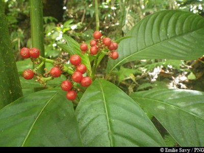
Café-Bois - Emilie Savy / PNG FloraPsychotria uliginosa
Psychotria uliginosa is a member of the Rubiaceae family. It is a rather rare plant in Guadeloupe, but can be seen in Basse Terre at Grand Etang or at Monts Caraïbes.
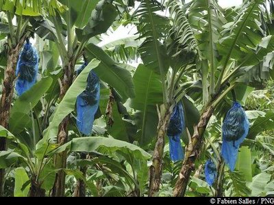
champs de bananiers - Fabien Salles / PNG FloraBanana trees
A member of the Musaceae family, banana trees are in fact giant plants, sometimes growing to around ten metres tall. It has no trunk as such, but overlapping leaves that keep it upright. It is similar to giant leek plants. It is a perennial plant with large leaves that are made up of 80% water. The flowers first point towards the sky before spreading downwards. Banana cultivation is an integral part of the economy in Guadeloupe. Its leaves are used in local handicrafts, such as in hat making.
Description
Hiking trail colour: yellow
The start of the trail is located around twenty metres below the parking area, so head back down for a short while. The sign showing the start of the trail reads "Trace Vallée Beaugendre - Grande Rivière".
The trail climbs steadily and is well marked. Be aware not to mix it up with other unofficial tracks. Head to the left of a cabin and follow the trail that goes straight into the forest. At the intersection on Crête Corossol, turn left towards the "Trois Crêtes". Walk along the ridge, paying attention to the prominent slopes. When you get to the shelter, a few metres further along the trail, the views can be magnificent on a clear day. You can sleep at the shelter or carry on with the hike towards Piton de Bouillante and the Mamelles to the north, or even join up with the Merwart or Victor Hugues trails (routes will be available online soon).
If not, turn around to return to the same route. You can also head back by la Vallée de la Grande Rivière des Vieux Habitants (see sheet "Trois Crêtes from la Vallée de la Grande Rivière").
- Departure : Vallée de Beaugendre, Grand Camp, Vieux-Habitants
- Arrival : Vallée de Beaugendre, Grand Camp, Vieux-Habitants
- Towns crossed : Vieux-Habitants
Recommandations
As Guadeloupe is prone to natural risks, extra care should be taken in this natural environment. For the benefit of all hikers, responsible behaviour is very important.
Warning : the parking area is unsupervised.
Access and parking
GPS coordinates of the start point : Lat : 16,10451 N - Long : 61,73135 W.
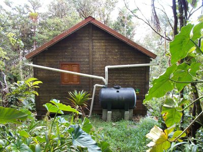
Road access is difficult (steep slopes and road surface in very poor condition). At the Marigot stretch of Vieux-Habitants, take the road that climbs towards "Vallée de Beaugendre" (crossroads located at the corner of the bakery, opposite the pink National Park reception centre). Head past the water tank and cottages, keep going uphill until you reach the end of the road and then park on the left after a very steep climb at a clearing marked by an impressive mango tree.
Parking :
Source
Report a problem or an error
If you have found an error on this page or if you have noticed any problems during your hike, please report them to us here: