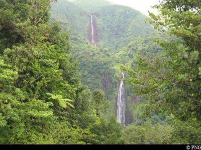
First Chute du Carbet waterfall
Attachment
- Downloadpdf
Les sources hydrothermales du massif de la Soufriere
Credit: fiche pédagogique BRGM au sujet des sources hydrothermales du massif de la Soufriere - BRGM
16 points of interest
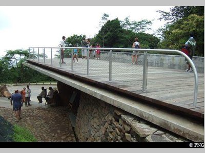
Promontoire de l'aire d'accueil du Carbet - PNG  Viewpoint
Promontory, extensive views
Accessible to persons with reduced mobility, on a clear day this promontory offers a panorama of la Grande-Terre (Petit Cul-se-sac marin), Marie-Galante and la Désirade.
The information boards explain the geological formation of the waterfalls.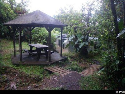
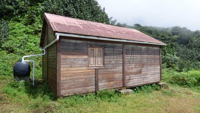
aire de pique-nique des Chutes du Carbet - PNG  Area of relaxation
Picnic area
A small path leads to the toilets and a special picnic area.
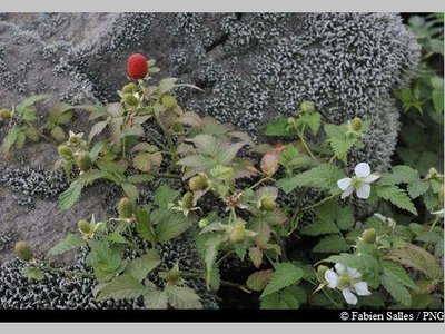
"Framboisier montagne" - Fabien Salles / PNG  Flora
FloraRoseleaf bramble
A member of the Rosaceae family, Rubus rosifolius is a hygrophilous species (i.e. one that needs moisture) which thrives in moderate shade: its white flowers and red fruits need the sun to grow. It is found up to 1,500 metres above sea level, where it colonises the banks of forest paths, invades the undergrowth of tropical forest and forms dense thickets. Its fruits are especially popular among birds.
Vue sur les deux Chutes - PNG ViewpointViews of both the Chute du Carbet waterfalls
Views of the first and second Chutes du Carbet waterfalls and information panels.
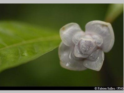
Graine bleue montagne - Fabien Salles / PNG FloraPsychotria aubletiane
Psychotria aubletiane, also known as Ipeka bata, belongs to the Rubiacieae family. It is a wetland shrub with upright branches. It features elliptical leaves, white axillary flowers and fruits in small drupes that turn bright blue.
"Queue de rat" - Emilie Savy / PNG Flora"Rat's tail"
This name refers to a number of species in the Piperaceae family.
As shrubs or small evergreen trees (ranging from 2-7 metres tall) with black, wart-like bark, rat's tails are a favourite among bats.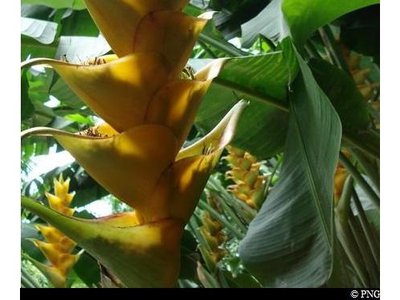
balisier - PNG FloraBalisiers
A member of the Musaceae family, Heliconia caribaea is a large grass that is typical of the Lesser Antilles tropical rainforest. A member of the same family as the banana trees, the plant can grow up to 5 m high. It features an inflorescence that resembles a red ear or red ear with yellow trim, or sometimes completely yellow. Its flowers are visible all year round, most notably between April and June.
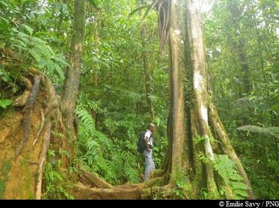
Corossolier montagne - Emilie Savy / PNG FloraGuatteria caribeae
The Guatteria caribeae is a very straight tree in the Annonaceae family that often has multiple trunks. It features dark bark and hanging branches and produces dark, plump berries. Its bark was used to make ropes and its wood to make masts for boats. It is still used today in Guadeloupe to make traditional sailing dinghies.
Gommier blanc - Emilie Savy / PNG FloraGommier
The Gommier (Dacryodes excelsa) can grow up to 35 metres tall. When they are damaged, its white trunk and roots exude a white resin with a pungent turpentine smell, which is traditionally used as incense or as kindle-wood, because it burns slowly regardless of the surrounding humidity. It is said that the tree has the ability to cast out spirits. It is strictly forbidden to remove any plant parts from the National Park. Its trunk was used by American Indians to make their canoes (kanawa), and is still used today by coastal people from many tropical countries, such as Dominique, to craft fishing vessels. The tree's seeds are a favoured food among pigeons.
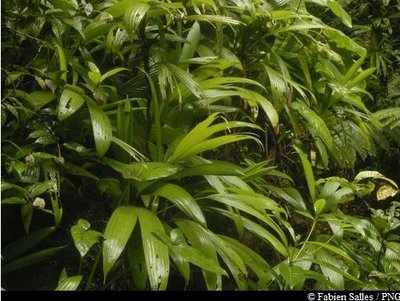
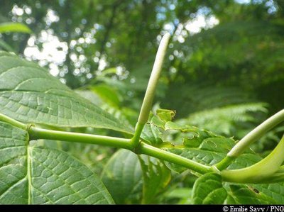
"Ailes à mouche" - Fabien Salles / PNG FloraAsplundia rigida
Asplundia rigida, the French name for which can be translated literally as "fly wings", is a member of the Cyclantaceae family. Its name is particularly apt, given its similarity with the insect. A typical species of moist forest undergrowth, there are three species in the Asplundia genus. Two are terrestrial and one is epiphytic and lianescent (where the vines climb from aerial roots).
Bois cotelette noir - Fabien Salles / PNG FloraTapura latifolia
Tapura lotifolia is a member of the Melastomaceae family. With a fluted trunk, this tree rarely grows taller than 20 metres. Its leaves feature five main lengthways veins that run perpendicular to its many secondary veins.
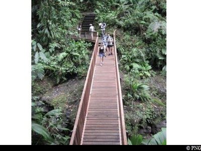
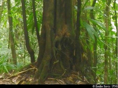
Passerelle sur la Rivière du Grand Carbet - PNG  History
The Grand Carbet river
This river is 140,000 years old. Its course has been changed over the years by successive lava flows in the valley. With its three great waterfalls, the Grand Carbet river can be seen from the sea. A local legend has it that this river was the reason why Christopher Columbus disembarked in Guadeloupe, as he went in search of fresh water on land.
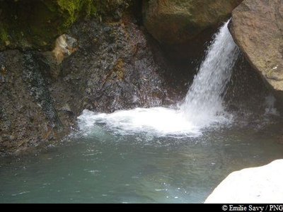
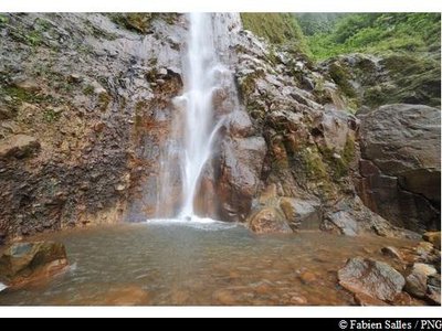
bassin sur la rivière du Grand Carbet - Emilie Savy / PNG  River and waterfall
Access to a pool
Access to a fine pool.
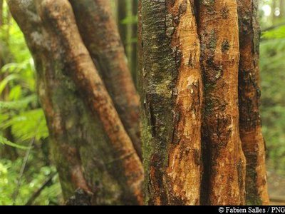
Bois bandé et bois cotelette noir - Emilie Savy / PNG FloraA walk between tapura latifolia and bwa bandé
Point where the trail passes between a "Bwa bandé" to the left and a Tapura latifolia on the right. "Bwa bandé" is the Creole name for Richeria grandis, a member of the Phyllanthaceae family. It is a very large variety and is distinctive for its reddish-brown bark
Too often it falls victim to rogue extraction. Translating literally as "bandaged wood", it is known for its qualities as an aphrodisiac. Its wood is used as timber or in carpentry. Tapura latifolia is a member of the Melastomaceae family. With a fluted trunk, this tree rarely grows taller than 20 metres. Its leaves feature five main lengthways veins that run perpendicular to its many secondary veins.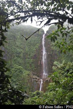
Vue sur la Première Chute du Carbet - Fabien Salles / PNG ViewpointView of the first Chute du Carbet waterfall
A view that heralds the arrival of this waterfall, with an opening onto the first Chute du Carbet and amber-coloured pools at its base.
la Première Chute du Carbet - Fabien Salles / PNG River and waterfallThe first Chute du Carbet waterfall
The highest on the river, the first Chute du Carbet waterfall stands at an impressive 115 metres. It is the perfect spot for a picnic or a snack. Make sure you bring your rubbish with you.
Description
Hiking trail colour: yellow
Walk on for a few metres and enjoy the views at the promontory, which offers a panorama of la Grand-Terre. Head back onto the path. On a clear day, views of the two waterfalls from the vegetation on the right await. At the first intersection, keep going straight on. Cross the wooden bridge over the Grand Carbet river. At the next intersection, you can take a quick detour to have a look at the second Chute du Carbet waterfall. Allow 30 minutes to visit the second waterfall and return to the intersection. Alternatively, go straight towards the first Chute du Carbet waterfall. The trail heads up and over a number of wooden decks. At the intersection, head left and begin a steep climb. The trail descends again, reaching the Longueteau ravine. Here you will need to cross. Be careful, as when it is raining the water can rise very quickly and the return walk can be hazardous. Keep going as the trail gets gradually narrower and enjoy the views of the waterfall. Keep going uphill for a few minutes before you reach the base of the first Chute du Carbet waterfall.
Take a few minutes to enjoy the spectacular views and then take the same trail to return to the Chutes du Carbet welcome area.
- Departure : Chutes du Carbet, Capesterre-Belle-Eau reception area
- Arrival : Chutes du Carbet, Capesterre-Belle-Eau reception area
- Towns crossed : Capesterre-Belle-Eau
Altimetric profile
Recommandations
As Guadeloupe is prone to natural risks, extra care should be taken in this natural environment. For the benefit of all hikers, responsible behaviour is very important.
Warning : the parking area is unsupervised.
Information desks
Reception area of Les Chutes du Carbet
terminus de la RD4 , route de l'Habituée, 97130 Capesterre-Belle-Eau
Opening hours :
- In low season (May 1st to June 30th, September 1st to October 31th) : daily from 7.00 am to 1.00 pm.
- In high season (November 1st to April 30th, July 1st to August 31th : daily from 7.00 am to 4.30 pm.
Services : reception centre, shop, toilets, parking, picnic area. The promontory of the reception area is accessible to people with reduced mobility.
In exchange for the services provided on the site, a financial contribution is requested to visitors (prices 06/2023 to 05/2024) :
- Adults : 5.45 € / pers.
- Children (- 12 years) : 3.30 € / pers.
- Families (2 adults + 2 children): 7.60 €
- Groups adults (from 8 pers.) : 3.80 € / pers.
- Groups children (from 8 pers.) : 1,65€ / pers.
- One-year access card : 8.75 € / pers.
GPS location : Lat: 16,04198 N - Lng: 61,63822 W.
Access and parking
GPS coordinates of the start point : Lat : 16,04198 N - Long : 61,63822 W.
Using Route RN1, from Saint-Sauveur (between "Bananier" and the town of Capesterre-Belle-Eau), turn towards Chutes du Carbet. Keep going on the RD4. The road is steep and winding. Go past the Grand Etang parking area, keep going until the end of the road and park in one of the available spaces.
Parking :
Accessibility
Those with reduced mobility can access the promontory for an extensive panorama of Grand-Terre (Petit Cul-de-Sac Marin), Marie-Galante and la Désirade on a very clear day. At the promontory, there is a permanent bilingual exhibition about geology and hydrology.
- Emergency number :
- 114
More information
Source
Report a problem or an error
If you have found an error on this page or if you have noticed any problems during your hike, please report them to us here: