From Bois Baron to Anse Maurice
Le Moule Coastal trail
From Bois Baron to Anse Maurice
Difficult
4h
5,2km
+145m
-173m
Cross
PR (short hike network)
Embed this item to access it offline
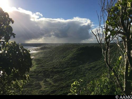
This trail for the physically fit shows that despite the reputation of Grande Terre as a "flat land", there is plenty of work for the old leg muscles! Steep cliffs, dry forest, sunshine and views out to sea are all part of the programme.
8 points of interest
AAMG  Viewpoint
Cliff
From the top of this cliff, the panorama over the coast and the town of Le Moule is spectacular. If you climb to the top you can see the thick layer of sediment laid down by the sea to form Grande-Terre.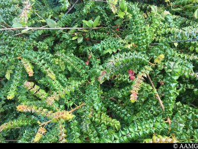
Petit Houx - AAMG  Flora
FloraChristmas bush
The Christmas bush (Comocladia dodonaea) lives on the limestone hills of the xerophile (dry) forest. It has highly toxic sap. If it touches your skin, three or four days later, blisters appear, similar to burns. They itch a lot. Be careful!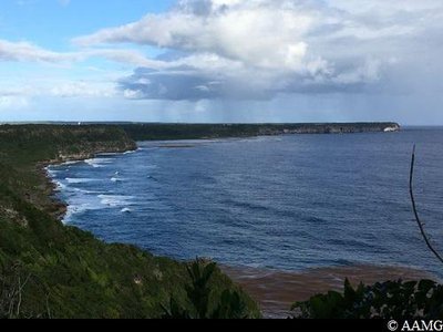
AAMG ViewpointView over the Petit-Canal cliffs
This viewpoint shows you the north and east coasts of Grande-Terre. On the horizon, Guadeloupe's first wind farm is unusual in that it can be lowered to the ground in bad weather.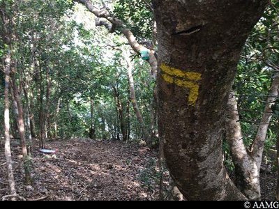
Gommier rouge - AAMG FloraGumbo-Limbo
The Gumbo-Limbo is a typical tree in dry areas. It can be recognised by its shiny, red bark which peels away in fine flakes or scales (squame). The wood is used to make posts for fences and hedges. The sap is aromatic, white and sweet, and used as a poultice for bruising.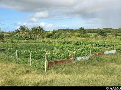
jardins - AAMG  Agricultural landscape
Creole garden
Just behind this gate (which we should take care to close behind us), people grow crops. These Creole gardens have historic importance. They enabled people to be self-sufficient in food, medicine and flowers for decoration. They are still very much rooted in today's Creole culture.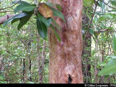
Bois d'Inde - PNG FloraWest Indian bay tree
The West Indian bay tree (Pimenta racemosa) is an aromatic tree with a light brown bark that peels off. It is used in local cuisine because it has very fragrant leaves. There are 3 different varieties: the clove for meat sauces, aniseed and lemon for desserts. Marinating the leaves in rum produces "bay rum", which is used in massages for muscular pain.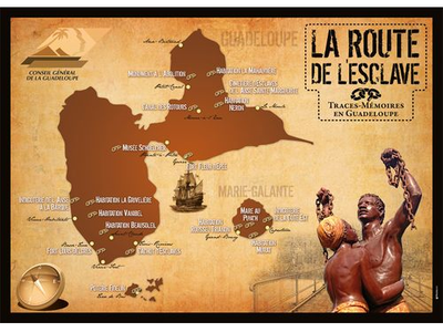
La Route de l'Esclave en Guadeloupe - © CG 971  The Slave Route
Anse Sainte-Marguerite slave cemetery
The Sainte-Marguerite slave cemetery is a major landmark and currently the best researched in all the West Indies. The discovery of human bones, fragmented by the sea, and the threat of a slow destruction of the sandbar gave rise to an archaeological campaign taking place from 1997 to 2002. A vast cemetery from the colonial era was uncovered. The exceptional extent and conservation of this funeral site with its hundreds of graves allows us to study funeral practices and the treatment given to the dead, but also to highlight the state of health of the population by carrying out biological analyses. In use between the second half of the 18th century and 1848, the year slavery was abolished, the dead from several villages were buried there. The burial practices (use of coffins and decoration of graves) were Christian, as recommended by the Code Noir (Black Code). The various biological analyses have shown bodily damage due to strenuous physical effort and high rates of tuberculosis. Some deliberate dental mutilations (front teeth sharpened to a point), as well as morphological studies, point to origins in Africa for most of the deceased individuals. These various clues suggest that this burial site brought together a population of slaves who made up over 80% of the inhabitants of the north of Grande-Terre at this period.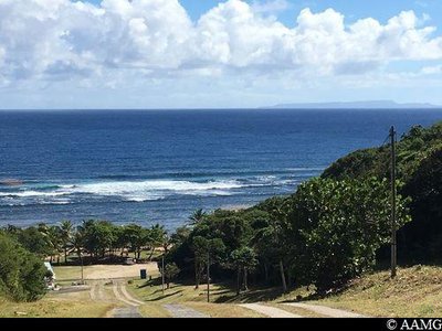
Anse Maurice - AAMG  Area of relaxation
Anse Maurice beach
The Anse Maurice beach is the only beach in the municipality of Petit-Canal. The beach is far from the tourist routes, so that it has kept its unspoilt and peaceful atmosphere. The pleasant breezes on the beach make this an ideal spot for people in search of rest and relaxation.
Description
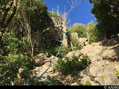
Set off to the left, following the "Anse-Maurice" markings. It starts off hard with a very steep climb and a rope to help you. Soon you arrive in a savannah, where you just need to go straight ahead (please note, the markings are not easily visible). You will walk alongside some barbed wire on your left. You arrive at a very steep descent with a rope in the middle of some Latanier palm trees. The climb just afterwards is not easy, and watch out for the empty spaces. You then need to climb over a metal gate. Just afterwards comes a tricky section very close to a sheer drop, but with a wonderful view. You then arrive in a savannah where you need to head to the right (Please note, no markings). You then walk alongside and climb over another metal gate. Further on, you need to pay attention and make sure you follow the markings to the LEFT (if you go straight ahead, it's DANGEROUS). Then comes a tricky descent with no rope. So be careful. You are now in the Anse à L'Ecu ravine. Cross the Anse à L'Ecu plateau and make sure you keep to the left (follow the markings). There is a gentle climb to the top of the cliff, and then you arrive at a metal gate. Walk alongside it to the right as far as a barbed wire gate. Go through the gate, and don't forget to close it behind you. In the savannah, turn right and walk alongside the fence until you get to another barbed wire gate. Continue into the undergrowth until you arrive at the savannah. The path leads straight ahead alongside the vegetation on your right. After a section in the undergrowth, you will arrive in a field. Go straight ahead across the field (opposite). We arrive at a last tricky descent. Watch out for the stones rolling under your feet. You arrive at the coast. Follow the coastline until Anse Maurice beach, passing in front of the Anse Marguerite slave cemetery.
- Departure : Spot for paragliding take-offs in Bois Baron, Le Moule.
- Arrival : Anse Maurice beach, Petit-Canal.
- Towns crossed : Le Moule and Petit-Canal
Altimetric profile
Recommandations
NB: this is a non-circular trail, so you should leave your car at the end of the trail.
It is strongly recommended to be in good shape physically and to be accompanied by a professional guide or a person who knows the trail well. People who are afraid of heights should take care. They would be better off avoiding this trail.
In this natural setting, you should be particularly careful and alert, since Guadeloupe is subject to natural risks. It is vital to act in a responsible way, so that everyone can enjoy the hike!
Please note: unsupervised car parks and swimming.
Information desks

2 rue Gambetta, 97117 Port-Louis
Access and parking
GPS starting point: 16,35700° N - Long: 61,39094° W.
---
Leaving from Le Moule, head for Sainte Marguerite along the D123 and then the D120, when you get to Sainte Marguerite primary school. On your right there is a big panel showing the paragliding spot. Follow the path as far as the car park.
---
Leaving from Le Moule, head for Sainte Marguerite along the D123 and then the D120, when you get to Sainte Marguerite primary school. On your right there is a big panel showing the paragliding spot. Follow the path as far as the car park.
Parking :
Start: Bois Baron; arrival: Anse Maurice beach.
Source
Rando Guadeloupehttps://www.randoguadeloupe.gp/
Report a problem or an error
If you have found an error on this page or if you have noticed any problems during your hike, please report them to us here: