Houëlmont tour
A trail rich in history, focusing on the native Americans, Delgrès and his men. On the way it tells the story of the men whose graves alone bear witness to their lives here.
3 points of interest
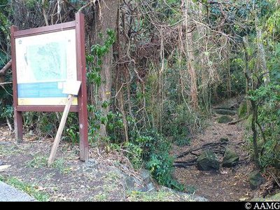
entrée en forêt - AAMG  Information board
Go into the woodland
Entrance of the "Houëlmont Tour" trail.
Follow the yellow markings.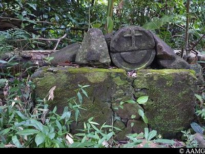
AAMG  Cultural and architectural heritage
Grave
The grave is a reminder that the site was once occupied by religious, to whom the area was left.
Keep your eyes peeled so you don't miss the grave at the roadside.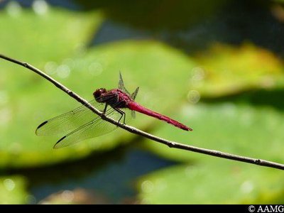
AAMG  Fauna
FaunaDragonfly
This is a very inquisitive insect. There is no need to look for them, they will come to you.
Description
Follow the yellow markings.
At the end of the straight line on the marina road, turn left before the Ravine Salée bridge.
At the intersection, turn right into the estate.
Continue as far as the steep but short climb.
Follow the trail in the forest near the panel, after reading the information.
Follow the yellow markings, going up towards Houëlmont.
Cross the road (access to the Volcanological Observatory) and take the path leading down opposite you. Be careful in the descent.
Continue the Houëlmont Tour, following the markings, and you will arrive at the road (diversion set up in May 2020 after a rock slide). Continue down the road and turn left before arriving at Bisdary stadium.
Near Bisdary stadium, continue the trail straight ahead in the forest
Go down as far as the road behind the marina (Rue de L'Espadon)
Turn left and stay on the pavement
Continue the trail until you go back down to your parking place.
- Departure : Rivière Sens marina, Gourbeyre.
- Arrival : Rivière Sens marina, Gourbeyre.
- Towns crossed : Gourbeyre
Altimetric profile
Recommandations
May 2020: diversion set up by the ONF after a rock slide. Make sure you follow the new markings (northern part of the trail).
---
NB: between the Bisdary stadium and the top of the Rivière-Sens marina housing estate, there is a downhill track MTB.
---
Don't set off after 3.30 pm. Take water with you and make sure your phone is charged.
In this natural setting, you should be particularly careful and alert, especially since Guadeloupe is subject to natural risks. It is vital to act in a responsible way, so that everyone can enjoy the hike!
Please note: unsupervised car parks.
Information desks

46 rue Paul Baudot, 97100 Basse-Terre

rond point "Dos d'Ane", Valkanaërs, 97113 Gourbeyre
Access and parking
GPS starting point: Lat: 15,98271° N - Long: 61,71491° W.
---
Park near the marina car park. There are plenty of parking spaces all along the road.
Parking :
More information
Source
Report a problem or an error
If you have found an error on this page or if you have noticed any problems during your hike, please report them to us here: