Morne Cadet / St Jean Bosco
Climbing the sometimes steep slopes, you will see a wonderful parade of flora and fauna of surprising diversity in an untamed and relaxing atmosphere.
12 points of interest

AAMG  Flora
FloraForest sanctuary
Just look at the wealth of flowers at the site! The Monts Caraïbes mountains have a series of 3 different forest types: xerophile forest (semi-deciduous); mesophile forest (evergreen) and ombrophile forest.
This area with high levels of candlewood marks a transition and entrance to the mesophile forest.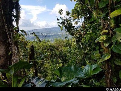
AAMG  Viewpoint
View over Saint-Charles
One of the few panoramas during the ascension, giving a glimpse of the view from the summit.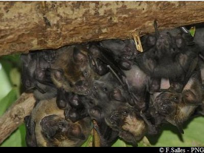
Chauves souris - PNG  Fauna
FaunaBats
It is not unusual in this area to hear the monotonous chant of the bat. Bats are the only mammal species native to Guadeloupe, with 14 species. The species potentially found on Monts Caraïbes include:
- the strictly endemic species in Basse Terre, the Guadeloupe big brown bat, Eptesicus guadeloupensis.
- 3 sub-endemic species: the Guadeloupe big-eyed bat, Chiroderma improvisum (Basse-Terre and Montserrat); the Dominican myotis, Myotis dominicensis (Basse-Terre and Dominica) and Thomas's yellow-shouldered bat, (Basse-Terre and Montserrat).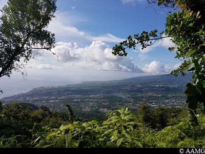
AAMG ViewpointPanorama from Cadet
An exceptional view over the areas of Gourbeyre, Basse-Terre and Saint-Claude towards the north. To the south, a view over Morne Grande Voûte, separated from Morne Cadet by the Salée Ravine.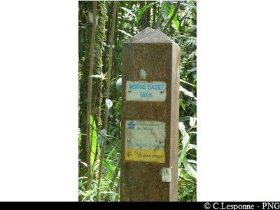
sommet du Morne Cadet - PNG  Summit
Morne Cadet summit
Information panel at the summit, altitude 681m.
 Information board
Vent Soufflé intersection
Intersection towards Morne Vent Soufflé.
Please note, there are no signs at this point.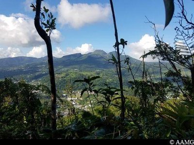
Vue sur le massif de la Soufrière - AAMG ViewpointSoufrière panorama
View over the Grande Savane and Valkanaërs districts, as well as the Soufrière.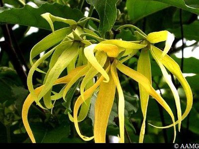
Fleurs d'Ylang-ylang - AAMG FloraSpecific variety
Ylang-ylang, Cananga odorata, is well known for its highly fragrant flowers, which are distilled to produce a very popular essential oil.
The fragrance is released in wet and cool weather.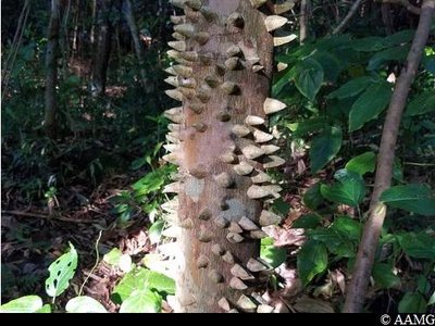
Lépiné blanc - AAMG FloraPrickly Yellow
The prickly yellow (Zanthoxylum caribaeum) is a medium-sized tree, which can exceptionally grow up to 20 metres in height. It has a very prickly trunk and branches, and very rough, cracked and blackish bark.
Its wood is much in demand in the region, especially to make handles for farm tools.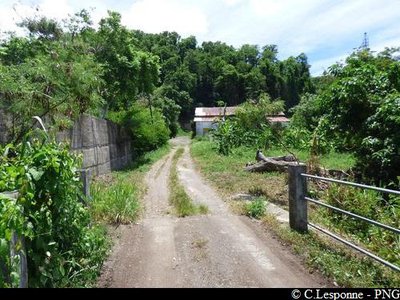
pont de St Jean Bosco - PNG  Cultural and architectural heritage
Saint Jean Bosco
Saint Jean Bosco is an education centre working on behalf of young people in difficulties since 1935.
Take care when leaving the forest, because it is hard to spot the trail due to the grass.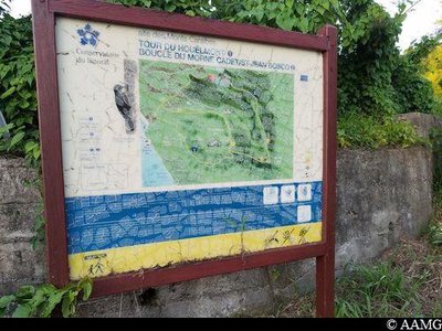
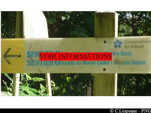
Panneau du Conservatoire du littoral - AAMG Information boardSite panel
Information panel at the Coastal Conservatory.
Arriving from Morne Cadet, cross the road and continue on the trail opposite. River and waterfall
River Sens
The River Sens takes its source on the slopes of the Palmiste plateau in Gourbeyre. It is then joined by the Ravine Rouge and the Ravine Blanche, before reaching its mouth at the beginning of the Rivières Sens section. These gullies were an opportunity to set up Habitations (residences) in the Monts Caraïbes, including the Habitation Bisdary.
Description
The start of the trail is shown by a wooden marker. There is a steep slope for a few yards at the start of the trail, which then levels out. There are two intersections a few yards apart with a cross sign. Take the trail to the right with yellow markings. In the last part of the ascension, the path is narrow, slippery and steep. The markings are sometimes on the ground and sometimes on trees. After the summit (point 1), continue for a few yards, then go to the left to begin the descent. The slope gradually becomes steeper.
There are two intersections 1.5 km after the summit (point 2). Follow the yellow markings to the left along the crest.
Lastly, there is a 3rd intersection, to the left (point 3; direction marker). Take the path going down to the left towards Saint Jean Bosco. Then continue straight ahead until you arrive at the Habitation Bisdary from the rear.
- Departure : Route du Houelmont, at the ONF sign, turn left. The trail begins 10m below.
- Arrival : Habitation Bisdary, on the D38.
- Towns crossed : Gourbeyre
Altimetric profile
Recommandations
In rainy or wet weather, the level for the trail rises from average to difficult. The slopes become particularly muddy and slippery.
Take care when leaving the forest for Saint Jean Bosco, because the grass makes it hard to spot the trail.
Information desks

46 rue Paul Baudot, 97100 Basse-Terre

rond point "Dos d'Ane", Valkanaërs, 97113 Gourbeyre
Access and parking
GPS starting point: Lat: 15.97882°N - Long: 61.70044°W.
---
In Gourbeyre, Blanchet section, follow the D38 towards the Soufrière Volcanological Observatory; go up to the ONF panel for the Houëlmont forest.
Source
Report a problem or an error
If you have found an error on this page or if you have noticed any problems during your hike, please report them to us here: