Tête Allègre / Sofaïa circular trail
18 points of interest

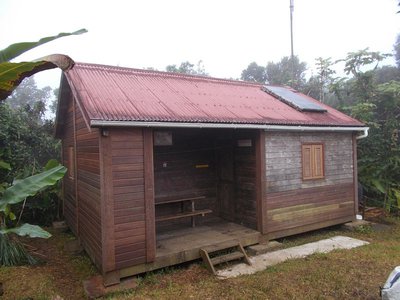
panneau au départ - C.Lesponne  Information board
Starting panel
You will see the panel introducing two neighbouring trails: the Saut des Trois Cornes trail and the Tête Allègre trail. The start of the Galbas circuit is shared by both of these trails. Please note, this trail is not mentioned on the starting panel.
On the way, you will see signs guiding you along the Galbas trail.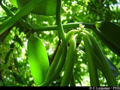
gousses de vanille - PNG  Agricultural landscape
Vanilla
There are more and more agroforestry projects, and vanilla is one of the main crops, with half of the vanilla farmers working as franchisees. The ONF authorises franchises or "concessions", which are drawn up to respect technical and environmental provisions related to forest management.
Vanilla is an orchid that likes shaded, cool and humid environments. Growing it is tricky and time-consuming. Since there are no pollinating insects in the archipelago, pollination is carried out by hand.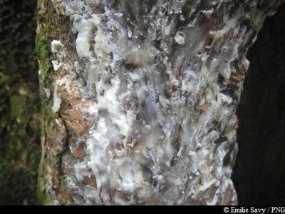
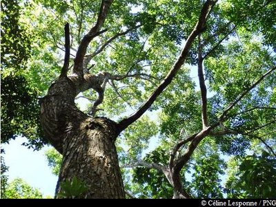
PNG  Flora
FloraCandlewood
Candlewood (Dacryodes excelsa) can grow up to 35 metres in height. From the trunk and roots a white sap with a strong smell of resin seeps out when cut. The sap is traditionally used as incense or to light fires, since it burns very slowly, whatever the humidity level. It is believed it can chase away evil spirits. Candlewood trunks were used by native Americans to make canoes (kanawa), and in many tropical countries today, such as Dominica, the trunks are used by coastal populations to make fishing boats. Wood pigeons are fond of the seeds from the tree.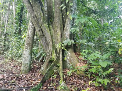
AAMG_1 FloraHaya blanca
Guatteria caribeae is a very straight tree, often with more than one trunk. It has blackish bark and dangling branches. The tree's berries are pulpy and black. The bark is used to make rope, and the wood to make ships' masts. It is still used today to make traditional sailing boats in Guadeloupe (kanot).
Bois bandé (écorce) - PNG Flora"Bwa Bandé"
Richeria grandis is known as "Bwa Bandé" locally. This is a very tall species that can be recognised with its tough leaves and reddy-brown bark. Its fruits are very specific, forming little capsules that look like green raisins. They mass together in large numbers on the branches. The "bwa-bandé" is unfortunately often the victim of illegal cuttings, since its bark is renowned as an aphrodisiac. The wood was once used to make frameworks and in carpentry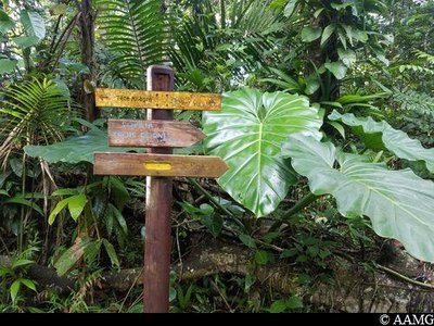
panneaux signalétiques - AAMG Information boardSignpost
First intersection with the Boucle de Tête Allègre trail. Turn right to follow "Sofaïa" / Galbas.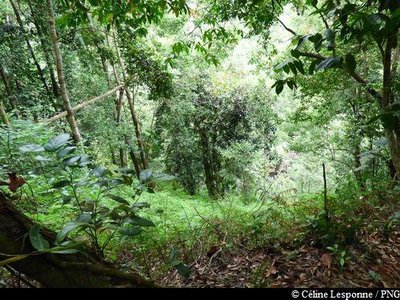
Vue sur la rivière Moustique - Céline Lesponne / PNG  Viewpoint
Viewpoint
View of the Moustique river below.
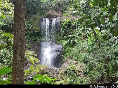
Saut des Trois Cornes - PNG  River and waterfall
Saut des Trois Cornes
Le Saut des Trois Cornes with its fine waterfall.
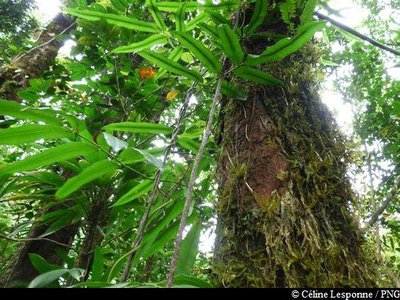
liane - Céline Lesponne / PNG FloraCreeper plant
You can see a magnificent creeper plant not far from the path.
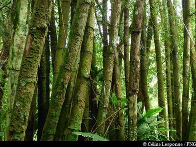
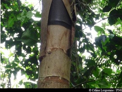
touffe de bambous - Céline Lesponne / PNG FloraBamboo
A member of the Poaceae family, bamboo is more closely related to grasses than to trees. Made up of a woody, hollow stalk, its stem grows extremely quickly. It is both a highly resistant and invasive species in Guadeloupe and concerted efforts are being made to put it to best use in crafts and construction.
Mahogany Petites Feuilles - Céline Lesponne / PNG FloraWest Indian Mahogany
The West Indian Mahogany (Swietenia mahagoni) is a robust species native to Ispagnola. This dry forest tree was initially planted as an ornamental feature for houses, but then spread elsewhere. Despite the wood being of extraordinary quality, it grew too slowly to be used in reforestation. When degraded forests needed to be revived and enriched, foresters turned to this tree for the task.
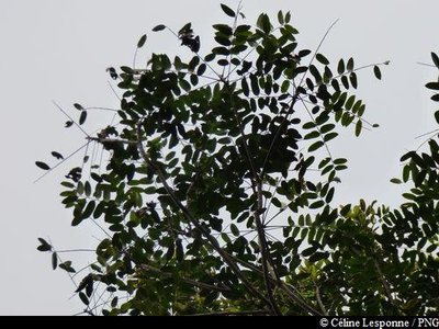
Acajou blanc (feuilles) - Céline Lesponne / PNG FloraSimarouba amara
Simarouba amara is a remarkable tree from the dense forest of Guadeloupe.
Laurier rose - Céline Lesponne / PNG FloraThe Yucca Plum Pine
Podocarpus coriaceus is also commonly known as the Yucca Plum Pine. It is a member of the Podocarpaceae family. Closely related to conifers, it is an average-sized tree, measuring around 10-16 metres. Its leaves – dark green on top – have a leathery quality that is reminiscent of the common oleander. They have a span of 6-15 cm with no discernible stalk. While its flowers are discreet, its brown-coloured seeds in their red floral buds are particularly eye-catching. It has a thin layer of bark. This species is found throughout the West Indies and flowers mainly in December and January.
"Bois bandé" - Fabien Salles / PNG Flora"Bwa bandé"
Richeria grandis belongs to the Phyllanthaceae family. It is a large variety, distinctive for its tough leaves and reddish-brown bark that so often falls victim to rogue extraction. Also known as bwa bandé in Créole, it is renowned for its aphrodisiac qualities. Its wood is used as timber or in carpentry. It has very distinctive, green, grape-like fruits which form small pods and form copiously on its branches.
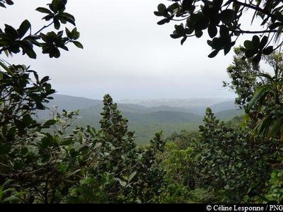
point de vue vers Deshaies - Céline Lesponne / PNG ViewpointViewpoint
Fine views towards the west (Deshaies and Mer des Caraïbes).
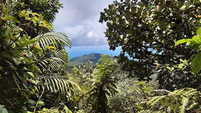
point de vue (ouest) vers la Mer des Caraïbes - C.Lesponne - PNG ViewpointLe Grand Cul-de-Sac Marin
View of Le Grand Cul-de-Sac Marin.
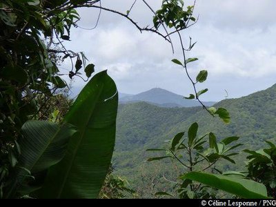
Vue sur le Morne à Louis - Céline Lesponne / PNG  Summit
Tête Allègre
The top of "Tête Allègre" (715 m) and beautiful views : towards the south (Morne à Louis) and the north (Grand Cul-de-Sac Marin).
Palmier montagne (tronc) - Céline Lesponne / PNG FloraThe Sierran palm
The Sierran Palm (Prestoea montana) is a member of the Arecaceae family. Despite its size, it is in fact a palm tree. Like ferns, it does not have a trunk but a stipe. It can live in both hygrophilous forest, where it can reach a height of ten metres, and at altitude, where it does not grow beyond two metres.
Description
Hiking trail colour: yellow
Start out on the path that heads towards "Tête Allègre". Keep going until you reach the intersection (point 1). Turn right towards "Sofaïa" and then keep going in the same direction (point 2). Go downhill until you reach the Moustique river. You can then turn left (point 3) to keep going until Saut des Trois Cornes.
Alternatively, or later on, cross the river (point 3) to reach the other side.
Head up until you reach the small intersection. Turn right towards Sofaïa on the old botanical path. You should then reach the Sofaïa parking area [Here you can use the outdoor showers, located below the car park. These showers use the hot and sulphurous waters of Sofaïa].
Continue the hike by heading on the paved road, towards "Baille-Argent". Keep going in this direction until you reach the intersection (point 4). Go uphill steadily until you reach la Barre de l'Ile. Keep going (point 7) to the south towards "Belle Hôtesse" and then straight on (point 5) towards "Tête Allègre / Choisy". Continue in this direction (point 6), and start the descent towards the finish.
- Departure : From the "La Muraille" forest road
- Arrival : On the "La Muraille" forest road
- Towns crossed : Sainte-Rose, Deshaies, and Pointe-Noire
Altimetric profile
Recommandations
This route is hazardous when it is raining. Do not plan a hike if it has been raining the day before or if bad weather is forecast. If water levels are rising, do not try to cross the river. Wait until they return to normal.
Extra care should be taken in this natural environment, as Guadeloupe is prone to natural risks. For the benefit of all hikers, responsible behaviour is requested.
Please note : the parking and swimming areas are not supervised.
Information desks
Headquarters of the National Park of Guadeloupe
Montéran, 97120 Saint-Claude
The reception and shop are open to the public :
- Monday, Tuesday and Thursday : 8 am to 12.30 pm and 2 pm to 5 pm.
- Wednesday : from 8 am to 1 pm.
- Friday : 8 am to 12.30 pm.
Services : reception, shop, toilets, free parking. Building accessible to people with reduced mobility.
Localisation GPS : Lat: 16,01634 N - Lng: 61,70753 W.
Access and parking
GPS coordinates of the start point : Lat : 16,27685 N - Long : 61,71681 W.
On Route RN2, between Lamentin and Sainte-Rose : at the roundabout of La Boucan, turn towards "Cadet" and "Bonne Mère". Then follow the signs that point towards Domaine de Séverin. One you have reached le Domaine, go past the parking area and head left on the road that goes round it. Then carry on for around 3km, first on the road bordering the sugar cane and pineapple fields and then to finish on the La Muraille forest road. You then reach the small parking area at the start, located next to the hike information board.
Parking :
More information
Source
Report a problem or an error
If you have found an error on this page or if you have noticed any problems during your hike, please report them to us here: