The Smugglers trail
7 points of interest
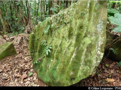
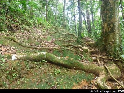
grosse roche - Céline Lesponne / PNG  Geology
Large rock formations
Large rock formations with a distinctive shape. Water, the primary erosion agent, works mechanically on the rocks, producing a polishing effect.
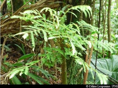
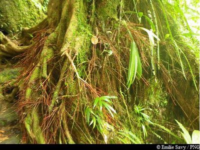
"Fougère bâtard" - Céline Lesponne / PNG  Flora
FloraTree ferns
Phyllanthus mimosoides, a member of the Euphorbiacieae family, resembles a small tree fern. Set on the same level, its compound leaves are in fact branches made up of small, simple leaves. Lower down, they have tiny white flowers on their axils.
carrefour au sommet - C.Lesponne  Summit
Intersection at the top
Intersection between the Smugglers Trail (east/west) and the Alizés trail "GR G1" (south/north), beneath the power line.
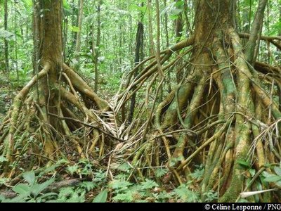
Bois Rouge Carapate - Emilie Savy / PNG FloraBwa rouj carapate
A member of the Euphorbiacieae family, Amanoa caribeae is endemic to the Lesser Antilles. It is a large tree with a trunk that rests straight on its buttresses, depending on the terrain. The most distinctive feature of this species is its reddish bark and roots at the foot of the trunk. Its leaves vary in shape: sometimes they are whole, sometimes pointed. Its flowers form small clusters, while its very hard wood was used as timber or in carpentry.
Palétuviers jaunes - Céline Lesponne / PNG FloraChewstick tree
Symphonia globulifera, also commonly known as the chewstick tree, belongs to the Clusiaceae family. The tree grows in thick, humid and swampy forests. Reaching up to 25-30 metres in height, it has stilt roots and a yellow latex trunk. Its flowers are formed of bright red petals, while its fruits resemble nutmeg, are oval in shape and yellow when ripe. It wood was one used as timber for houses and resin for boats.
Gommier blanc - Céline Lesponne / PNG FloraThe Gommier
The Gommier (Daryodes excelsa) can grow up to 35m high. When they are damaged, its white trunk and roots exude a white resin with a pungent turpentine smell, which is traditionally used as incense or to start fires, because it burns slowly regardless of the surrounding humidity. It is reported that the tree has the ability to cast out spirits. Its trunk was used by American Indians to make their canoes (kanawa), and is still used today by coastal people from many tropical countries, such as Dominique, to make fishing vessels. Its green seeds are popular with pigeons.
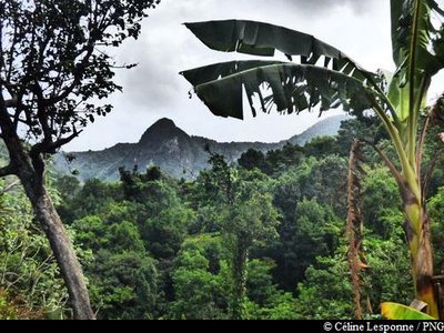
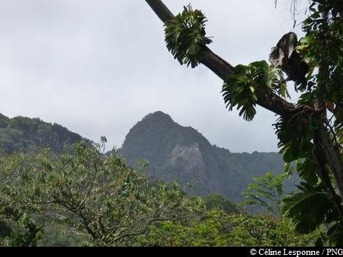
point de vue sur les crêtes - Céline Lesponne / PNG  Viewpoint
Viewpoint
Views north of "La Couronne" (663 m) and le Piton Guyonneau (750 m).
Description
Hiking trail colour: yellow
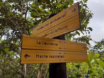
Take the forest path, behind the National Forestry Office hiking information boards. Climb steadily until you reach the high-voltage line for the first time. Keep going through the forest. The trail gets flatter and winds its way through the rainforest near by some remarkable trees, such as chewstick and chestnut trees. Cross some small ravines and then reach the summit (here you cross a power line for a second
time). Intersection with the Alizés trail (GR G1, north/south of Basse Terre). Keep going, heading in the direction of "Contrebandiers / Les Plaines" and begin your descent towards the west. Come out onto the concrete road and then keep going until the final sign.
N.B. As this is a circular trail, make sure to leave your vehicle at the start point.
- Departure : Sainte-Rose, forest road of Duportail, starting from the information boards.
- Arrival : Pointe-Noire, end of Route RD17 (Les Plaines / Notre-Dame des Larmes)
- Towns crossed : Sainte-Rose and Pointe-Noire
Altimetric profile
Recommandations
As Guadeloupe is prone to natural risks, extra care should be taken in this natural environment. For the benefit of all hikers, responsible behaviour is very important.
Warning : the parking areas are not supervised.
Information desks

entrée de la Vallée des Plaines - RD 17, 97116 Pointe-Noire

le bourg, 97126 Deshaies
Access and parking
GPS coordinates of the start point : Lat : 16,25081 N - Long : 61,70589 W.
On Route RN2, between Lamentin and Sainte-Rose : at the roundabout of the La Boucan bridge, turn towards "Bonne Mère". Then reach the crossroads with "Cadet". At the crossroads, turn left and keep going towards "Bone" and then "Duportail". Proceed on the Duportail forest road until you reach the signs that show the start of the hike.
Parking :
Source
Report a problem or an error
If you have found an error on this page or if you have noticed any problems during your hike, please report them to us here: