Pointe des Châteaux trail
On this trail under the sea pray, hikers will witness the amazing harmony between the marine and the lagoon environments.
Attachment
- Downloadpdf
depliant_pte_des_chateaux
Credit: Dépliant "Sentiers de la Pointe des Châteaux" - St François
7 points of interest
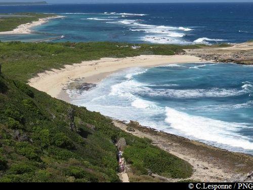
Vue sur l'Eperon depuis la plage de l'Anse à la Gourde - F.Frederic - CD 971  Viewpoint
Eperon
View towards Eperon.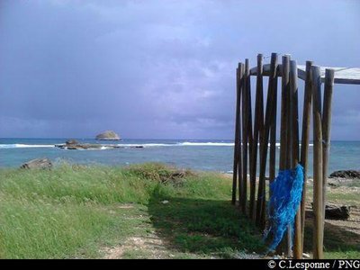
Pointe à la Gourde - PNG ViewpointEperon, Pointe à la Gourde
View towards Eperon from la Pointe à la Gourde (in the shelter of the wooden structure).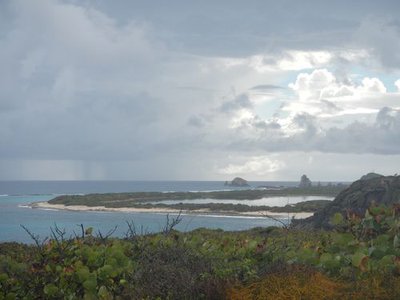
Grande Saline et Pointe des Châteaux - F.Frederic - CD 971 ViewpointGrande Saline, Pointe des Châteaux
The elevated terrain allows visitors to take advantage of a panorama over the Désirade, the Grande Saline and the Pointe des Châteaux.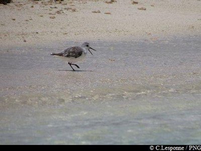
PNG  Fauna
FaunaShorebirds
The large expanse of water that make up the salt pans are a haven for the birdlife, especially shorebirds.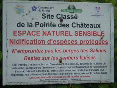
F.Frederic - CD 971  Information board
Listed site
Information panel: listed site.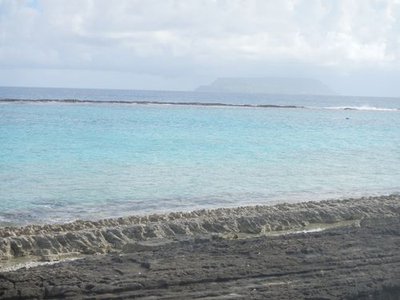
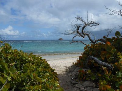
Barrière de corail - F.Frederic - CD 971 ViewpointCoral Reef
Coral reef along the Pointe à Plume, with la Désirade in the background.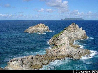
vue depuis la croix vers la Désirade - PNG  Cultural and architectural heritage
La Croix de la Pointe des Châteaux
On the top of the Morne Pavillon, a cross has overlooked the countryside since 1951.
It serves as a landmark to the sailors who arrive from the open sea. From this point you can see the plateau of the island of La Désirade (in the north-east) and the islands of Petite-Terre (south-east). An orientation table helps with the reading of the landscape.
Description
Hiking trail colour : yellow.
Start at Anse à la Gourde beach and make a right (overlooking l’Eperon, a rock located in the sea, about half a mile away from the coast). The sand path roams between bushes. White sand and coral reef protected turquoise water make Anse à la Gourde a true paradise beach. But it also is a historic site : excavations revealed a succession of Amerindian settlings over a thousand years.
Reach the heights of Anse à la Gourde. Pass by a sheet metal shack and start your climb on a white gravel path. Keep going straight downhill until you reach Pointe Tarare.
Enter the copse to your right and reach the cliffs (view of La Desirade, La Grande Saline, la Pointe des Châteaux). Keep going straight until you get to Anse à Plume. Bypass La Grande Saline by the left (depending on the season, you might be able to observe wader colonies feeding of the mud) following first the shore, then Anse des Salines. Get out on D118 road, cross the parking lot and start climbing Morne Pavillon to get to the tip of Pointe des Châteaux, symbolized by the cross.
Follow the same route on your way back.
- Departure : Anse à la Gourde beach
- Arrival : Anse à la Gourde beach
- Towns crossed : Saint-Francois
Altimetric profile
Recommandations
Stay on marked path, particularly by the lagoons. Do not take the banks. The lagoons are a sensitive nesting environment for protected species.
Dogs are not allowed, even on a leash.
Please note : the parking and swimming areas are not supervised.
Information desks

avenue de l'Europe, 97118 Saint-François
Access and parking
GPS coordinates of the start point : Lat : 16,257913 N - Long : 61,213574 W.
In Saint François, head towards La Pointe des Châteaux road RD118. Around 3 miles after the airfield, make a left towards Anse à la Gourde. Hike starts at the parking lot.
Parking :
Accessibility
New in 2025: a platform has been installed near the main trail to allow visitors to observe birds, while respecting them and limiting disturbance.
- Emergency number :
- 114
Source
Report a problem or an error
If you have found an error on this page or if you have noticed any problems during your hike, please report them to us here: