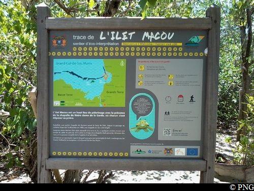
l'Îlet Macou trail
Morne-à-l'Eau Coastal trail
l'Îlet Macou trail
Easy
0h30
626m
+0m
0m
Return trip
PR (short hike network)
Embed this item to access it offline
3 points of interest
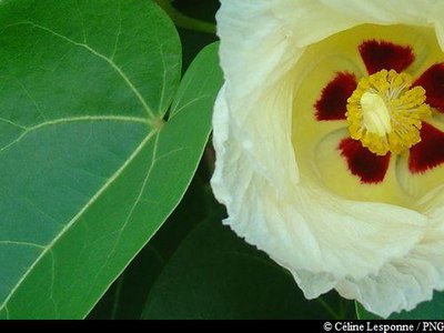
fleur de Catalpa - PNG  Flora
FloraVegetation on the islet
The Islet has been cleared over a good part of its area to allow the planting of a coconut grove. The natural vegetation of this islet is otherwise mainly composed of species able to withstand the changing general conditions, and likely to adapt to the variations in salinity in particular. In this way, a row of red mangrove (Rhizophora mangle) precedes a forest area full of white mangrove (Avicennia germinans), gray mangrove (Laguncularia racernosa), and buttonwood (Conocarpus erectus). Succeeding this band of mangrove, the Catalpa (Thespesia populnea) comprises the bulk of the woodland, on soils which are most often dewatered. [Source: Espaces remarquables du littoral - Egis Eau 2012]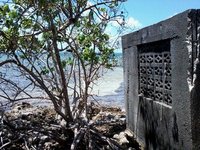
érosion derrière la chapelle - PNG  Geology
Coastal erosion
Until last century, the islet was connected to the mainland and even a few years ago, a strip of sand almost 10 metres wide was present between the shoreline and the chapel.The erosion of the banks is tangible proof of the fragility of the environment.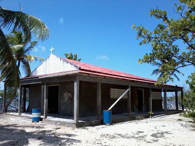
la chapelle - PNG  Cultural and architectural heritage
Chapelle
A small chapel once graced the end of the islet. Since the passage of hurricane Hugo in 1989, a permanent chapel has been erected: Notre Dame de Macou is much used by its regulars. It is littered with empty conch shells, left there by passing fishermen.
Description
Starting from the pontoon, follow the trail which leads into the forest. Cross the forest and the more sparsely vegetated area. Go to the end of the islet (chapel).
Return by the same route up to the starting point at the pontoon.
- Departure : the Îlet Macou pontoon
- Arrival : the Îlet Macou pontoon
- Towns crossed : Morne-à-l'Eau
Recommandations
The Macou coastline has many sea turtle nesting sites. Please respect these beaches !
As Guadeloupe is prone to natural risks, extra care should be taken in this natural environment. For the benefit of all hikers, responsible behaviour is very important.
Information desks

2 rue Gambetta, 97117 Port-Louis
Access and parking
Starting point : Lat : 16,34910°N - Long : 61,52726°W.
---
Access by sea only (boat, kayak, etc).
More information
Source
Rando Guadeloupehttps://www.randoguadeloupe.gp/
Report a problem or an error
If you have found an error on this page or if you have noticed any problems during your hike, please report them to us here: