Vieux-Bourg coast / Babin
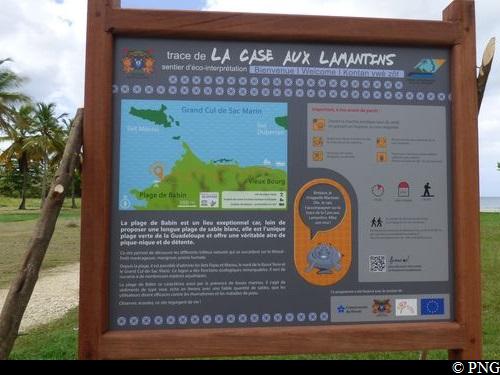
Morne-à-l'Eau Coastal trail
Vieux-Bourg coast / Babin
Easy
2h30
5km
+54m
-54m
Return trip
PR (short hike network)
Embed this item to access it offline
Babin beach is an exceptional site, since it is the only "green beach" in Guadeloupe. It has a picnic area and is the ideal spot to take it easy.
8 points of interest
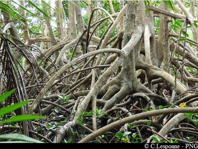
Palétuviers rouges (échasses) - PNG  Flora
FloraRed mangroves
The riverbank or coastal mangrove forest, with stable salt levels (at least 30 grams per litre), is home to the red mangrove (Rhizophora mangle), recognisable by its aerial roots. The roots allow acorn barnacles, mussels, mangrove oysters and sponges to develop. Almost a hundred species of mostly young shellfish and fish have been listed in the mangrove forest. For the juvenile red porgy, bar jack and tarpon, as well as for young shrimp and lobster, the mangrove forest is their nursery. It is vital for the equilibrium and development of marine animals.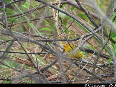
Paruline jaune - PNG  Fauna
FaunaAmerican yellow warbler
The American yellow warbler (Setophaga petechia) is known as "Ti Jon" ("Lit'l Jon") in Creole. It is a sedentary bird found all over the West Indies. In most islands, it lives mainly in the mangrove forests, but can also sometimes be found in the coastal forests and even in the mountain forests.
Watch and listen! This site is teeming with life.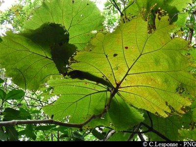
PNG FloraGrandleaf seagrape
The grandleaf seagrape (Coccoloba pubescens) is a member of the Polygonaceae family. It can be found all over the West Indies.
The tree can grow up to 25m in height. Some leaves are 45 cm in diameter. They are bright green and pale on the other side with yellow veins. The flowers are a greenish white colour. The fruits are 2 cm wide.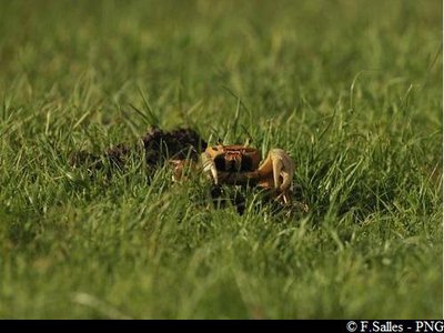
crabe de terre - PNG FaunaCrabs
Many burrows and crabs can be seen in the mangrove forest alongside the footpath, including Cardisoma guanhumi, generally known as the blue land crab.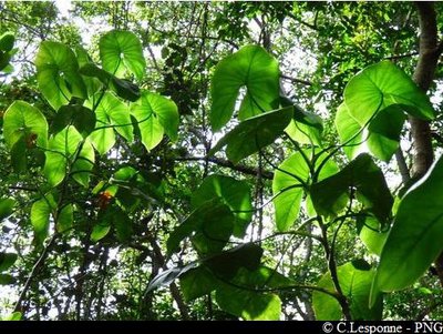
PNG Flora"Moco-moco"
Montrichardia arborescens, known as Moco-moco in the West Indies, belongs to the Araceae family. The plant can grow up to 3 or 4 metres high and has large, arrow-shaped leaves. The flowers have the unusual quality shared by all Araceae flowers of producing heat (thermogenesis).
The plant grows right next to rivers and in coastal marshes.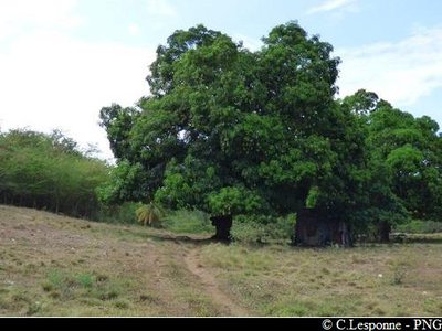
PNG FloraThree big mango trees
The mango tree (Mangifera indica L.) is a member of the Anacardiaceae family, originally from south Asia. It can grow between 10 and 25 metres high.
Mango trees are often grown in tropical countries for their fruit. They were probably one of the first fruit trees to be cultivated.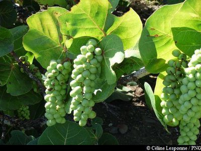
Raisiniers bord de mer - PNG FloraCoastal vegetation
Next to the sea, the portia tree (Thespasia populnea), seagrape (Coccoloba uvifera) and Indian almond (Terminalia catappa) form a bar of coastal vegetation.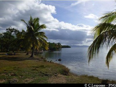
plage de Babin - PNG  Area of relaxation
Babin
Babin beach is noticeable for its sea mud. The sludge-like sediments, rich in silt, have only a small quantity of sand. It is thought to be an effective remedy for rheumatism and skin diseases. From the beach, you have a good view of the Fajou and Macou islands, the north of Basse-Terre and the Grand Cul-de-Sac Marin.
Description
Trail markings: yellow.
Starts from the car park next to the Vieux-Bourg fishing port. Take the Rue de la Case aux Lamantins towards the municipal nautical centre. Walk past the stadium, then 150 metres further on, turn off the road and enter the forest. Then follow the footpath with yellow markings. It winds its way between the mangrove and the wet meadow. Carry on until you arrive at the Babin site.
Take the same route on the way back.
- Departure : Vieux-Bourg port, Morne-à-l'Eau
- Arrival : Vieux-Bourg port, Morne-à-l'Eau
- Towns crossed : Morne-à-l'Eau
Altimetric profile
Recommandations
In this natural setting, you should be particularly careful and alert, since Guadeloupe is subject to natural risks. It is vital to act in a responsible way, so that everyone can enjoy the hike!
Please note: unsupervised car park.
Please note: unsupervised car park.
Information desks
2 rue Gambetta, 97117 Port-Louis
Access and parking
GPS starting point: Lat: 16,34224°N - Long: 61,51056°W.
---
From the RN5 road, south of the town of Morne-à-L'Eau, take the RD107 road towards "Vieux-Bourg". Stay on the road as far as the port of Vieux-Bourg.
---
From the RN5 road, south of the town of Morne-à-L'Eau, take the RD107 road towards "Vieux-Bourg". Stay on the road as far as the port of Vieux-Bourg.
Parking :
Vieux-Bourg port.
Source
Rando Guadeloupehttps://www.randoguadeloupe.gp/
Report a problem or an error
If you have found an error on this page or if you have noticed any problems during your hike, please report them to us here: