Murat trail
Grand-Bourg
Murat trail
Easy
3h
8,9km
+153m
-149m
Loop
PR (short hike network)
Embed this item to access it offline
This trail allows you to explore rural landscapes typical of the "Grande Galette", through the canefields, Creoles gardens and their neighbouring houses, with pools scattered over the planted meadows, grazed by cattle and goats.
9 points of interest
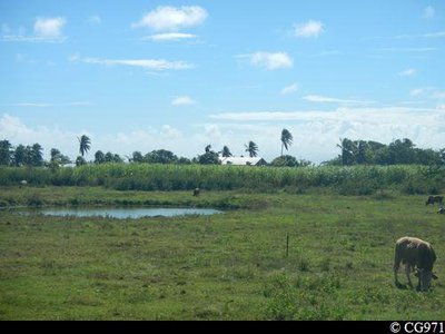
Campagne marie-galantaise - CG971  Agricultural landscape
View over a meadow
Typical scene of the Marie-Galante countryside, with cattle tied up not far from a pool (a natural drinking trough) with a field of sugar cane in the background.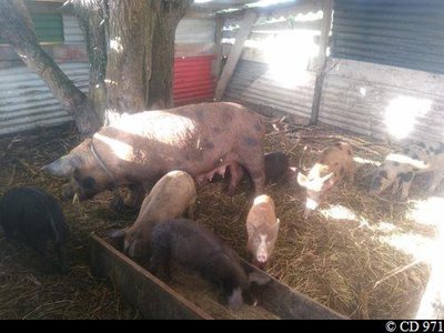
Enclos d'élevage de porcs - CD 971 Agricultural landscape'Pak a kochon'
Pens for rearing pigs.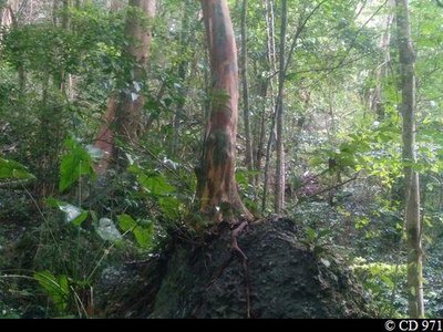
Bois d'inde "perché" - CD 971  Flora
FloraBay rum tree
A specimen of the bay rum tree, Pimenta racemosa, perched on a rocky outcrop.
The Coulée Ouliée
The many stones littering this ravine testify to the power of the floods of heavy rain.
la Coulée Ouliée - CD 971  River and waterfall
The Coulée Ouliée
The many stones littering this ravine testify to the power of the floods of heavy rain.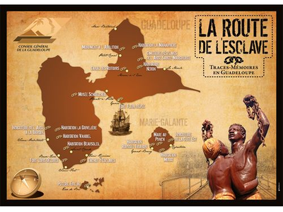
La Route de l'Esclave en Guadeloupe - © CG 971  The Slave Route
Route de l'Esclave : Mare au Punch
The tradition connected with this place is linked to the tragic events which occurred on 24 and 25 June 1849, on the occasion of the first legislative elections in the West Indies. The serious electoral incidents which occurred at Marie-Galante led to the results of the legislative elections of the whole of Guadeloupe being declared invalid by the National Assembly.
The opposition between the supporters of Schoelcher and Perrinon (Republican) denouncing the fraud, and the enforcement of the law, caused between 50 and 100 deaths. Many arrests were made, giving rise to convictions, some very heavy, during the trial which took place in 1850.
At these events, former slaves who had been freed reportedly looted and burned the Pirogue residence and then spilled all the rum and the sugar from the estate into the nearby pool - the Mare au Punch. Three days and three nights of celebrations followed !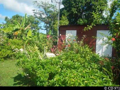
Jardin d'agrément - CD 971 FloraExample of a pleasure garden
Only a trained eye can interpret the hidden messages in this colourful plantation.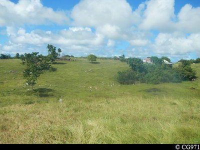
Paysage rustique - CG971 Agricultural landscapeView over an enclosed meadow.
Rustic landscape illustrating a most bucolic and pleasant way of life.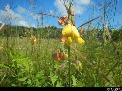
CG971 FloraChacha (Devil bean)
Crotalaria retusa, is locally called chacha (bell), or rattle from the sound obtained by shaking the seeds contained in the pods produced by this legume.
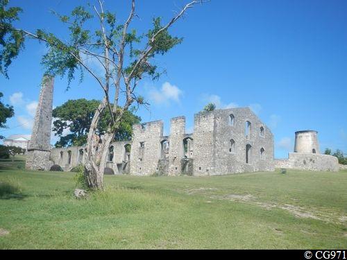
La Route de l'Esclave en Guadeloupe - © CG 971 The Slave RouteRoute de l'Esclave : Murat residence
The founder of this sugar works was probably Antoine Luce, a notary from the Champagne area, who came to Marie-Galante in 1657. By 1665, the residence already owned eleven slaves aged from nine to 36. In 1807, Dominique Murat, who was born in Aquitaine and was the husband of a Creole from Marie-Galante, bought the property and added new buildings.
The sugar farm, now known as Bellevue La Plaine, became an important producing unit.
In 1807, 114 slaves were involved, and this number tripled over two decades, since by 1839 there were 307 (175 women, 132 men), which made it one of the largest 'workshops' in
Guadeloupe a few years before the abolition of slavery.
With the help of European and mixed-race craftsmen, the 'talented slaves' - workmen, masons and carpenters - worked on the construction of buildings whose remains, radically restored in the 1960s when there was a suggestion of building a hotel, can still be seen today. The residence contains all the usual buildings of a sugar-works: one or more mills (here there was one animal mill and one windmill), the sugar-works itself and its outbuildings, the slave quarters. The quality of the dressed stone masonry, the crest on the windmill, which bears the master's name and initials and the date of construction (1814), reflect undeniable expertise.
The originality of the dwelling is not the contrast between the 'big house', where the master lived, and the hundred long-disappeared thatched 'cases' mounted on wooden poles, where most of the slaves lived in 1839, but in the Neo-classical architecture of the Murat's house.
If the design was undoubtedly due to the family, the knowledge of contemporary architectural styles is clear in the freed master-masons or the master carpenters, many of whom had learned their trade as slaves.
Description
Coming out of the Murat residence (ecomuseum, medicinal garden), take the road on the left, which runs along the fence, and arrive at a stony path.
Take the right turn (Point 1) through the sugar cane fields. When you reach a former mill,
veer a little to the left and continue straight on, ignoring a track on the right, then another on the left. After a pool, reach a crossing.
Fork left (Point 2), ignoring the road on the right: go along a grassy path between the pastures and the undergrowth. Leave the poincianas on the right and turn sharp left. Go into the forest and follow the trail on the left, which meanders in and out of the half-light of the tall trees in the creek bed, the Coulée Ouliée (notice the huge buttress roots of the fig trees leaning against the limestone blocks). Go past a clearing, along the edge under the mango trees, and then back into the undergrowth once more, by going straight ahead.
Shortly after coming out of the wood, turn left (Point 3). The trail climbs through the acacias and pastures. At the top of the hill, bear right and join the RN 9 beside the Mare au Punch (the ruins of the old Pirogue sugar refinery are located on the other side of the road). Carry on along the road on the left for 200 metres.
Continue to the left (Point 4) on a stony path. At the crossing, turn right and go back on to a road. Head to the left towards Ducos (Point 5).
After the bend, carry straight on; the road turns into a stony path, the Chemin de Morne Rouge, which goes downhill towards the coastline (in clear weather, there is a viewpoint of the island of Dominique to the left and the Saintes archipelago to the right; you can also see the coral reef).
Come out on to a road; follow it to the left and reach a crossing. Turn right, to return to the starting point.
- Towns crossed : Grand-Bourg
Altimetric profile
Recommandations
In the event of heavy rain, access to the Coulée Ouliée may be dangerous: the waters of the ravine may rise rapidly, and there is a risk of slipping on muddy ground.
Information desks

rue Pierre Leroy, ancien Palais de justice, 97112 Grand-Bourg (Marie-Galante)
Access and parking
Starting point : Lat : 15,87745°N - Long : 61,29890°W.
---
From Grand-Bourg, take the DR 203 towards Capesterre and follow the sign for Habitation Murat.
---
From Grand-Bourg, take the DR 203 towards Capesterre and follow the sign for Habitation Murat.
Parking :
Parking in the Murat residence
More information
Source
Rando Guadeloupehttps://www.randoguadeloupe.gp/
Report a problem or an error
If you have found an error on this page or if you have noticed any problems during your hike, please report them to us here: