Delgrès 'trace'
8 points of interest
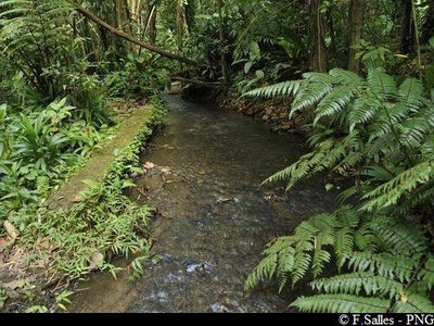
canal Lepelletier - F.Salles - PNG  River and waterfall
Lepelletier Canal
The trail runs along the Lepelletier canal, which serves the Saint-Claude community below.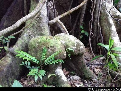
PNG  Flora
FloraRemarkable tree
The trunk of this buttressed tree has a very unusual form, which reminds us of the the 'coco fesse' of the coco de mer of the Indian Ocean.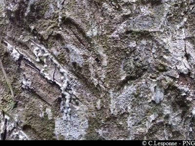
tronc du Gommier blanc - PNG FloraGommier
The Gommier (Daryodes excelsa) can grow up to 35m high. When they are damaged, its white trunk and roots exude a white resin with a pungent turpentine smell, which is traditionally used as incense or to start fires, because it burns slowly regardless of the surrounding humidity. It is reported that the tree has the ability to cast out spirits. Its trunk was used by American Indians to make their canoes ("kanawa"), and is still used today by coastal people from many tropical countries, such as Dominique, to make fishing vessels. Its green seeds are popular with pigeons.
PNG FloraGiant Philodendron
The Giant Philodendron (Philodendron giganteum) is an epiphytic or terrestrial species that flourishes in humid or shady areas.
It grows equally well from the earth as it does on rock or in trees. It develops many very long aerial routes, which are used in basketry. It has large, dark green leaves that are fleshy and shiny to the eye. Each leaf is supported by a large petiole (between 0.6 and 1.5 metres), which grows from a large, yet short stem resting on trunks or rocks.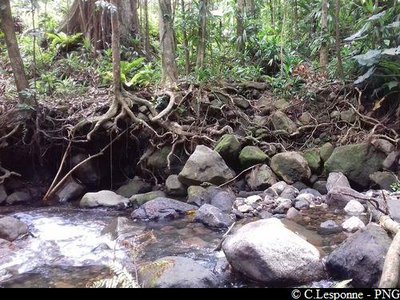
traversée de la Rivière Noire - PNG River and waterfallRivière Noire
Crossing the Rivière Noire, which rises on la Soufrière. Be careful when crossing the watercourse !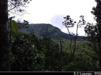
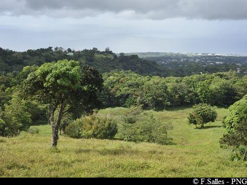
PNG  Viewpoint
View of le Nez Cassé
Viewpoint over le Nez Cassé, looking north east.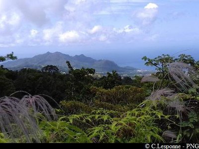
PNG ViewpointBeautiful viewpoint
From the clearing, viewpoint over the Caribbean mountains and the coastline of Basse-Terre.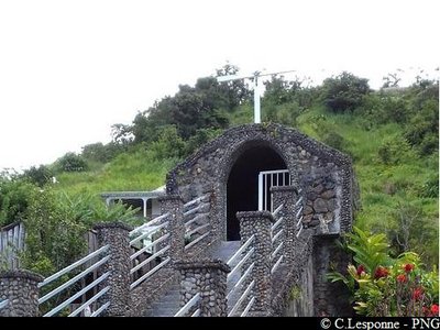
PNG  Cultural and architectural heritage
Chapelle Sainte-Marie
This chapel was blessed on 17 November 2013 by Father Lafranconi, priest of the parish of Saint Augustin in Saint-Claude. The chapel is dedicated to Mary, protector of Guadeloupe.
Description
Hiking trail colour : yellow.
---
The path starts at the rear of the picnic area. Go into the forest and along the canal. At the crossroads (Point 1), turn left in the direction of Papaye.
Follow the next waymarkers carefully.
Continue on the path and cross several small gullies. Arrive at Rivière Noire (Point 2), and cross carefully. Go up the trail opposite. You are entering the National Park. Continue in the forest. Reach an open plateau (view). Carry on and arrive at the edge of cultivated areas (Jardins Créoles). The trail finally comes out on a concrete path; continue up to the little chapel. Return by the same route up to the starting point.
On arrival, you can take advantage of the Beausoleil picnic area.
- Departure : Saint-Claude, Beausoleil picnic area.
- Arrival : Saint-Claude, Beausoleil picnic area.
- Towns crossed : Saint-Claude
Altimetric profile
Recommandations
Be careful (point 3 on map) : the trail passes alongside a landslide.
---
As Guadeloupe is prone to natural risks, extra care should be taken in this natural environment. For the benefit of all hikers, responsible behaviour is very important.
Please note: the parking area is not supervised.
Information desks
Maison Darracq, 149 avenue du Maréchal Foch, 97120 Saint-Claude
Headquarters of the National Park of Guadeloupe
Montéran, 97120 Saint-Claude
The reception and shop are open to the public :
- Monday, Tuesday and Thursday : 8 am to 12.30 pm and 2 pm to 5 pm.
- Wednesday : from 8 am to 1 pm.
- Friday : 8 am to 12.30 pm.
Services : reception, shop, toilets, free parking. Building accessible to people with reduced mobility.
Localisation GPS : Lat: 16,01634 N - Lng: 61,70753 W.
Access and parking
Starting point : Lat : 16,03136°N - Long : 61,68057°W.
---
Go through the town of Saint-Claude, passing in front of the Post Office and the University.
Continue climbing on the RD11 (heading for La Soufrière), until arriving at the Beausoleil picnic area, at the entrance to the forest.
Parking :
Source
Report a problem or an error
If you have found an error on this page or if you have noticed any problems during your hike, please report them to us here: