Papaye – Bains Chauds Matouba liaison
Saint-Claude
Papaye – Bains Chauds Matouba liaison
Medium
1h
1,3km
+112m
-52m
Cross
PR (short hike network)
Embed this item to access it offline
1 point of interest
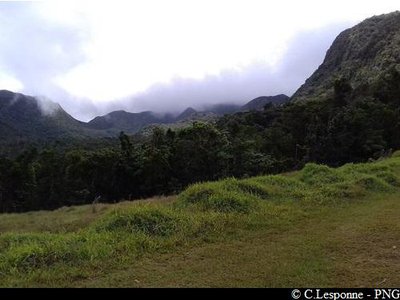
vue vers le nord - PNG  Viewpoint
Viewpoint
There is a viewpoint over the Basse-Terre mountain chain to the north east (Grande Découverte, Sans-Toucher) and over Basse-Terre to the south west.
Description
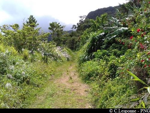
Hiking trail colour : yellow.
---
The path starts behind the water tower. Set out on the path. At the end of the fields, go slightly downhill on the left to enter the forest (Point 1); you will see an information panel.
The trail then carries on in the forest. Pass close to a water catchment area (Point 2). Follow the path to its crossroads with the Matouba/Bains Chauds trail.
(To go to the site of the Bains Chauds (hot springs), turn right at the crossroads and continue for 30 minutes from that junction. Return by the same route).
- Departure : behind the water tower, above the Matouba/Papaye clinic, Saint-Claude.
- Arrival : crossroads with the Matouba/Bains Chauds trail
- Towns crossed : Saint-Claude
Altimetric profile
Recommandations
As Guadeloupe is prone to natural risks, extra care should be taken in this natural environment. For the benefit of all hikers, responsible behaviour is very important.
Please note: the parking is not supervised.
Please note: the parking is not supervised.
Is in the midst of the park
The national park is an unrestricted natural area but subjected to regulations which must be known by all visitors.
Information desks
Headquarters of the National Park of Guadeloupe
Montéran, 97120 Saint-Claude
The reception and shop are open to the public :
- Monday, Tuesday and Thursday : 8 am to 12.30 pm and 2 pm to 5 pm.
- Wednesday : from 8 am to 1 pm.
- Friday : 8 am to 12.30 pm.
Services : reception, shop, toilets, free parking. Building accessible to people with reduced mobility.
Localisation GPS : Lat: 16,01634 N - Lng: 61,70753 W.
Access and parking
Start point : Lat : 16,04613°N - Long : 61.68570°W.
---
In the town of Saint-Claude, pass La Poste (the post office), turn left on to Avenue du Maréchal Foch, then pass in front of the Pavillon du Tourisme and the Hôtel de Ville (town hall). At the stop in front of the church, turn right on to the RN3 which goes up towards Matouba.
When you reach the town of Matouba, head for 'Papaye'. Continue as far as the clinic. The path starts above the water tower.
Source
Rando Guadeloupehttps://www.randoguadeloupe.gp/
Report a problem or an error
If you have found an error on this page or if you have noticed any problems during your hike, please report them to us here: