Hairpin road
1 point of interest
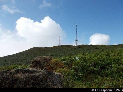
vue sur la Citerne - PNG  Viewpoint
View over La Citerne
In fine weather, view over La Citerne.
Description
Starting from the refuge, set off up the path towards La Citerne. The path steadily climbs and broadens out little by little. It then joins up with the old road before arriving at the crossroads with the road leading to the aerials (summit of La Citerne).
From there, you will see links to other hiking trails, including climbs up Mount Echelle, La Soufrière, etc.
Plan to have a vehicle at the planned point of arrival (in Les Bains Jaunes, for example), or return by the hairpin road and go down towards the Carbet Falls visitors' area in Capesterre-Belle-Eau.
---
NB: the hairpin road is a section of the "Trace des Alizés" GR hiking trail (stage 2).
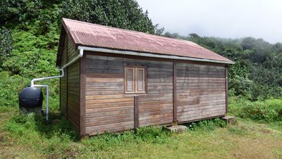
More details about La Citerne refuge: HERE.
- Departure : La Citerne refuge, Capesterre-Belle-Eau.
- Arrival : a crossroads with the old Citerne road (access road to the aerials), at the foot of Mount Echelle.
- Towns crossed : Capesterre-Belle-Eau and Gourbeyre
Altimetric profile
Recommandations
In this natural setting, you should be particularly careful and alert, since Guadeloupe is subject to natural risks.
It is vital to act in a responsible way, so that everyone can enjoy the hike!
Information desks
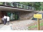
Reception area of Les Chutes du Carbet
terminus de la RD4 , route de l'Habituée, 97130 Capesterre-Belle-Eau
Opening hours : daily from 7.00 am to 5.00 pm.
Services : reception centre, shop, toilets, parking, picnic area.
In exchange for the services provided on the site, a financial contribution is requested to visitors (prices 06/2025 to 05/2028) :
- Adults : 6,00 € / pers.
- Children (- 12 years) : 4,00 € / pers.
- Families (5 pers. ; 1 or 2 adults + 1 or 4 children) : 14,50 €
- Groups adults (from 8 pers.) : 4,50 € / pers.
- Groups children (from 8 pers.) : 2,50€ / pers.
- One-year access card : 16,50 € / pers.
The promontory of the reception area is accessible to people with reduced mobility.
GPS location : Lat: 16,04198° N - Lng: 61,63822° W.
Access and parking
GPS starting point (La Citerne refuge): Lat: 16,04105°N - Long: 61,64827°W.
---
No road access.
NB: traffic is prohibited on the old Citerne road (access reserved for the emergency services and the aerial technical teams).
Source
Report a problem or an error
If you have found an error on this page or if you have noticed any problems during your hike, please report them to us here: