Grande Pointe path
A trail that will delight hikers with its richness in culture, heritage and history, as well as exceptional fauna and flora. If you like sketching, you will love the panels with tips to help you draw like a professional.
8 points of interest
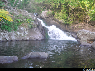
Rivière La Coulisse - AAMG  River and waterfall
River Coulisse
It takes its name (lit. "River Slide") from a water slide located upstream, where local inhabitants would come to relax and have fun.
You can swim, but be careful when it is raining because the level rises quickly.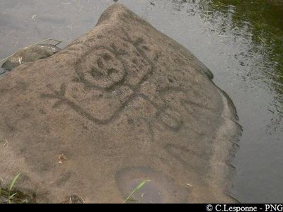
PNG  Cultural and architectural heritage
Engraved rocks
A series of engraved rocks (petroglyphs), with the centrepiece showing a woman in labour.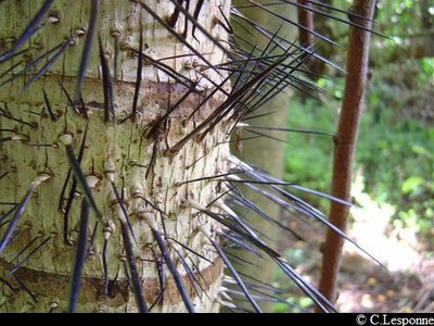
PNG  Flora
Flora"Chou piquant"
This palm tree is endemic to Guadeloupe.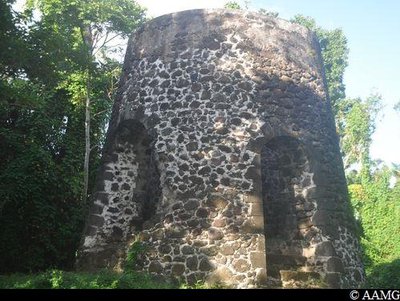
le moulin à vent - AAMG Cultural and architectural heritageWindmill
One of the few windmills in Basse-Terre.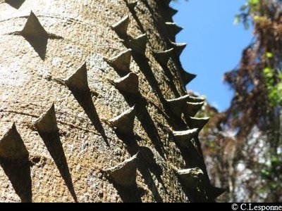
PNG FloraLépiné tree
Its very resistant wood was once used for frameworks and cabinet-making, to make parts of windmills and pestles for coffee mills.
The Kalinagos called it "Allioua".
Its bark was used to reduce fever and to make dyes.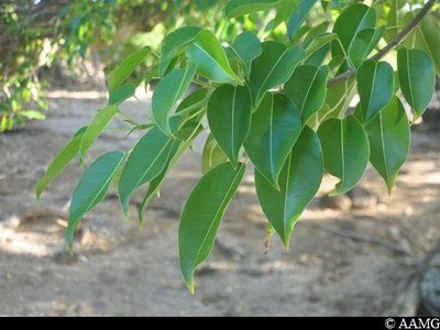
AAMG FloraManchineel tree
Be careful, the tree's fruits look tasty, but you must never eat them or even touch them because they are poisonous.
The same goes for all the other parts of the tree.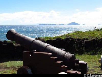
canons - PNG Cultural and architectural heritageGunpowder depot and cannons
Gunpowder depot, and a few yards further on, well-conserved cannons. This was a strategic site, defending the Les Saintes Canal.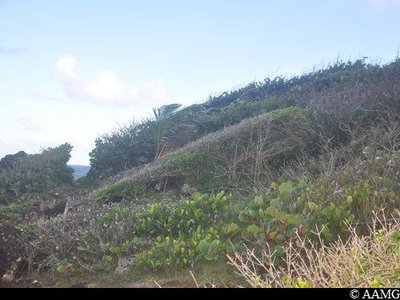
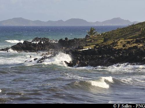
AAMG Floravegetation flag
The vegetation is continually exposed to the wind, so it looks as if the tree only grows on one side. The phenomenon is known as wind deformation.
Description
Starting from the car park, follow the road towards the right for 200m.
Follow the track on the right. You will see the introduction panel at the entrance.
Follow the yellow markings.
Follow the track as far as La Coulisse river.
Cross the river, paying attention on the slippery rocks, and don't try to cross in bad weather.
Continue along the track for 500m, as far as the engraved rocks known as "la femme qui accouche" ("the woman in labour").
Continue on to the windmill. Walk around the windmill to get a good look at it. Towards the left are the remains of a watermill. It is about 200 m away. Towards the right are the remains of some buildings about 100 m away.
Retrace your steps to the windmill and continue the trail.
Continue for about 1 km and you will see the gunpowder depot and the artillery battery. Carry on to the left after the artillery battery.
Make your way along the path between the volcanic rocks.
Continue along the path as far as the steps, about 1.5 km further on.
One last effort and you're there!
- Departure : La Coulisse, Anse Duquery, Trois-Rivières.
- Arrival : Grande Pointe Path, Trois-Rivières.
- Towns crossed : Trois-Rivieres
Altimetric profile
Recommandations
NB: this is a non-circular trail, so you should leave your car at the end of the trail.
Go with a mountain guide to make the most of the site.
Caution: River crossing. The route can be dangerous in wet conditions. Do not attempt it if it has rained the day before or if bad weather is forecast. If the water level rises, do not attempt to cross the river; wait until it recedes.
Don't climb on or touch the engraved rocks.
---
In this natural setting, you should be particularly careful and alert, since Guadeloupe is subject to natural risks. It is vital to act in a responsible way, so that everyone can enjoy the hike!
Please note: unsupervised car parks and swimming.
Information desks

Le bourg, 3 rue Gerville Réache, 97114 Trois-Rivières

46 rue Paul Baudot, 97100 Basse-Terre
Access and parking
GPS starting point: Lat: 15,96963° N - Long: 61,63080° W.
---
Start: Chemin de la Coulisse, Trois-Rivières:
From the N1 road, take the D6 towards Trois-Rivières, pass the petrol station on your right (just before a bridge) then turn left (N15°58'36.2" W61°38'11.5"), go down until you see a parking area on your left (N15°58'10.8" W61°37'50.6").
Arrival access: via Chemin Neuf, Trois Rivières: from the N1 road arriving from Pointe à Pitre, turn left (N15°59'16.8" W61°37'05.1) after " Trou aux chiens", Trois rivières. Turn left.
Be careful, access is dangerous from the N1, so you should take a short cut.
Parking :
More information
Source
Report a problem or an error
If you have found an error on this page or if you have noticed any problems during your hike, please report them to us here: