Piton de Bouillante by Mamelle de Petit-Bourg
11 points of interest
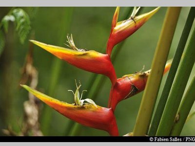
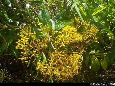
balisiers - Fabien Salles / PNG  Flora
FloraBalisiers
A member of the Musaceae family, Heliconia caribaea is a large grass that is typical of the Lesser Antilles tropical rainforest, growing up to 5 metres tall. It flowers all year round, especially between April and June. Its inflorescence resembles a red ear or red ear with yellow trim, or sometimes completely yellow.
Laurier rose (ou Laurier montagne) - Emilie Savy / PNG FloraThe Yucca Plum Pine
A member of the Podocarpaceae family, Podocarpus coriaceus is also known as the Yucca Plum Pine. Similar to conifers, the Yucca Plum Pine is an average-sized tree that can grow between 10-16 metres tall. It has leathery leaves that are similar to an oleander's. They are dark green on top, with a span of 6-15cm and virtually no petiole. Its flowers are discreet, but its brownish seeds in its red buds are certainly eye-catching. It has a thin layer of bark. This species is found throughout the West Indies and flowers mainly in December and January.
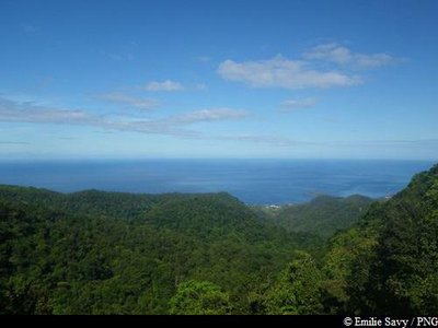
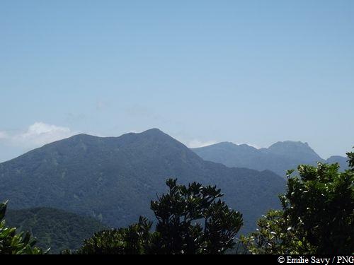
vue sur Bouillante et les Ilets Pigeon - Emilie Savy / PNG  Viewpoint
View of Bouillante and les Ilets Pigeon
View of Bouillante and les Ilets Pigeon, classified as the central area of the National Park since 2009 on account of the rich biodiversity found there.
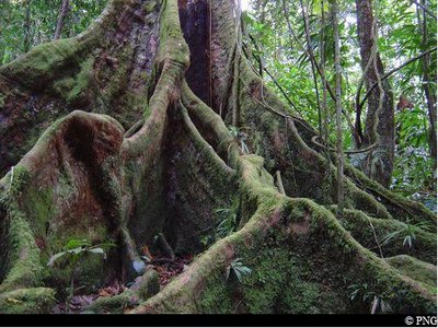
Acomat Boucan - PNG FloraAcomat boucan
The Acomat boucan (Sloanea caribaea) belongs to the Elaeocarpaceae family. It is an extremely large tree that can reach up to 40 metres in height. It is the most spectacular tree in the Sloanea genus. It has an exposed trunk and magnificent buttresses. Its bark is reddish-brown and tends to flake off in thin strips when the tree ages. Formerly, visitors to the forest would make use of its enormous buttresses to shelter their fires and to smoke meat. It has since been established that lighting fires among the roots is not conducive to the well-being of trees.
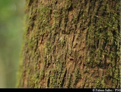
bois bandé (écorce) - Fabien Salles / PNG Flora"Bwa bandé"
Richeria grandis belongs to the Phyllanthaceae family. It is a large variety, distinctive for its tough leaves and reddish-brown bark that so often falls victim to rogue extraction. Also known as bwa bandé in Créole, it is renowned for its aphrodisiac qualities. Its wood is used as timber or in carpentry. It has very distinctive, green, grape-like fruits which form small pods and form copiously on its branches.
De Malendure au Grand Cul-de-Sac Marin - De Malendure au Grand Cul-de-Sac marin ViewpointFrom Malendure to Grand Cul-se-Sac Marin
A large opening allows for impressive views of Malendure (Bouillante) to the west and the bay of Grand Cul-de-Sac Marin to the north.
Les deux Culs-de-Sacs marins - Les deux Culs-de-Sacs marins ViewpointThe two Cul-de-Sac Marins
View of the Grand and Petit Cul-de-Sacs Marins and, below, of the Bras David river to the northeast.
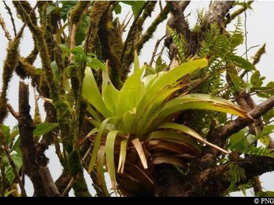
"Ananas bois" - PNG FloraGlomeropitcairnia penduliflora
A member of the Bromeliaceae family, Glomeropitcairnia penduliflora, or "Zanana mawon" in Créole, is a tropical, epiphyte (living on other trees' branches) or terrestrial plant. It has straight, tough and thick leaves which, arranged in the format of rosettes, take in substantial levels of water and are even home to some frogs. It features a floral scarp in the middle.
Herbe à pique bâtard - Emilie Savy / PNG FloraSenecio lucidus
Senecio lucidus belongs to the Asteraceae family. It is endemic to the Lesser Antilles. Its flowers are yellow-orange in colour. This plant is used in traditional Creole medicine because of its antiviral and pain-relieving qualities.
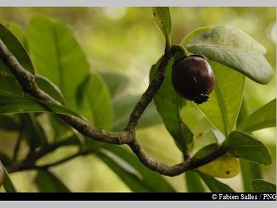
Clusia mangle - Fabien Salles / PNG FloraClusia mangle
Clusia mangle belongs to the Clusiaceae family. It thrives at 800 metres above sea level, where strong winds abound and there is constant humidity. It is a shrub with leathery, fleshy and shiny leaves. Its fruits, measuring between 1-2 centimetres, are similar to large yellow/green olives.
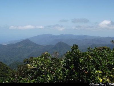
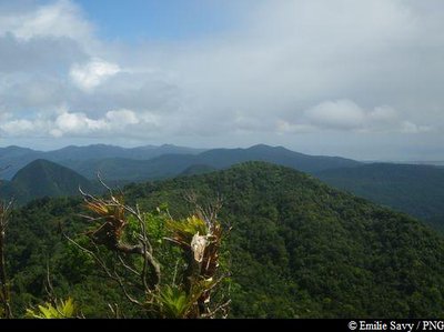
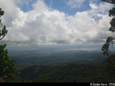
Vue depuis le Piton de Bouillante - Emilie Savy / PNG  Summit
Piton de Bouillante
Piton de Bouillante stands at 1,088 metres above sea level. Its summit offers spectacular, panoramic views on a clear day.
Description
Hiking trail colour: yellow
Starting from the National Park information boards, take the start of the ridge trail (same start point as the Mamelle de Petit-Bourg trail). Go straight on at the first intersection. Walk over the wooden decking and stay on the same trail. At the next intersection, go straight on. Once you reach the top of Piton de Bouillante, the panoramic views are fully deserved after the last steep climb! Head back on to the same trail to return to the parking area.
Alternatively, you can also head back down towards Bouillante from the summit, down to the "Village", "Bon Air" (ridge trail) or "Birloton" sections. You can also keep going on the GR1 path (red and white signs), towards the Trois Crêtes shelter.
- Departure : near Col des Mamelles, Petit-Bourg
- Arrival : near Col des Mamelles, Petit-Bourg
- Towns crossed : Petit-Bourg and Bouillante
Altimetric profile
Recommandations
Pay attention to cars on Route RD23, as it is a major road.
There are no litter bins on the route, so please be considerate and take your rubbish with you.
Extra care should be taken in this natural environment, as Guadeloupe is prone to natural risks. For the benefit of all hikers, it is very important that you behave responsibly.
Please note : the parking area is not supervised.
Information desks
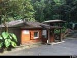
Maison de la Forêt
RD 23 - Route de la Traversée, 97170 Petit-Bourg
Opening hours :
- In low season (May 1 to June 30 and September 1 to October 31) : every day (except weekends) from 9 am to 4.30 pm.
- In high season (November 1 to April 30 and from July 1 to August 31) : every day from 9 am to 4.30 pm ; sunday from 9 am to 12.30 pm.
Services: reception, permanent exhibition, free parking. Building and restrooms accessible to people with reduced mobility. Picnic area nearby.
Please note : parkings are not supervised.
Localisation GPS : Lat: 16,17600 N - Lng: 61,69280 W.
Access and parking
GPS coordinates of the start point : Lat : 16,17827 N - Long : 61,73176 W.
On Route de la Traversée (RD23), the parking area for the start of the trail is near to Col des Mamelles.
-> From Côte-sous-le-Vent (Bouillante / Pointe-Noire): 22 minutes after Col des Mamelles.
-> On the other side (Prise d'Eau, Petit Bourg): you will need to drive for around 4 km after Maison de la Forêt to find the start point.
You can park near the sign for the start of the trail that runs alongside Route RD23.
Parking :
Source
Report a problem or an error
If you have found an error on this page or if you have noticed any problems during your hike, please report them to us here: