Mamalier
Vieux-Habitants Coastal trail
Mamalier
Easy
1h30
2,4km
+7m
-10m
Cross
PR (short hike network)
Embed this item to access it offline
A seaside hike with the chance to see a wide range of birds, typical coastal vegetation and to visit some more original sites, such as the old coconut orchard.
4 points of interest
AAMG  Pond
PondFord - Birds
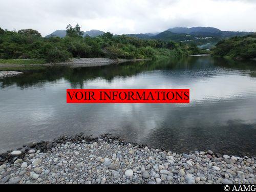
Be careful here: the current is sometimes quite strong. Don't hesitate to go slightly upstream of the river to find a crossing point where the current is less strong.
This is also a chance to see the birds that are often present, including the green heron and egrets.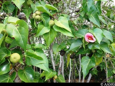
AAMG  Flora
FloraPortia tree
A very common tree on the Guadeloupe coast, often mistaken for the dangerous manchineel tree (see below)... but very different in the shape of its leaves, which are a pretty heart shape! It has beautiful flowers which turn from yellow to pink at different stages of its life. The fruit is ribbed, green and then brown, and floats in the sea. The scientific name is Thespesia populnea.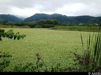
AAMG PondView over the lake
A green viewpoint over the lake, located between the sea and the mountains. There are a lot of common moorhens, as well as the smaller and more discreet pied-billed grebes. Much of the lake is covered by water lettuce, Pistia stratiotes. The plant floats at the surface and reproduces quickly by vegetative reproduction, using runners at the end of which new little plants grow.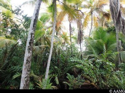
AAMG FloraFormer coconut orchard
This former coconut orchard with 4000 trees was planted during the First World War to make soap. A panel explains the history of the plantation and the production process.
Description
From the first few yards of the trail, you have to cross one of the arms of the Grande Rivière in Vieux-Habitants (point 1). But this first crossing is problem-free, since this is not the main arm of the river. After making your way past the houses built in the middle of the river, you reach the coast, where you have to cross the main arm of the Grande Rivière (point 2). Don't hesitate to go upriver a little to find a spot where the current is less strong, because the waters can be impressive near the river mouth (if the current is too strong, retrace your steps).
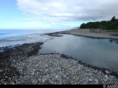
After that, there are no real difficulties. You just need to walk along the coast. You pass by the Etang beach, cross the Bel Air gully (point 3), then the old coconut orchard before arriving behind the football stadium, just before the Pointe Beaugendre.
After that, there are no real difficulties. You just need to walk along the coast. You pass by the Etang beach, cross the Bel Air gully (point 3), then the old coconut orchard before arriving behind the football stadium, just before the Pointe Beaugendre.
- Departure : Boulevard des Habissois Souverains, in the town of Vieux-Habitants (after the cemetery)
- Arrival : Behind the stadium before the River de Beaugendre (Chemin de Navarraine, just before the Maison du Parc)
- Towns crossed : Vieux-Habitants
Altimetric profile
Recommandations
1.5 litres of water per person, enclosed shoes, hat, suncream and a snack.
Please note, the trail involves crossing several rivers. Be careful in bad weather. If the current is too strong, turn back.
In this natural setting, you should be particularly careful and alert, since Guadeloupe is subject to natural risks. It is vital to act in a responsible way, so that everyone can enjoy the hike!
Please note: unsupervised car parks and swimming.
Information desks

46 rue Paul Baudot, 97100 Basse-Terre
Access and parking
GPS starting point: Lat: 16,05952° N - Long: 61,76849° W.
---
In the town of Vieux-Habitants, next to Simaho beach.
A Coastal Conservatory sign on Boulevard des Habissois Souverains marks the start of the trail. Plenty of parking places nearby.
---
In the town of Vieux-Habitants, next to Simaho beach.
A Coastal Conservatory sign on Boulevard des Habissois Souverains marks the start of the trail. Plenty of parking places nearby.
Parking :
Near the start, Boulevard des Habissois Souverains
Source
Rando Guadeloupehttps://www.randoguadeloupe.gp/
Report a problem or an error
If you have found an error on this page or if you have noticed any problems during your hike, please report them to us here: