Trace du Petit Malendure
Bouillante Coastal trail
Trace du Petit Malendure
Medium
2h
2,8km
+185m
-237m
Cross
PR (short hike network)
Embed this item to access it offline
Wonderful views await you as you pass through a ravine, a headland or a bay ...
15 points of interest
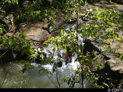
Rivière Colas - CD971  River and waterfall
River Colas
Waterfall and pool along the River Colas.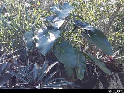
Siguine blanche - CD971  Flora
FloraPhilodendron giganteum
The Philodendron giganteum always grows near wetland or rivers.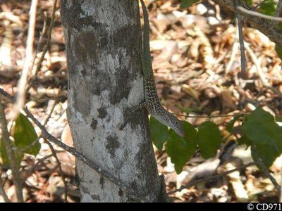
Anolis - CD971  Fauna
FaunaZandoli
A type of anole (Anolis marmoratus girafus) with a camouflaged costume.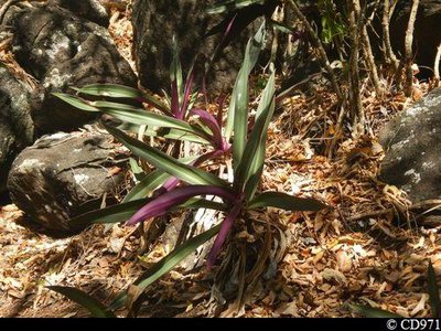
Tradescantia Spathacea - CD971 FloraMoses-in-the-cradle
A member of the commelinaceae family called Tradescantia Spathacea which likes dry and rocky environments.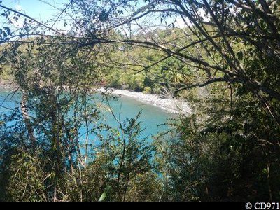
Anse Colas - CD971  Viewpoint
Anse Colas
View over Anse Colas and the Caribbean Sea.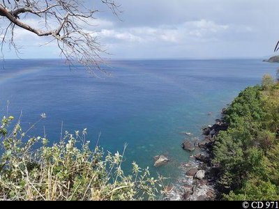
Falaise Noire - CD971 ViewpointFalaise Noire
Panorama from Falaise Noire with a view over the Caribbean Sea.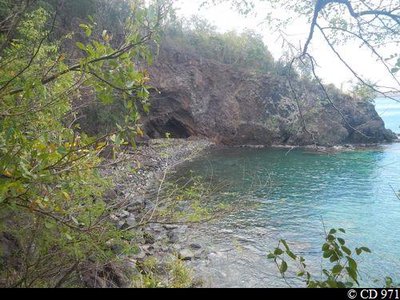
Anse Feuillard - CD971  Geology
Anse Feuillard
Anse Feuillard is the ideal spot for a relaxing break.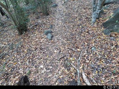
Parterre de feuilles - CD971 FloraA bed of leaves
Trees take advantage of Lent to renew their foliage.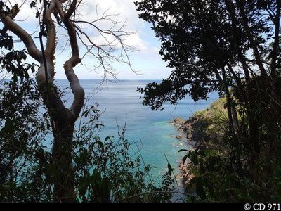
Pointe à Négresse - CD971 ViewpointPointe à Négresse
A window open onto Pointe à Négresse.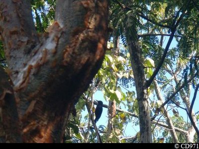
"Tapeur" - CD971 FaunaGuadeloupe woodpecker
The only endemic bird species to the country, the Guadeloupe woodpecker measures 26-28 cm. Its beak is long and slender and, in the male, is longer than the head, unlike in females. It is adorned with black plumage, has a blood-red throat and belly and blue/black back. It can be seen quite frequently on tree trunks, which it hammers into with its powerful beak (hence its Creole name of Toto bwa). It moves over short distances in rippling, gliding movements. The Guadeloupe woodpecker is included on the list of endangered species.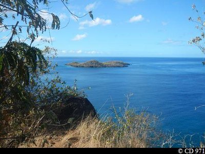
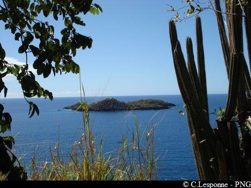
îlets Pigeon - CD971 ViewpointView over the Îlets de Pigeon
Panorama over the Îlets de Pigeon from Falaise Bellon.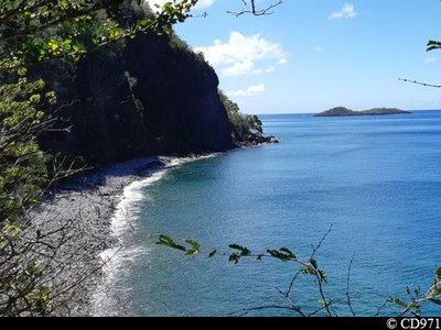
Anse Zombi - CD971 ViewpointAnse Zombi
View over Anse Zombi and the Îlets Pigeon.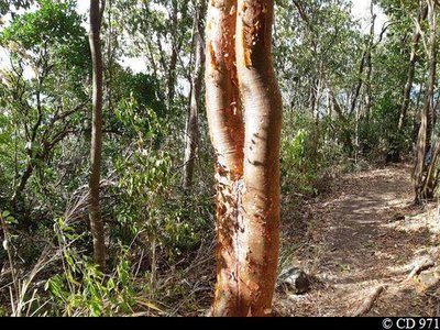
Gommier rouge - CD971 Flora"Gumbo-Limbo"
The gumbo-limbo, Bursera simaruba, is a typical dry-forest tree. It is noticeable because of its peeling bark (desquamation) with a bright red colour.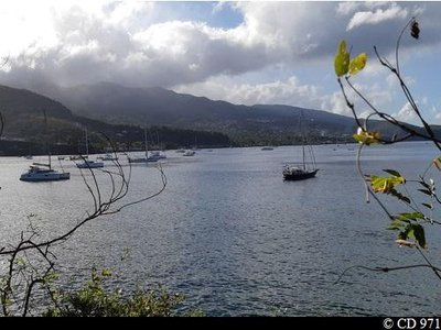
Rade de Malendure - CD971 ViewpointMalendure harbour
View over Malendure harbour and the hills of Bouillante (Bois-Malher, Poirier, Desmarais, etc.)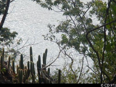
Cactus cierge - CD971 FloraPipe organ cactus
Pipe organ cactuses (Cephalocereus nobilis) grow here.
Description
Just after you set off, the path runs close by the River Colas. Follow the path through the rocks and the slate stone. You arrive at a fork (option to go down to Anse Colas and the pebble beach by the path to the right).
Turn left. From Pointe à Zombi, the view takes in the Colas and Zombi bays. Follow the path leaving to the left at right angles (you pass by a building). Go straight ahead through the dry forest (pear trees, logwood, gumbo-limbo) and you begin a steady climb. Along the way there are views over Anse Feuillard, La Pointe Negresse and the island of Montserrat (70 km north-west of Basse-Terre). Walk past a barrier near Falaise Noire. You cross a gully (to the right, access to Anse Feuillard) and go straight ahead. After 250 m, you reach a crossroads. Continue on the main pathway towards Pointe de Malendure. You start to go down towards Fond Ravine, crossing a wood before arriving at Petit Malendure beach.
Take the same route on the way back.
- Departure : 30 metres after the bridge over the River Colas leading to Malendure, Bouillante.
- Arrival : Petit Malendure beach, Bouillante.
- Towns crossed : Bouillante
Altimetric profile
Recommandations
NB: this is a non-circular trail, so you should leave your car at the end of the trail.
In this natural setting, you should be particularly careful and alert, since Guadeloupe is subject to natural risks. It is vital to act in a responsible way, so that everyone can enjoy the hike!
Please note, unsupervised car parks and swimming.
In this natural setting, you should be particularly careful and alert, since Guadeloupe is subject to natural risks. It is vital to act in a responsible way, so that everyone can enjoy the hike!
Please note, unsupervised car parks and swimming.
Information desks

plage de Malendure, 97125 Bouillante
Access and parking
GPS starting point: Lat: 16,18666° N - Long: 61,77989°W.
---
RN2 road to Bouillante, Colas section: between Malendure beach and the junction of the RD33 road, La Traversée.
---
RN2 road to Bouillante, Colas section: between Malendure beach and the junction of the RD33 road, La Traversée.
Parking :
Start: edge of the RN2 road, Colas section. Finish: roadside "Petit Malendure" car park.
Source
Rando Guadeloupehttps://www.randoguadeloupe.gp/
Report a problem or an error
If you have found an error on this page or if you have noticed any problems during your hike, please report them to us here: