Village Crests – Dupuy
Bouillante
Village Crests – Dupuy
Medium
3h
3,5km
+602m
-126m
Cross
PR (short hike network)
Embed this item to access it offline
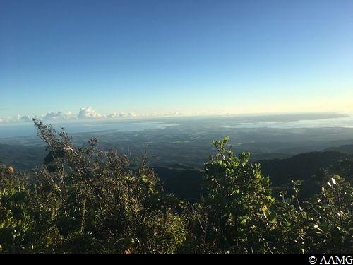
In fine weather, there are wonderful views all the way with the high point at the summit of the Piton with a view over the two Culs-de-Sacs Marins.
8 points of interest
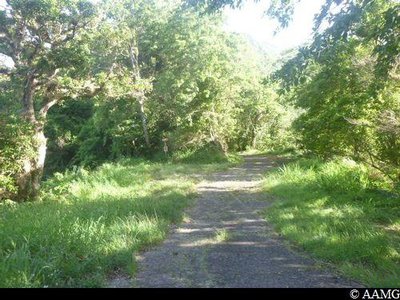
Parking départ - AAMG  Information board
Starting point
Signs for the start in the car park. A great view over the "Thomas" Valley.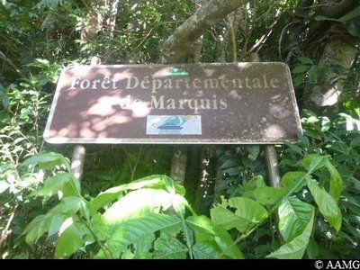
Panneau Forêt Marquis - AAMG Information board"Le Marquis" forest panel
Entrance to the Departmental Forest.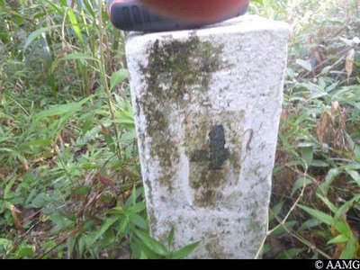
Borne limite forêt départementale - AAMG Information boardBoundary marker
A boundary marker showing the limits of the departmental forest.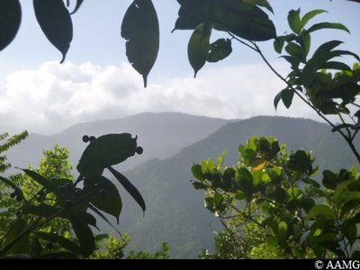
Point de vue forêt Côte Sous le Vent - AAMG  Viewpoint
Panorama over the Faux Piton de Bouillante
Magnificent scenery around the Côte Sous-Le-Vent mountain.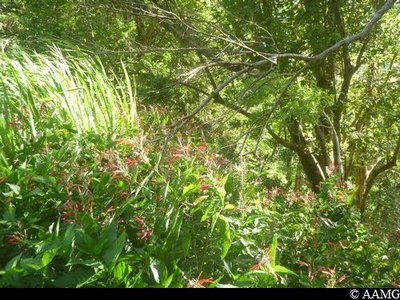
herbe a poison - AAMG  Flora
FloraFish grass
Lobelia Persicifolia, known locally as "Herbe à Poisson" (Fish Grass), is an endemic plant that can only be found in Guadeloupe and nowhere else in the world. It was used by native Americans to daze fish in the river, making it easier to catch them.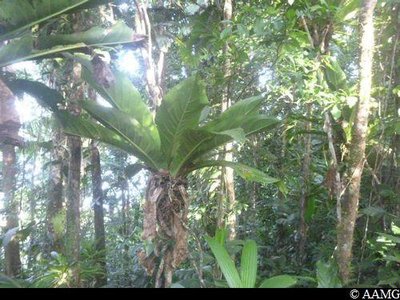
Siguine Rouge - AAMG FloraBird's nest anthurium
Anthurium Hookeri, the bird's nest anthurium, is a member of the Araceae family. It is an epiphyte, which grows on trees. It lives on air humidity, rain and the leaves from trees falling into the cone formed by its leaves. The plant is sometimes so big and heavy that the branch it is attached to will break under its weight.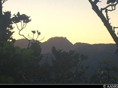
Soufrière au lever du soleil - AAMG ViewpointView over La Soufrière
Early in the morning, the sunrise over La Soufrière in a cloudless sky is a rare and magical moment.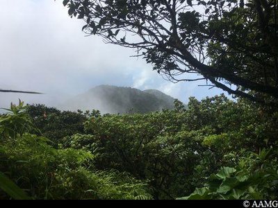
AAMG Information boardCrossing towards Piton de Bouillante
Once you have arrived, there are several options : towards the Piton de Bouillante in the north, towards the Ricard Forest / Espérance (north-west) or towards the Faux Piton de Bouillante (retracing your steps).
Description
There are arrows showing the starting point. Make sure you follow the official markings (yellow panel and paint) and not the orange dots, which will not take you to the right place.
The trail rises non-stop to the crest as far as the "Crêtes des Bois" crossroads with a descent towards "Bon Air". At this crossroads (point 1), head for Piton de Bouillante. A relatively flat section is followed by a series of steep climbs and descents. Just before the summit, there is a little rope to help you go up a section with large steps. The last 100 metres before arriving at the Piton de Bouillante are flat.
The trail rises non-stop to the crest as far as the "Crêtes des Bois" crossroads with a descent towards "Bon Air". At this crossroads (point 1), head for Piton de Bouillante. A relatively flat section is followed by a series of steep climbs and descents. Just before the summit, there is a little rope to help you go up a section with large steps. The last 100 metres before arriving at the Piton de Bouillante are flat.
- Departure : Bouillante, Route de Village, Dupuy section.
- Arrival : Piton de Bouillante.
- Towns crossed : Bouillante and Vieux-Habitants
Altimetric profile
Recommandations
Set off early in the morning in fine weather. The sunrise at the Piton is magnificent.
In this natural setting, you should be particularly careful and alert, since Guadeloupe is subject to natural risks. It is vital to act in a responsible way, so that everyone can enjoy the hike!
Please note: unsupervised car park.
In this natural setting, you should be particularly careful and alert, since Guadeloupe is subject to natural risks. It is vital to act in a responsible way, so that everyone can enjoy the hike!
Please note: unsupervised car park.
Information desks

plage de Malendure, 97125 Bouillante
Access and parking
GPS starting point: Lat: 16.11345°N - Long: 61.74260°W.
---
Arriving from Vieux-Habitants: follow the signs to Bouillante. Just after Petite Anse beach, go up to the right towards the "Village" section on the D14 road. Cross the "Village" section then continue up a steep slope until the concrete road starts to widen a little with a nice view to your left. There is a place to park there.
Parking :
At the starting point, there is room for 10 or so cars.
Source
Rando Guadeloupehttps://www.randoguadeloupe.gp/
Report a problem or an error
If you have found an error on this page or if you have noticed any problems during your hike, please report them to us here: