Davidon forest road
Petit-Bourg
Davidon forest road
Easy
2h
5,2km
+319m
-54m
Cross
PR (short hike network)
Embed this item to access it offline
The forest on either side of the forest path is a chance for hikers to see wide-ranging plant life and exceptional animals.
6 points of interest
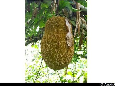
Jacquier - AAMG  Flora
FloraJackfruit
The jackfruit belongs to the same family as breadfruit. It is the biggest fruit in the world. It can weigh up to 20 kg.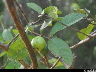
Goyavier - AAMG FloraCommon guava
A bird probably first brought the seed here. It is a great boon to hikers, if they manage to get to the fruits before the animals living in the wood.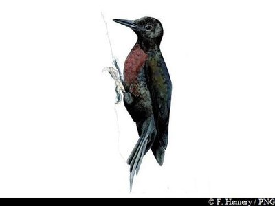
Pic de Guadeloupe - F.Hemery  Fauna
FaunaGuadeloupe woodpecker
The Guadeloupe woodpecker (Melanerpes herminieri) is between 26 and 28 cm long. It has a long, slender beak. The male's beak is longer than its head, in contrast to the female. Its plumage is black, its breast is blood red and its black bluish black. You will see it quite often on tree trunks, where it hammers away with its powerful beak (hence its Creole name "Toto bois" ("wood comforter") or "Tapè" ("hitter"), leaving a lot of holes in the bark.
The Guadeloupe woodpecker is the only bird species endemic to Guadeloupe and is listed as an endangered species.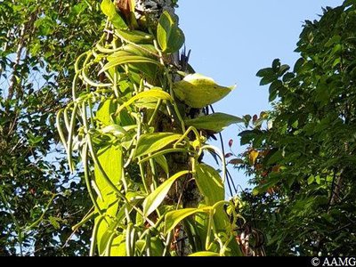
vanille - AAMG FloraVanilla
Vanilla is a spice consisting of the fruit of different climbing tropical orchids, and especially the Vanilla planifolia species.
Growing and preparing vanilla calls for lengthy and painstaking care to produce a richly aromatic spice. This makes it one of the world's most expensive products. It comes in the form of black, shiny sticks, usually known as "pods".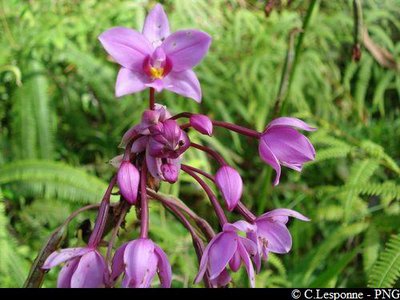
orchidée - PNG FloraOrchid
This orchid is known as Spathoglottis plicata and was originally from Asia.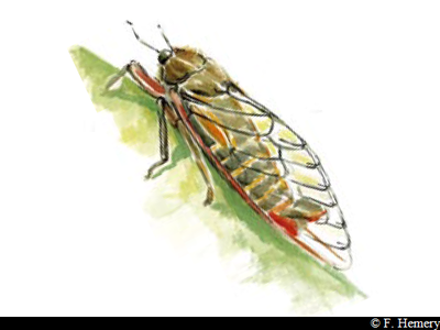
cigale - F.Hemery FaunaCicada
The cicada (Fidicina mannifera) was accidentally introduced into Guadeloupe from Guiana and is now an invasive species. It can be recognised by its stocky body and triangular-shaped head. But in general we will notice it first of all with our ears! To attract females, the males sing them serenades. These sounds vary, depending on the species and circumstances. They are made by a kind of soundbox consisting of a double drum with two cymbals moved by its muscles. Cicada have invented a disconnectable ear. When the male is silent, it listens to the others, but when it is singing, it relaxes its eardrum, so that it becomes deaf and cannot be bothered by the sounds it is making.
Description
No markings.
Take the forest road. At the crossroads (point 1) continue straight ahead and follow the forest path. When you arrive at the end of the forest road, enter the forest, following the track.
You arrive at the intersection with the Morne Léger trail.
You have the option to continue on this other trail.
Take the forest road. At the crossroads (point 1) continue straight ahead and follow the forest path. When you arrive at the end of the forest road, enter the forest, following the track.
You arrive at the intersection with the Morne Léger trail.
You have the option to continue on this other trail.
- Departure : Behind INRA, Prise D'Eau, Petit-Bourg.
- Arrival : Link with the Morne Léger trail
- Towns crossed : Petit-Bourg and Lamentin
Altimetric profile
Recommandations
Don't set off after 3 pm.
The car park is for INRA staff in priority, so take care when parking.
Stay on the forest road and the recommended route.
NB: unsupervised car park.
The car park is for INRA staff in priority, so take care when parking.
Stay on the forest road and the recommended route.
NB: unsupervised car park.
Is in the midst of the park
The national park is an unrestricted natural area but subjected to regulations which must be known by all visitors.
Information desks
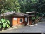
Maison de la Forêt
RD 23 - Route de la Traversée, 97170 Petit-Bourg
Opening hours :
- In low season (May 1 to June 30 and September 1 to October 31) : every day (except weekends) from 9 am to 4.30 pm.
- In high season (November 1 to April 30 and from July 1 to August 31) : every day from 9 am to 4.30 pm ; sunday from 9 am to 12.30 pm.
Services: reception, permanent exhibition, free parking. Building and restrooms accessible to people with reduced mobility. Picnic area nearby.
Please note : parkings are not supervised.
Localisation GPS : Lat: 16,17600 N - Lng: 61,69280 W.

Angle des rues Bel Air et Delgrès, 97170 Petit-Bourg

le bourg, 97126 Deshaies
Access and parking
GPS starting point: Lat: 16.20384°N - Long: 61.66618°W.
---
Take the D23 road to the Barbotteau roundabout. Take the exit towards the D1 for "Prise d'eau".
Turn first left after the church, towards INRA.
Cross the bridge and continue straight ahead, passing the "Domaine Duclos" on your left.
Take the uphill road after the Domaine Duclos, park in the car park opposite the buildings.
Parking :
Behind INRA.
Source
Rando Guadeloupehttps://www.randoguadeloupe.gp/
Report a problem or an error
If you have found an error on this page or if you have noticed any problems during your hike, please report them to us here: