Etangs circular trail
13 points of interest
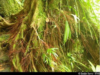
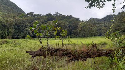
Acomat Boucan - F. Salles / PNG  Information board
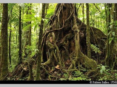
Info point 17: "The tree of a thousand buttresses"
The Acomat boucan (Sloanea caribaea) belongs to the Elaeocarpaceae family. It is an extremely large tree that can grow up to 40 metres tall. It is the most spectacular tree in the Sloanea genus, with an exposed trunk and magnificent buttresses. Its bark is reddish-brown and tends to flake off in thin strips when the tree ages. Formerly, visitors to the forest would use its enormous buttresses to shelter their fires and to smoke meat. It has since been established that lighting fires among the roots is not conducive to the well-being of trees.
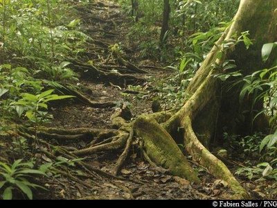
Au royaume des racines ... - F. Salles / PNG Information boardInfo point 16: "A fragile soil"
Plant roots in the soil are easy to spot throughout the trail. They are evidence of a young and shallow soil, which was only set down very recently.
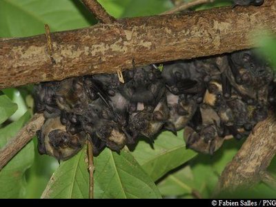
"Guimbos" - Fabien Salles / PNG  Fauna
FaunaBats
When you turn right, you may be able to hear the unmistakeable sound of bats, which inhabit this area.
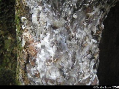
sève du Gommier blanc - Emilie Savy / PNG  Flora
FloraThe Gommier
The Gommier (Daryodes excelsa) can grow up to 35m high. When they are damaged, its white trunk and roots exude a white resin with a pungent turpentine smell, which is traditionally used as incense or to start fires, because it burns slowly regardless of the surrounding humidity. It is reported that the tree has the ability to cast out spirits. It is strictly forbidden to take away any plant parts from the National Park. Its trunk was used by American Indians to make their canoes (kanawa), and is still used today by coastal people from many tropical countries, such as Dominique, to make fishing vessels. Its green seeds are popular with pigeons.
Bois rouge carapate - Emilie Savy / PNG FloraBwa rouj carapate
A member of the Euphorbiacieae family, Amanoa caribeae is endemic to the Lesser Antilles. It is a large tree with a trunk that rests straight on its buttresses, depending on the terrain. The most distinctive feature of this species is its reddish bark and roots at the foot of the trunk. Its leaves vary in shape: sometimes they are whole, sometimes pointed. Its flowers form small clusters, while its very hard wood was used as timber or in carpentry.
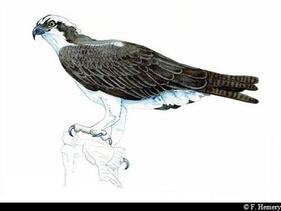
Balbuzard pêcheur - F. Hemery FaunaOsprey
An opening in the vegetation provides the perfect vantage point to see some ospreys. The Osprey (Pandion haliaetus) is a raptor with its own scientific family, the Pandionidae. In Guadeloupe it is known as the Gligli montagne. It has a blue/black beak, with dark brown plumage on its back and a speckled brown/white belly. It measures between 55-60 cm and boasts a wingspan of 1.8 metres. It feeds on the fish that it catches in ponds or at the seafront.
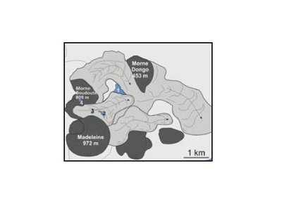
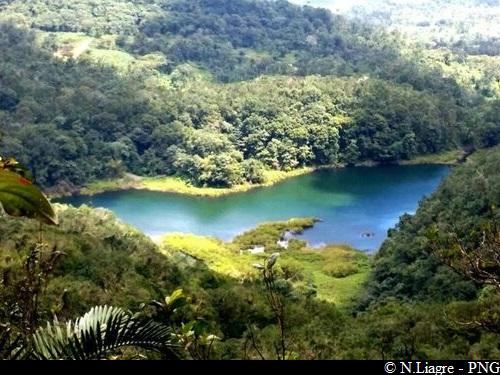
Illustration n°1 - BRGM  Geology
How the Grand Etang was formed
The largest pond in the Basse-Terre mountains, the Carib Indians called it "the great water of the mountain".
More than 10,000 years ago, a natural depression was formed between the lava flows of the Madeleine and Morne Boudoute, pushing against Morne Dongo. With its waterproof clay bedrock, the natural basin quickly filled up with water, forming into the Grand Etang pond.
As it was eroded over time, the Grand Etang gradually filled up with materials from the hillsides around it. Plant formations started to develop from the banks and shallows, eventually covering the entire lake. Unless appropriate action is taken, by pulling up and cutting down the plants, and dredging the sediment, the Grand Etang looks set to disappear completely.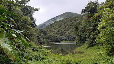
Etang As de Pique et vue sur la Citerne - C.Lesponne - PNG  Viewpoint
As-de-Pique and Citerne
View of l'Etang As-de-Pique and the top of the Citerne (known for its French TV antenna).
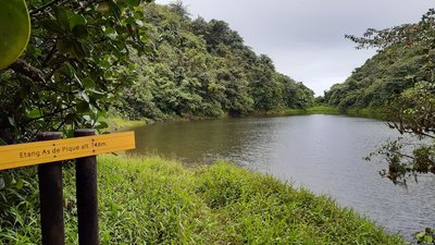
L'Etang As de Pique - C.Lesponne  Pond
PondL'Etang As-de-Pique
Etang As-de-Pique, set at 748 metres above sea level.
 Flora
FloraGeonoma
There are two species of palm in the Geonoma genus that are endemic to the Lesser Antilles and that co-exist in Guadeloupe. G. dussiana (10-15 cm in diameter) has a bigger stipe (trunk) than G. martinicensis (3-5 cm in diameter).
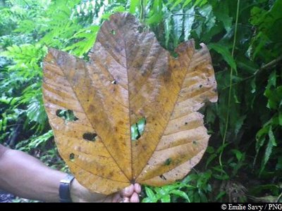
Feuille de Mapou Baril - Emilie Savy / PNG FloraMapou baril
Sterculia caribea is endemic to the Lesser Antilles. Depending on the age of the plant, its leaves come in different shapes. Its fruits - large woody follicles that cluster together in groups of four or five - are highly distinctive. They are lined with urticating bristles on the inside. Its flowers appear in the form of a bunch of small yellow and pink bells.
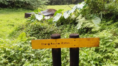
Etang Roche - C.Lesponne PondEtang Roche
L'Etang Roche is set at 650 metres above sea level. It is almost always dry, especially during Lent (the driest season in Guadeloupe, running from December to June).
Etang Madère (sec) - C.Lesponne PondEtang Madère
Beautiful views of l'Etang Madère and the Madeleine massif. The pond is almost always dry.
Description
Hiking trail colour: yellow
Follow the concrete path leading from the car park. Go up to the Grand Etang to enjoy the great views. Turn back and walk for a few metres and then turn left towards l'Etang As-de-Pique.
At the three intersections that follow, head in the same direction (right twice and straight on once). Once you get to l'Etang As-de-Pique, walk along it from the left. Enjoy the views marked out by the sign "Etang As-de-Pique". Turn around and head back down to the previous intersection. Turn right to reach l'Etang Roche. Walk alongside the pond, making sure to follow the trail that continues until l'Etang Madère. Turn left at the next intersection and then right and finally left to return to the concrete road. Keep going up until you reach the parking area. Both at the start and at the end points you can join the Grand Etang tour.
N.B. The numbered info markers correspond to detailed and illustrated information which can be found in the "Grand Etang Discovery Guide".
- Departure : Etangs parking area, Capesterre-Belle-Eau
- Arrival : Etangs parking area, Capesterre-Belle-Eau
- Towns crossed : Capesterre-Belle-Eau and Trois-Rivieres
Altimetric profile
Recommandations
As Guadeloupe is prone to natural risks, extra care should be taken in this natural environment. For the benefit of all hikers, responsible behaviour is very important.
Warning : the parking area is unsupervised.
Information desks
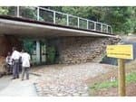
Reception area of Les Chutes du Carbet
terminus de la RD4 , route de l'Habituée, 97130 Capesterre-Belle-Eau
Opening hours : daily from 7.00 am to 5.00 pm.
Services : reception centre, shop, toilets, parking, picnic area.
In exchange for the services provided on the site, a financial contribution is requested to visitors (prices 06/2025 to 05/2028) :
- Adults : 6,00 € / pers.
- Children (- 12 years) : 4,00 € / pers.
- Families (5 pers. ; 1 or 2 adults + 1 or 4 children) : 14,50 €
- Groups adults (from 8 pers.) : 4,50 € / pers.
- Groups children (from 8 pers.) : 2,50€ / pers.
- One-year access card : 16,50 € / pers.
The promontory of the reception area is accessible to people with reduced mobility.
GPS location : Lat: 16,04198° N - Lng: 61,63822° W.
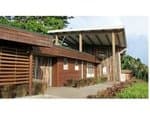
Headquarters of the National Park of Guadeloupe
Montéran, 97120 Saint-Claude
The reception and shop are open to the public :
- Monday, Tuesday and Thursday : 8 am to 12.30 pm and 2 pm to 5 pm.
- Wednesday : from 8 am to 1 pm.
- Friday : 8 am to 12.30 pm.
Services : reception, shop, toilets, free parking. Building accessible to people with reduced mobility.
Localisation GPS : Lat: 16,01634 N - Lng: 61,70753 W.
Access and parking
GPS coordinates of the start point : Lat : 16,02922 N - Long : 61,62748 W.
After Saint-Sauveur on Route RN1 (between "Bananier" and the town of
Capesterre-Belle-Eau), head towards "Chutes du Carbet".
Keep going on the RD4. The road is steep. Parking for the Etangs is shown at an intersection on the left.
Parking :
More information
Source
Report a problem or an error
If you have found an error on this page or if you have noticed any problems during your hike, please report them to us here: