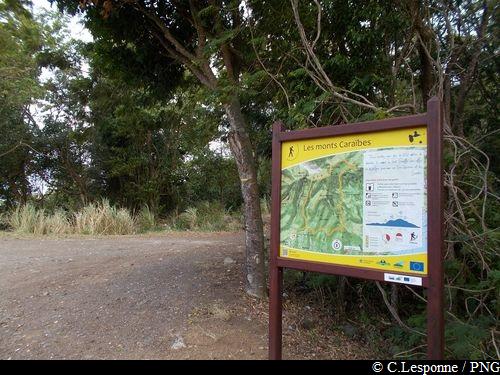
Monts Caraïbes
11 points of interest
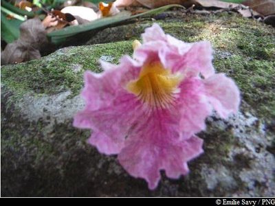
Fleur de Poirier pays - Emilie Savy / PNG  Flora
FloraTabebuia heterophylla
Tabebuya heterophylla, also known as the pink trumpet tree, can be identified by its beautiful pink-coloured flowers with yellow middle that dot the ground. It is very resistant to the wind. Its wood is used as timber or in carpentry. It is also often put to good use to make the saintois canoe.
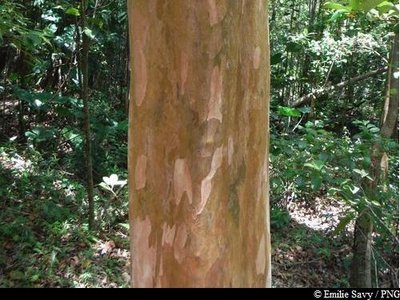
Bois d'Inde - Emilie Savy / PNG FloraWest Indian bay tree
The West Indian bay tree (Pimenta racemosa) is native to the West Indies. Its trunk has green-orange shades. It has fragrant leaves that smell of anis, cloves or lemon depending on where it grows.
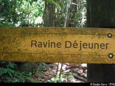
Panneau signalétique - Emilie Savy / PNG  Agricultural landscape
La Ravine Déjeuner
The Déjeuner Ravine testifies to signs of an ancient human presence. Palms were used to locate inhabited or cultivated sites in the forest from far away, including cacao, banana or bread trees. There are also vanilla creepers, which live in the undergrowth and thrive on shade
(see the video link for the "natural areas" magazine which explains how vanilla is grown).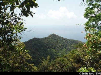
Pointe de Grande Anse - Emilie Savy / PNG  Viewpoint
La Pointe de Grande Anse
Opening onto Pointe de Grande Anse à Trois-Rivières.
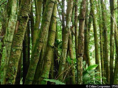
Bambou - Céline Lesponne / PNG FloraBamboo
A member of the Poaceae family, bamboo is more closely related to grasses than to trees. Made up of a woody, hollow stalk, its stem grows extremely quickly. It is both a highly resistant and invasive species in Guadeloupe and concerted efforts are being made to put it to best use in crafts and construction.
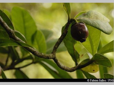
Clusia mangle - Fabien Salles / PNG FloraClusia mangle
Clusia mangle is a member of the Clusiaceae family. It is endemic to the Lesser Antilles, where it is found above 800 metres above sea level, where winds are often fierce and humidity is constant. It is a shrub with leathery, fleshy and shiny leaves. Its fruits, which are between 1-2 centimetres, are similar to big yellow/green olives.
Champfleury et la Madeleine - Emilie Savy / PNG ViewpointViews of Vent Soufflé
The summit of Vent Soufflé offers the perfect vantage point through les Saintes for La Soufrière up to the beach of Grande Anse de Trois-Rivières.
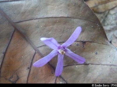
Liane Saint-Jean - Emilie Savy / PNG FloraSaint-Jean creeper
With their purple clusters, the Saint-Jean creeper, also known by French names such as "country lilac" and "coarse creeper", adds a rare splash of colour to this dry area. They are noticeable for their violet flowers on the ground.
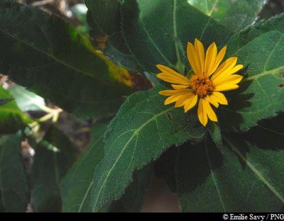
"Soleil" - Emilie Savy / PNG FloraTithonia diversifolia
A member of the Asteraceae family, Tithonia diversifolia is a flowering plant that produces a yellow, daisy-like flower. It was used to aid the dishwashing process. Its creeping leaves, mixed with sand, were highly effective in doing so.
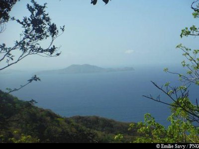
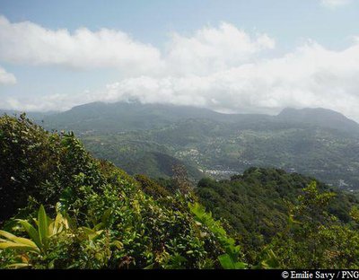
Les Saintes - Emilie Savy / PNG ViewpointViewpoint of les Saintes
A small opening in the vegetation allows for a splendid view of the two main islands of Les Saintes.
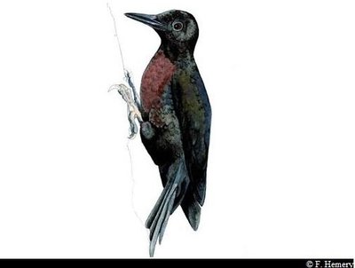
Pic de la Guadeloupe - F. Hemery  Fauna
FaunaGuadeloupe woodpecker
The only endemic bird species to the country, the Guadeloupe woodpecker measures 26-28 cm. Its beak is long and slender and, in the male, is longer than the head, unlike in females. It is adorned with black plumage, has a blood-red throat and belly and blue/black back. It can be seen quite frequently on tree trunks, which it hammers into with its powerful beak (hence its Creole name of "Toto bwa"). It moves over short distances in rippling, gliding movements. The Guadeloupe woodpecker is included on the list of endangered species.
Description
Hiking trail colour: yellow
Take the path which starts from the information boards. Head in the direction of "Ravine Lacroix" / "Gros Acajou" (N.B. The circular trail progresses anti-clockwise).
Go past the bottom of "La Voûte", and keep going until the Déjeuner ravine. The path then follows a steep climb : you will have to even more attentive here.
Once you reach the "Gros Acajou" intersection (Point 1), turn left towards "Vent Soufflé" / "Morne Grand Voûte".
(You can then visit the Houëlment volcanological observatory via le Morne Cadet. The signs are provided by the Coastal Conservatory).
The Monts Caraïbes trail then descends via the ridge until the base of Morne Grande Voûte (Point 2).
Head in the direction of Morne La Classe and then take the narrow path through the dry forest until you get back to point 3 (see map). Then return to the parking area, following the direction "Chateau d'eau" (water reservoir).
- Departure : Water reservoir, Vieux-Fort.
- Arrival : Water reservoir, Vieux-Fort.
- Towns crossed : Vieux-Fort and Gourbeyre
Altimetric profile
Recommandations
As Guadeloupe is prone to natural risks, extra care should be taken in this natural environment. For the benefit of all hikers, responsible behaviour is very important.
Warning : the parking area is unsupervised.
Information desks

rond point "Dos d'Ane", Valkanaërs, 97113 Gourbeyre
Access and parking
GPS coordinates of the start point : Lat : 15,95677 N - Long : 61,70063 W.
At Vieux-Fort, from the main road RD6 : take the town road, which goes up towards the stadium (rue de Matouba) towards the top of the town ("Matouba"). Keep going to the top of the hill, you can park next to the water reservoir and the electrical tower.
Parking :
More information
Source
Report a problem or an error
If you have found an error on this page or if you have noticed any problems during your hike, please report them to us here: