Deville-Maisoncelle loop
An overview of the forest landscapes of the island, before its agricultural recovery in the eighteenth century.
It was the S.A.U.B. (Société Anonyme des Usines de Beauport) who planted this forest in the 1950s, in a perspective of industrial diversification in the Grande Terre.
11 points of interest
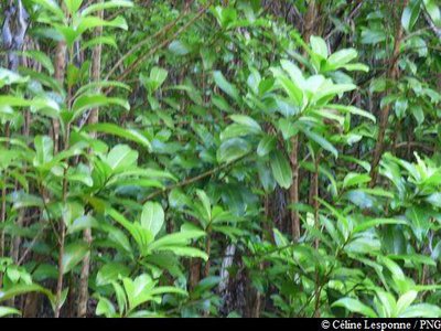
Galba - Céline Lesponne / PNG  Flora
FloraGalba
The galba (Calophyllum calaba) is a dry rainforest tree, recognisable by its very characteristic trunk. Its flowers are white and fragrant.
Since the nineteenth century, its balsam has been called 'Caribbean green balm' or 'Mary's balm' and is traditionally used to assist in the healing of wounds. It has been shown that the oil from the seeds is very rich in unsaturated fatty acids, sterols and vitamin E. It is used in the West Indies to nourish and protect the skin, hair and scalp.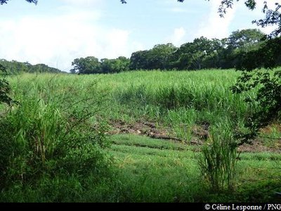
Champs de canne à sucre - Céline Lesponne / PNG  Agricultural landscape
Cane fields
Sugar cane has marked the history and landscape of Guadeloupe since the fifteenth century, the period where it would have begun to be planted in the Caribbean.
Cane is a grass, whose stem is used in the manufacture of sugar and rum; the foliage serves as cattle feed.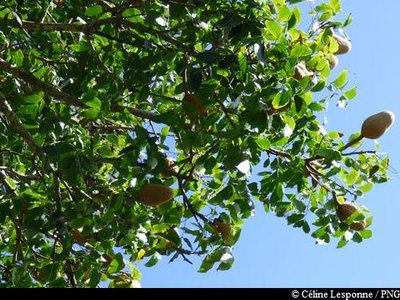
Mahogany Grandes Feuilles - Céline Lesponne / PNG FloraBig-leaf mahogany
Big-leaf Mahogany (Swietennia macrophylla), from the Meliaceae family, is a perennial tree with a large, straight, cylindrical bole. It has small yellowish green flowers.
This species was introduced with the objective of producing wood. In effect, its wood is very popular in cabinetmaking for its hardness and its colours, which has led to overexploitation in its area of origin. It is included in the Annex II of the Endangered Species (Washington Convention).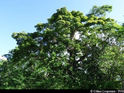
Fromager - Céline Lesponne / PNG FloraKapok tree
The fruits of the kapok tree give a white down, also called kapok.
In Guadeloupe, contrary to other regions and countries, the kapok has a bad reputation. Many legends are associated with it : 'soucougnans' and ghosts. This tree is also linked to the period of slavery: recalcitrant slaves were hanged from its branches.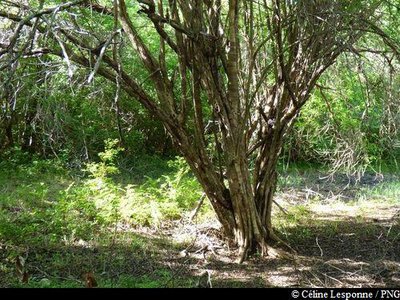
Campêche - Céline Lesponne / PNG FloraBloodwood tree
The bloodwood tree (Haematoxylum campechianum) belongs to the Fabaceae family. It can reach 15 metres in height. Typical of the Caribbean dry rainforest, it is distinguished by its very hard, heavy wood, dark in colour, and its dark red sap. You can obtain a tincture of its wood; the tree was also often used to make charcoal. Its nectar-laden flowers are appreciated by beekeepers.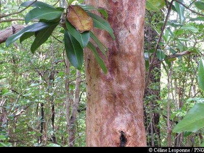
Bois d'Inde (tronc) - Céline Lesponne / PNG FloraBay rum tree
The bay rum tree (Pimenta racemosa) is a shrub which grows in the West Indies. It smells of aniseed, cloves, or lemongrass. The leaves and seeds (allspice) of this shrub are widely used in Guadeloupe cooking. The bay rum tree is also used for its many therapeutic virtues. In fact, Bay Rum can be used as a lotion to relieve rheumatism, bruises and headaches.
Filao (aiguilles et fruits) - Céline Lesponne / PNG FloraAustralian pine
The Australian pine (Casuarina equisetifolia) belongs to the Casuarinaceae family. It is a tree of Australian origin, also present in south-east Asia, the Pacific and the Caribbean. It can reach more than thirty metres in height. Its young green branches greens have a narrow, fluted morphology with a diameter of 2 mm. The Australian pine is a tree pioneer, able to grow in soils which are very poor in mineral elements.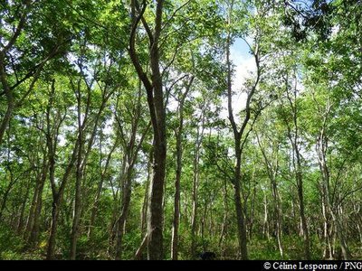
Plantation de Poiriers pays - Céline Lesponne / PNG FloraPink trumpet tree
The pink trumpet tree (Tabebuya heterophylla) is identifiable by its beautiful pink flowers with a yellow heart, which lie scattered over the ground. It is very wind- resistant. Its wood is valued in carpentry, and is used for building. It is also often used to make 'saintoise' canoes.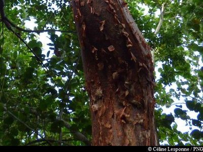
Gommier rouge (tronc) - Céline Lesponne / PNG FloraRed gum
The red gum (Bursera simaruba) is easily recognisable by its reddish bark, which comes off in strips. Under these tatters, the bark is green and smooth.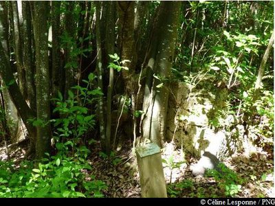
ruine - Céline Lesponne / PNG  Cultural and architectural heritage
Ruin
It is possible to make out the remains of a house wall, at the foot of a Spanish lime tree (Melicoccus bijugatus).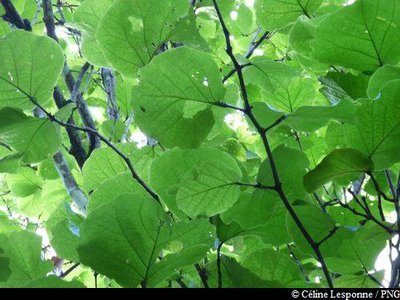
Raisinier Grandes Feuilles - Céline Lesponne / PNG FloraBig-leaf grape
The big-leaf grape (Coccoloba pubescens) is a species of the Polygonaceae family. This tree can reach 25 m in height. Its leaves can measure up to 45 cm in diameter; they are a brilliant green, paler on the back, with yellowish veins. The flowers are a greenish-white. The fruits measure 2 cm in diameter.
Description
Route way-marked : yellow.
---
Take the way-marked path which leads into the forest. Pass through a small marshy area. Continue to a cane field. Turn right. Continue on the path, and then turn left. The path goes along the edge of a field. Continue into the forest, following the way-marks. The path meanders through the forest. Then turn to the left (90° turn) and continue on the path. Come out on to a narrow road, passing dwellings. Then return to the forest. The path runs alongside a plantation, then continues in the forest.
It then comes out in another cane field; cross this and continue in the direction of the forest opposite. Reach the edge of the last cane field; go along it on the left, then go back into the forest. The trail then comes out beside the carbet, at the car park where you started.
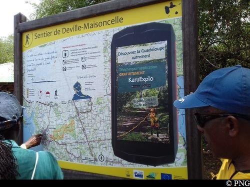
NB: the Departmental Council suggests KaruExplo, a light-hearted mobile app which allows you to explore the forest of Deville through riddles relating to the environment.
App is downloadable on Google Play and AppleStore.
- Departure : beside the RN6, at the bridge over the Ravine Deville.
- Arrival : beside the RN6, at the bridge over the Ravine Deville.
- Towns crossed : Petit-Canal
Altimetric profile
Recommandations
Footpath cleared 10.2017 after Hurricane MARIA.
--
In the natural environment, prudence and vigilance must be exercised, since Guadeloupe is subject to natural hazards. Adopting responsible behaviour is essential for hiking to remain a pleasure!
Attention: parking not supervised.
Information desks

2 rue Gambetta, 97117 Port-Louis
Access and parking
Starting point : Lat : 16,37752 N - Long : 61,47874 W.
---
On the RN6 :
• coming from the south (Pointe-à-Pitre / Morne-à-l'Eau): hike starts at the side of the main road (parking + picnic carbet), by the bridge over the Ravine Deville, BEFORE the village of Petit-Canal ;
• coming from the North (Port-Louis): hike starts at the side of the main road (parking + picnic carbet), by the bridge over the Ravine Deville, AFTER the village of Petit-Canal.
Parking :
More information
Source
Report a problem or an error
If you have found an error on this page or if you have noticed any problems during your hike, please report them to us here: