Sentier de Beautiran
December 2024 : change of starting point of the hike ; follow the markings starting from the "slave steps" (town of Petit-Canal).
Attachment
- Downloadpdf
depliant_bel_beautiran_2015
Credit: dépliant Beautiran (Histoire et patrimoine) - assoc. "Bel Botiran"
11 points of interest
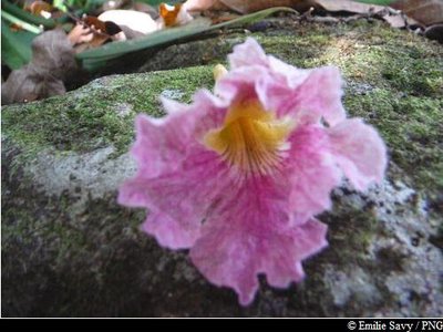
fleur de Poirier pays - PNG  Flora
FloraTrumpet Tree
The pink trumpet tree (Tabebuya heterophylla) is identifiable by its beautiful pink flowers with a yellow heart, which lie scattered over the ground. It is very resistant to the wind. Its wood is valued for carpentry, and is used for building. It is also often used in the composition of 'saintoise' canoes.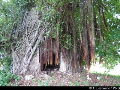
moulin et racines aériennes de Figuier - PNG  Cultural and architectural heritage
Moulin de Sainte-Amélie
Remains of the mill at Sainte-Amélie; the tower is encircled by a fig tree. Windmills were used to crush the stems of the sugarcanes to extract the juice (vésou), used to manufacture of sugar and then rhum agricole (cane juice rum).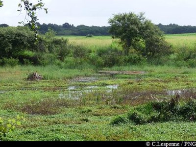
la mare - PNG  Pond
PondMare de Castex
A damp area in the middle of the cane fields, the Mare is an attractive place for water birds (herons, water hens, etc.) who come there to feed.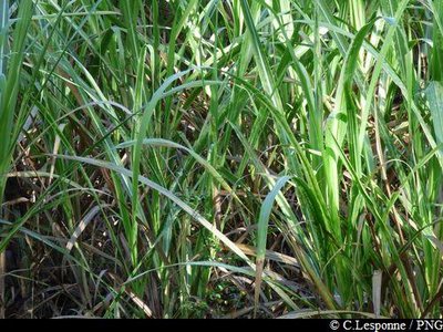
cannes à sucre - PNG  Agricultural landscape
Sugar cane fields
Sugar cane has marked the history and landscape of Guadeloupe since the fifteenth century, the period where it would have begun to be planted in the Caribbean. Cane is a grass, whose stem is used in the manufacture of sugar and rum; the foliage serves as cattle feed.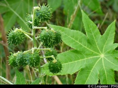
Carapatier (fruits verts) - PNG FloraCastor Oil Tree
The castor oil tree (Carapatier) is a pioneer plant, which means it is one which colonises open spaces. Carapate oil is manufactured from the seeds of the shrub. It has a cosmetic use, being recommended for the care of the hair.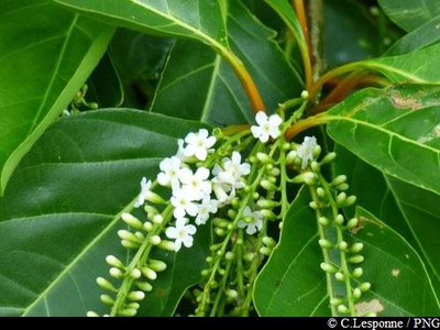
Bois carré en fleurs - PNG FloraFiddlewood tree
Characteristic of the dry rainforest in Guadeloupe, the fiddlewood (Citharexylum spinosum) can reach 15 metres in height. It is recognisable by its orange leaf-stems and its clusters of small round fruit, ranging from orange to black. Its flowers are white, perfumed and nectar-laden. Its twigs are square in section, giving the tree its common name.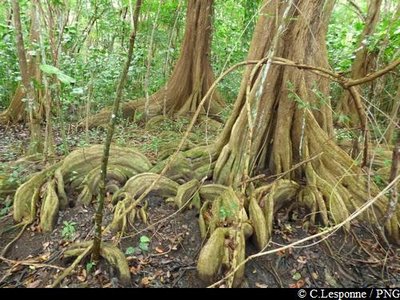
PNG FloraDragonsblood tree
The Dragonsblood (Pterocarpus officinalis) is a characteristic tree of the swampy forest, located behind the mangroves. It often has often imposing buttress roots, and its bark produces a red resin.Attachment
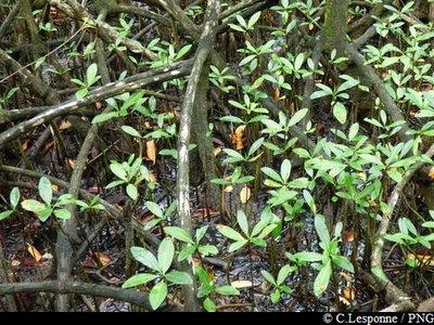
PNG FloraMangrove
On either side of the trail you will see the mangrove. Between the sea and the swampy forest, this vegetation consists of red, black, white and grey mangrove trees. The attached PDF describes the features which allow you to distinguish between these species.Attachment
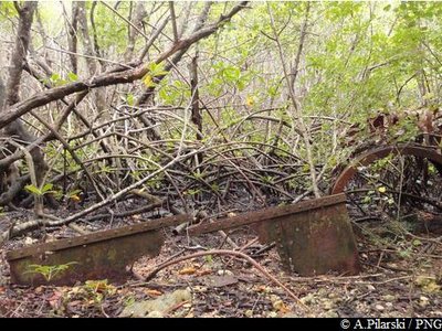
vestiges de métal - PNG  History
Industrial ruins
All along the trail, ruins of the industrial past of the site of Beautiran are still visible: rails, wagons, ancient storage buildings, etc.
It was the Clugny sugar farm which, in the late nineteenth century, invested in building a railway to connect it to the landing at Beautiran. In that way, its production could be routed to the port, and then shipped to Pointe-à-Pitre.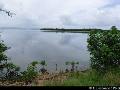
PNG  Viewpoint
Sea view
Coming out of the mangroves, there is a beautiful viewpoint over the bay of Grand Cul-de-Sac Marin as well as the contours of Sainte-Rose, in the distance.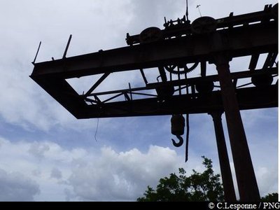
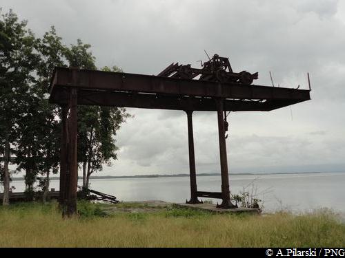
l'ancien portique - PNG HistoryOld Port of Beautiran
In the eighteenth and nineteenth centuries, Beautiran was the landing stage used by the neighbouring sugar farms (Beauport). There could be seen the wagons and dug-out canoes used to transport the sugar and rum to Pointe-à-Pitre. The Beautiran site was therefore a centre of activities for the trading fleets and their slaves. It was finally closed in the1960s.
Its equipment can still be seen, including the loading gantry (1865).
Description
Hiking trail colour : yellow.
---
- Departure : coming out of the village of Petit-Canal, after the new stadium, take the small path leading westwards.
- Towns crossed : Petit-Canal
Altimetric profile
Recommandations
As Guadeloupe is prone to natural risks, extra care should be taken in this natural environment. For the benefit of all hikers, responsible behaviour is very important.
Please note: the parking is not supervised.
Information desks

2 rue Gambetta, 97117 Port-Louis
Access and parking
Starting point : Lat : 16,38525 N - Long : 61,48295 W.
---
Coming out of the village of Petit-Canal and heading for Port-Louis, go past the new stadium then turn left on the first non-metalled track. Parking at the start of the track, near the hike information panel.
Parking :
More information
Source
Report a problem or an error
If you have found an error on this page or if you have noticed any problems during your hike, please report them to us here: