Deshaies coastline
11 points of interest
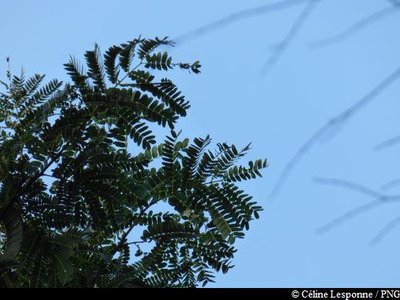
feuilles de "Tendacayou" - Céline Lesponne / PNG  Flora
FloraTendacayou
Acaia muricata is also known as Tendacayou because of the extreme hardness of the wood. Its small white flowers produce plenty of honey.
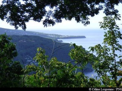
point de vue sur Deshaies - Céline Lesponne / PNG  Viewpoint
First viewpoint
Near the summit of Gros Morne, fine views to the south, with la Pointe Batterie and l'Anse de Deshaies below.
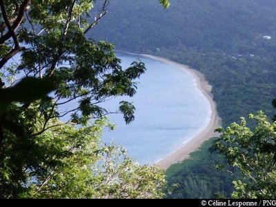
vue sur Grande Anse - Céline Lesponne / PNG ViewpointSecond viewpoint
On starting your descent, there are splendid views of Grande Anse bay to the north.
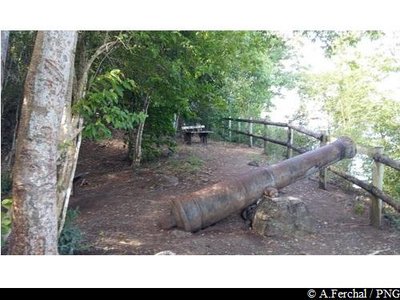
batterie de canons - A.Ferchal / PNG  History
Battery of canons
A battery of canons was once placed here to protect Grande Anse bay. For almost a whole century, Guadeloupe was a battleground for violent clashes between the French and English. A few years ago, this location was equipped with tables, allowing walkers a chance for a break after climbing Gros Morne.
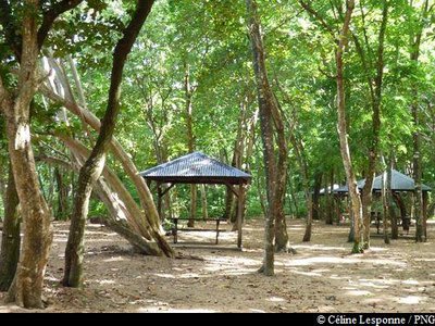
carbets - Céline Lesponne / PNG  Area of relaxation
Carbets
At the back of Grande Anse beach, some traditional carbet shelters are available for a well-deserved break.
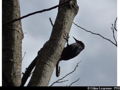
Pic de la Guadeloupe - Céline Lesponne / PNG  Fauna
FaunaGuadeloupe woodpecker
The only endemic bird species to the country, the Guadeloupe woodpecker measures 26-28 cm. Its beak is long and slender and, in the male, is longer than the head, unlike in females. It is adorned with black plumage, has a blood-red throat and belly and blue/black back. It can be seen quite frequently on tree trunks, which it hammers into with its powerful beak (hence its Creole name of "Toto bwa"). It moves over short distances in rippling, gliding movements. The Guadeloupe woodpecker is included on the list of endangered species.
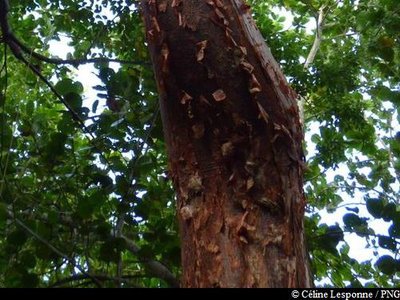
Gommier rouge - Céline Lesponne / PNG FloraBursera simaruba
Bursera simaruba is easy to spot, on account of its reddish bark that comes off in scraps. Its bark is green and smooth underneath.
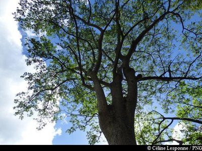
Mahogany - Céline Lesponne / PNG FloraThe West Indian Mahogany
The West Indian Mahogany (Swietenia mahagoni) is a robust species native to Ispagnola. This dry forest tree was initially planted as an ornamental feature for houses, but then spread elsewhere. Despite the wood being of extraordinary quality, it grew too slowly to be used in reforestation. When degraded forests needed to be revived and enriched, foresters turned to this tree for the task.
vestiges du mur - Céline Lesponne / PNG HistoryOld walls
The trail runs along the coast until Pointe Le Breton. You can still see the remnants of the old colonial road, including wall sections which have fallen into disuse but are still visible on the roadside.
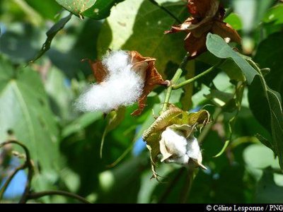
cotonnier - Céline Lesponne / PNG FloraGossypium
Gossypium is a generic name for all plants that produce cotton, whether in the wild or grown specifically for the purpose. There are different uses for the various parts of cotton plants: the fibrous hairs (cotton), which vary in size depending on the species and variety, the shorter fibres (linters), and the olive and protein-rich seeds. Other species are used as ornamental plants.
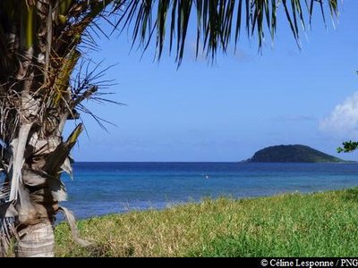
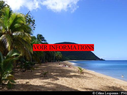
vue sur Kahouanne - Céline Lesponne / PNG ViewpointViewpoint
From the seafront to "Rifflet", a magnificent view of l'îlet Kahouanne, classified as a central part of the National Park.
Description
Hiking trail colour: yellow
The hike begins near to the Bethsy school, behind the sports field. Cross a small concrete bridge and start your walk into the forest. The trail climbs steadily to the top of Gros Morne. Then start your descent north: the path winds down, passes by the battery of canons and ends up at the backshore of Grande Anse de Deshaies. Follow the shady path by the beach and then come out onto the beach itself. Go past the mouth of the Mitan river. Go up the beach, cross the large parking area next to the restaurants and head onto the marked trail that leads north and goes past houses and cottages. Continue on the coastal path until Pointe Le Breton. The trail ends here, so take the small seafront path towards "Rifflet". Walk along the back shore until you reach La Perle beach and then head for the parking area. There are showers available on the beach.
N.B. As this is a circular trail, make sure to leave your vehicle at the start point.
- Departure : Deshaies, in the village: at the bottom of Gros Morne (near the cemetery).
- Arrival : Deshaies, La Perle beach.
- Towns crossed : Deshaies
Altimetric profile
Recommandations
As Guadeloupe is prone to natural risks, extra care should be taken in this natural environment. For the benefit of all hikers, responsible behaviour is very important.
The northern Basse Terre coastline includes some nesting sites for sea turtles. Please treat the beaches with due consideration !
Please note: the parking and swimming areas are not supervised.
Information desks

le bourg, 97126 Deshaies
Access and parking
GPS coordinates of the start point : Lat : 16,30959 N - Long : 61,79440 W.
At Deshaies : in the town, go to the bottom of Gros Morne. Walk in the direction of the cemetery and Bethsy school. The hike starts from behind the school.
Parking :
More information
Source
Report a problem or an error
If you have found an error on this page or if you have noticed any problems during your hike, please report them to us here: