Morne Morel
Terre-de-Haut
Morne Morel
Very easy
2h
2,7km
+143m
-139m
Loop
PR (short hike network)
Embed this item to access it offline
4 points of interest
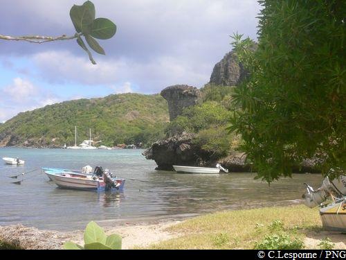
Baie du Marigot - F.Frederic - CD 971  Viewpoint
Viewpoint : Baie du Marigot
A glorious view over the many shades of turquoise in the waters of the Baie du Marigot.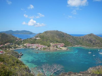
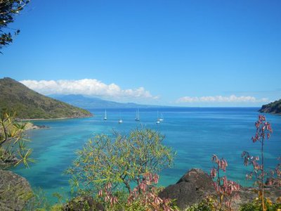
Vue sur la Baie du Marigot et le Fort Napoléon - F.Frederic - CD 971 ViewpointViewpoint : Baie du Marigot, Basse-Terre
The panorama of Fort Napoléon overlooking the Baie du Marigot, and the south of Basse-Terre.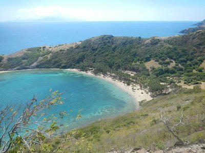
Vue sur la Baie de Pompierre et la Dominique - F.Frederic - CD 971 ViewpointViewpoint: Baie de Pompierre, Dominique
View from La Batterie Caroline, over the Baie de Pompierre, with the island of Dominique in the background.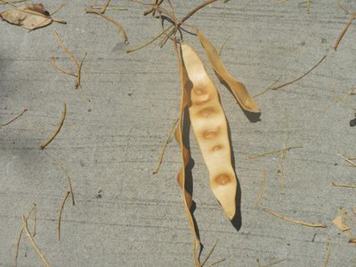
Gousse de l'Albizia lebbeck - F.Frederic - CD 971  Flora
FloraOld Woman's Tongue
A specimen of Albizia lebbeck, Old Woman's Tongue ("lang a vyé fanm"), whose pods 'sing' as the wind blows over them.
Description
Hiking trail colour : yellow.
---
Start the climb from the Conservatoire du Littoral information panel and follow the yellow way-markers. After a climb of approximately 570m, go along the fence (on the right-hand side) to reach the viewpoint (260m there and back) over Terre-de-Haut, Terre-de-Bas and Basse-Terre.
Come back along the same path to continue the climb. Carry on to a crossroads and turn right to reach the ruins of La Batterie Caroline (from the fortified platform there is a spectacular view over Dominique, Marie-Galante and, lower down, Pompierre beach).
Go back along the path, as far as the last junction. Begin the descent to the left, by the hairpin bends; go between the houses, taking the metalled road. When you reach the road (Pompierre beach is on the left), take the right turn to return to the starting point.
Be careful ! Be sure to follow the way-markers (there are several other trails along that 'trace')
- Departure : Baie du Marigot (beside the restaurant).
- Arrival : Baie du Marigot (beside the restaurant).
- Towns crossed : Terre-de-Haut
Altimetric profile
Recommandations
Be careful ! Be sure to follow the way-markers (there are several other trails along that 'trace')
Information desks

Place du Gouverneur Du Lion, débarcadere, 97137 Terre-De-Haut (Les Saintes)
Access and parking
Starting point : Lat : 15,872906 N - Long : 61,578608 W.
---
At Terre-de-Haut : from the town, beside the church, take the Pompierre direction. Go up the hill, then down again. At the crossroads by the stadium, head for the Baie du Marigot, the starting point of the hike.
---
At Terre-de-Haut : from the town, beside the church, take the Pompierre direction. Go up the hill, then down again. At the crossroads by the stadium, head for the Baie du Marigot, the starting point of the hike.
Source
Rando Guadeloupehttps://www.randoguadeloupe.gp/
Report a problem or an error
If you have found an error on this page or if you have noticed any problems during your hike, please report them to us here: