Montana Trail
A change of scenery is guaranteed when discovering this "lunar"-looking environment swept by Atlantic sea spray and teeming with animal species (sheep, goats, iguanas, passerines) and plant species (agaves, mapous, sea grape trees, cacti) that have adapted to extreme conditions.
11 points of interest
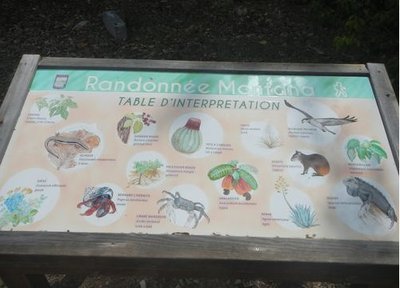
Table d'interprétation - CD 971  Information board
Explanatory panel
An explanatory panel describes the species (fauna and flora) which may be encountered on the trail.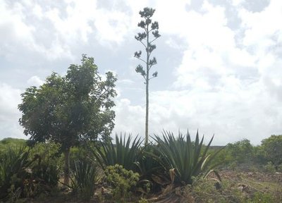
Agave endémique des Petites Antilles - CD 971  Flora
FloraAntigua Agave
A specimens of Agave Karatto, adapted to dry, hot stony soils. Its imposing flower stalk announces the end of the plant's life.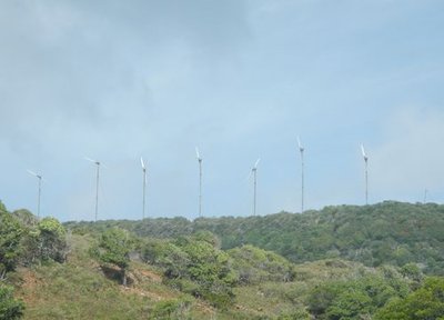
Parc éolien - CD 971  Summit
Wind Farm
View of the wind farm on the mountain plateau overlooking the trail.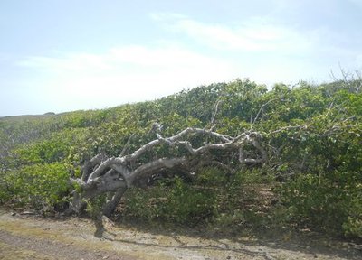
Mapou gris - CD 971 FloraGray Mapou (birdcatcher tree)
Specimen of Mapou Gray, Pisonia subcordata. Its branches lean in the direction of the prevailing winds.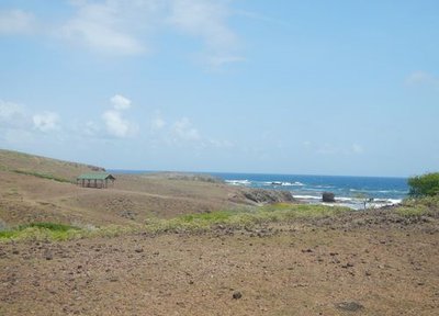
Carbet de la Pointe Mancenillier - CD 971  Area of relaxation
Carbet
This carbet invites you to take a break while enjoying the ocean panorama from the Pointe Mancenillier.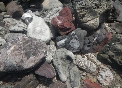
Patchwork rocailleux - CD 971  Geology
Rocky patchwork
This conglomeration of rocks of various types testifies to the geological character of the remarkable La Désirade.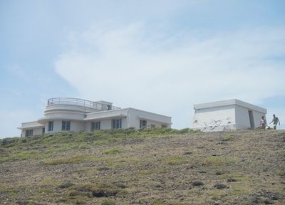
Ancienne station météo (façade Est) - CD 971  Cultural and architectural heritage
Former weather station
View of the abandoned weather station, whose Art Deco architecture was inspired by the work of Ali Tur.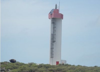
Phare de la Désirade - CD 971 Cultural and architectural heritageLighthouse
Lighthouse of la Désirade.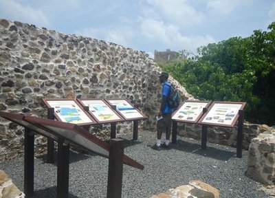
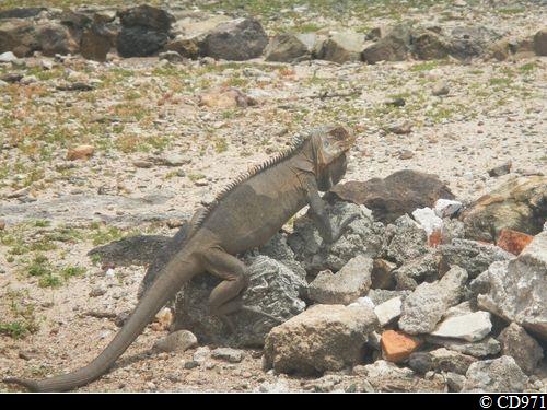
panneaux explicatifs - CD 971 Cultural and architectural heritageRuins of the old cotton farm
The site which was once home to a cotton farm and a leper colony now offers a exhibition tracing the geological history of la Désirade through information panels, as well as a rest area which has calmly been taken over by a group of iguanas.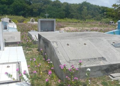
Cimetière marin - CD 971 Cultural and architectural heritageMarine cemetery
Last resting place, lulled by the tides.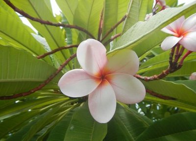
Fleur de frangipanier - CD 971 FloraFrangipani
Frangipani flower, Plumeria.
Description
Starting from the 'trace' entry sign, follow the waymarkers which lead up to Pointe Mancenillier. On reaching the coast, on the edge of the geological nature reserve, turn right, taking care on the stony trail leading towards Pointe Doublé.Then, after the weather station, reach the road which passes the lighthouse, the former cotton farm and the marine cemetery, to return to the start.
- Towns crossed : La Desirade
Altimetric profile
Recommandations
Trail cleared following Hurricane MARIA.
--
Trail mainly open; be sure to hydrate regularly.
Slippery passages on the stones: wear hiking shoes.
Beware of the manchineel trees (every part is poisonous).
Information desks
"Beausejour", capitainerie, 97127 Désirade
Transport
Bus service from the port with Karulis.
Access and parking
Starting point : Lat : 16,33052°N - Long : 61,01702°W.
---
From the marine port, follow the D207 as far as Baie-Mahault school.
Parking :
More information
Source
Report a problem or an error
If you have found an error on this page or if you have noticed any problems during your hike, please report them to us here: