Solitude
Named after a mulatto slave girl called Solitude, who went into hiding after slavery returned to Guadeloupe in 1802. She took part in the saga involving Louis Delgrès and fought for freedom, but was ultimately captured. She was executed a day after she gave birth and became a symbol for courage.
9 points of interest
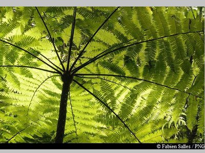
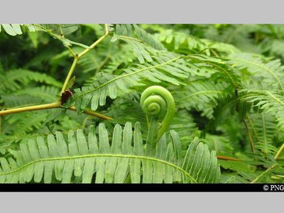
Fougère arborescente - Fabien Salles / PNG  Flora
FloraTree ferns
Tree ferns (Cyathea sp.), members of the Cyatheaceae family, include six species, the biggest of which (C. Arborea) can grow taller than 18 metres. Contrary to what the name suggests, tree ferns are not actually trees. The young leaves have the distinctive shape of a cross, while the black stipe is covered with petiole remnants. The fibrous material at the base of the stipe can be used to make sculptures and containers.
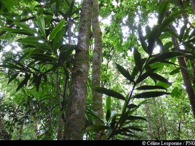
Laurier - Céline Lesponne / PNG FloraThe Yucca Plum Pine
Podocarpus coriaceus is also commonly known as the Yucca Plum Pine. It is a member of the Podocarpaceae family. Closely related to conifers, it is an average-sized tree, measuring around 10-16 metres. Its leaves – dark green on top – have a leathery quality that is reminiscent of the common oleander. They have a span of 6-15 cm with no discernible stalk. While its flowers are discreet, its brown-coloured seeds in their red floral buds are particularly eye-catching. It has a thin layer of bark. This species is found throughout the West Indies and flowers mainly in December and January.
Gommiers blancs - Céline Lesponne / PNG FloraThe Gommier
The Gommier (Daryodes excelsa) can grow up to 35m high. When they are damaged, its white trunk and roots exude a white resin with a pungent turpentine smell, which is traditionally used as incense or to start fires, because it burns slowly regardless of the surrounding humidity. It is reported that the tree has the ability to cast out spirits. It is strictly forbidden to take away any plant parts from the National Park. Its trunk was used by American Indians to make their canoes (kanawa), and is still used today by coastal people from many tropical countries, such as Dominique, to make fishing vessels. Its green seeds are popular with pigeons.
fougères Calumets - PNG FloraForked ferns
Dicranopteris pectinata is a member of the Gleicheniaceae family. It is a pioneer species that thrives in an open and sunny environment. It tends to colonise landslide areas, the edges of forest roads and rivers and, more generally,
any surfaces that have been severely stripped back in wet areas. Its network of underground roots plays a key role in consolidating the topsoil.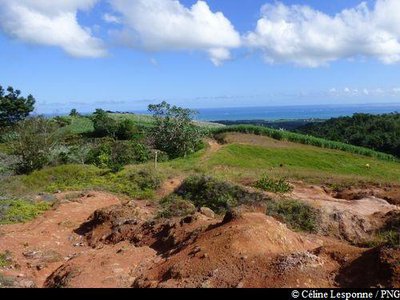
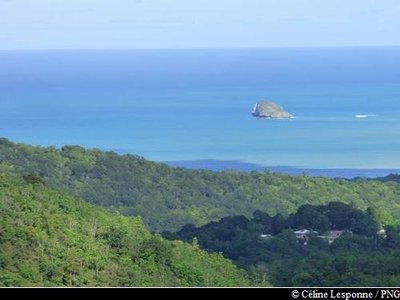
vue sur le Grand Cul-de-Sac Marin - Céline Lesponne / PNG  Viewpoint
Views of le Grand-Cul-de-Sac Marin
On leaving "Bois du Comté", the first splendid view of the bay of Grand Cul-de-Sac Marin to the north awaits.
Bois-Canon en bord de chemin - Céline Lesponne / PNG FloraPumpwood
Most common in light, windfall areas or at roadsides, the Pumpwood (Cecropia shreberiana) consists of a straight, hollow trunk with white bark and few branches. When you leave the forest and when you arrive at the intersection with the road, you cannot miss it. Its webbed leaves are white underneath and highly distinctive. They are green on top and form in clusters at the ends of branches. The tree flowers all year round. In traditional medicine, its leaves are made into a decoction which is used as a diuretic. It also acts as a tonic, anti-asthmatic and cardiac stimulant. Its latex can be used to treat bruises and surface wounds. The sap from its folded leaves is used to treat bronchitis.
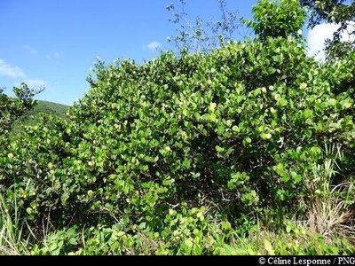
Icaquiers - Céline Lesponne / PNG FloraIcacos
The icaco is the fruit of the icaco tree, a shrub from the Chrysobalanceae family that grows in tropical regions. Its white flesh and floury pulp is edible.
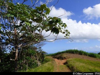
le Grand Cul-de-Sac Marin et Tête-à-l'Anglais - Céline Lesponne / PNG ViewpointView of le Grand Cul-de-Sac Marin
Carrying on your descent to "Solitude", second viewing point of le Grand Cul-de-Sac Marin. You can see islet Tête-à-l'Anglais in the bay.
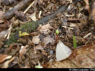
fourmis manioc - Céline Lesponne / PNG  Fauna
FaunaLeaf-cutting ant
The Acromyrmex octospinosus is sometimes also called the leaf-cutting ant. Large worker ants can measure over 1 cm, but small worker ants are less than 0.4 cm. There are between 10,000-20,000 ants in a colony. There is a mutually beneficial relationship (symbiosis) between these ants and the fungus that they produce. The fungus nourishes the ant, while the ant promotes the spread of the fungus by cultivating it. It also contributes to the growth of its culture by chewing on the plants which are used as a substrate. The leaf-cutting ant is considered an invasive species in Guadeloupe, wreaking havoc with many plants, such as ferns.
Description
Hiking trail colour: yellow
From Morne Mazeau : head out from the forest, starting at the information boards. After 200 metres, keep going straight on to the intersection. At the next intersection, turn left towards "Solitude". Then take on a long descent (around 4 km) into the forest, still in the direction of "Solitude". Once you emerge from the forest, the path then crosses sugar cane fields. Keep going straight downhill over the paved path. Follow the yellow markings and the path through the fields until you come out at the concrete road for "Solitude" (information board and parking area from the start).
To start : go down the road until the first junction (Route RD18). Turn left towards "Desbonnes" and "Caféière". Go as far as the junction on Route RN2 (close to the Grande Anse beach). Turn left, go past the village of Deshaies then join the starting point at Morne Mazeau, returning to your vehicle.
N.B. As this is a circular trail, make sure to leave your vehicle at the start point.
- Departure : Deshaies, summit of Morne Mazeau.
- Arrival : Sainte-Rose, "Solitude" (between Desbonnes and Duzer).
- Towns crossed : Sainte-Rose and Deshaies
Altimetric profile
Recommandations
As Guadeloupe is prone to natural risks, extra care should be taken in this natural environment. For the benefit of all hikers, responsible behaviour is very important.
Warning : the parking area is unsupervised.
Information desks

Place tricolore, 97115 Sainte-Rose
le bourg, 97126 Deshaies
Access and parking
GPS coordinates of the start point : Lat : 16,28862 N - Long : 61,76533 W.
-> From the north/Deshaies :
on Route Nationale RN2, around 2KM after the village, turn left at the bus stop "Mazeau" (opposite the "Villiers" substation): take the concrete road going uphill. Then at the crossroads, keep going uphill on the left. Continue until you reach the top of the hill and park on the side of the road, near the seismological monitoring station.
-> From the south / Pointe-Noire :
On Route Nationale RN2, around 3km after the beach at Ferry à Deshaies, turn right until the bus stop "Mazeau" (opposite the substation "Villiers"): take the concrete road leading uphill.Then, at the crossroads, keep going on the left. Keep going until the top of the hill and park on the side of the road, near the seismological monitoring station.
Parking :
Source
Report a problem or an error
If you have found an error on this page or if you have noticed any problems during your hike, please report them to us here: