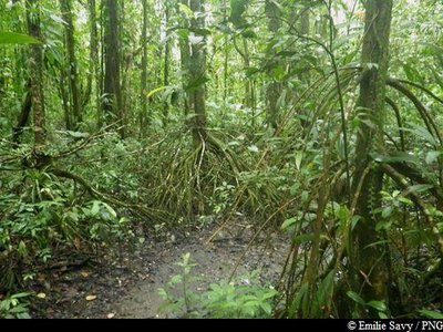
North Alizes trail
12 points of interest
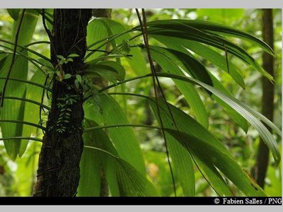
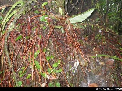
"Ailes à mouches" - Fabien Salles / PNG  Flora
Flora"Ailes à mouches"
A member of the Cyclantaceae family, the French common name of Asplundia rigida translates literally as "fly wings" on account of its similarity with the insect. A typical plant of hygrophilous (moisture-loving) forest undergrowth, there are three species of Asplundia: two terrestrial and one epiphytic and lianescent (vines climbing from aerial routes).
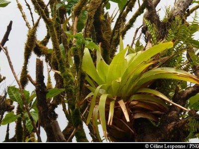
"Ananas bois" - Céline Lesponne / PNG FloraGlomeropitcairnia penduliflora
Commonly known in Creole as "Zanana mawon", Glomeropitcairnia penduliflora is a member of the Bromeliaceae family. It is a tropical grass, epiphyte on tree branches, or terrestrial. It has straight, tough and thick leaves which, arranged in the format of rosettes, take in substantial levels of water and are even home to some frogs. It features a floral scape in the middle.
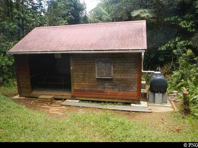
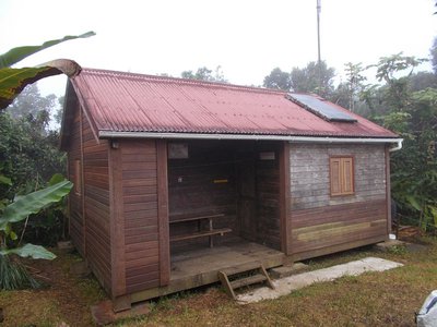
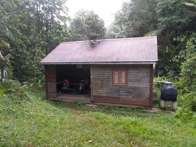
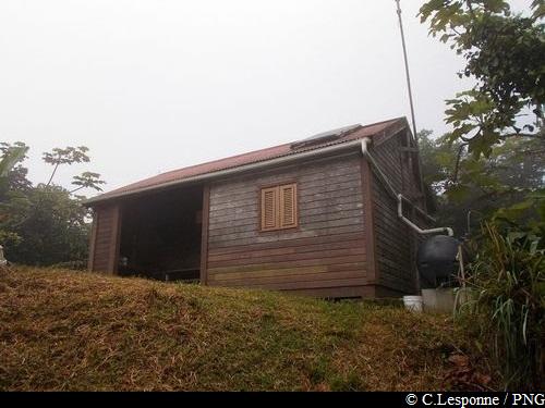
Refuge du Morne Léger - PNG  Mountain shelter
Morne Léger bivouac
The Morne Léger bivouac (shelter) has room for around 10 people to sleep in the heart of the rainforest.
It is strongly recommended that you bring your own floor mat or hammock (plus fasteners), because there are only wooden bunks available on site.
N.B. The shelters have no running water or electricity available. They are not supervised and do not include a cleaning service. Please leave them clean and tidy !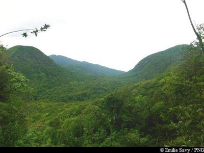
Les deux Mamelles - Emilie Savy / PNG  Viewpoint
Les Mamelles
View of Les Mamelles : La Mamelle de Pigeon to the west and La Mamelle de Petit-Bourg to the east.
Palétuvier jaune - Emilie Savy / PNG FloraMapou baril
Sterculia caribea, known in Créole as Mapou baril, is endemic to the Lesser Antilles. The leaves of this plant can differ depending on its age. Its flowers appear in the form of a bunch of small yellow and pink bells. It produces quite distinctive fruits that cluster together in groups of four or five in woody follicles: they are lined on the inside with dark red urticating bristles.
"Bwa rouj karapat" - Emilie Savy / PNG FloraAmanoa caribeae
Amanoa caribeae belongs to the Euphorbiaceae family. This species is endemic to the Lesser Antilles.
It is a large tree with a trunk that rests straight on its buttresses, depending on the terrain. The most distinctive features of this species are its reddish bark and roots at the foot of the trunk. Its leaves vary in shape: sometimes they are whole, sometimes pointed. Its flowers form small clusters. The hard wood of this tree was used as timber or in carpentry.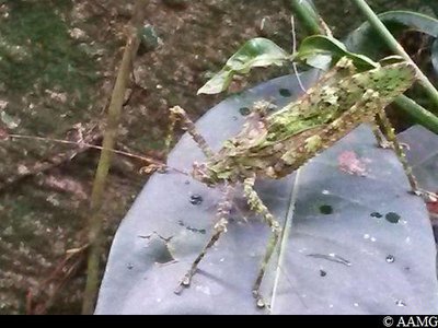
"gratte kwi" - AAMG  Fauna
Fauna"Gratte kwi"
An animal named after the noise it makes with its hind legs, recalling the sound produced when calabash containers are made (kwi).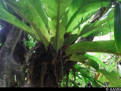
siguine rouge - AAMG FloraBird's nest anthurium
Anthurium hookeri is a member of the Araceae family.
It is often epiphytic, clinging to trees with its roots.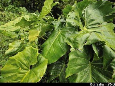
siguine blanche - PNG FloraPhilodendron giganteum
It can grow both in trees and on the ground.
When it rains, it's a good idea to take shelter under its large leaves until the squall is over.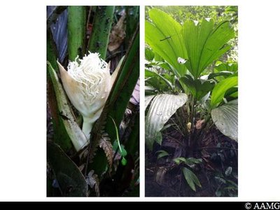
aile a mouche (fleur) - AAMG Flora"Aile à mouche" (lit. "Fly wing")
Asplundia insignis, can be seen here with its flower and fruit (photo).
 Summit
Morne Jeanneton
Summit of Morne Jeanneton, altitude of 744 m.- Summit
La Couronne
Summit of La Couronne, 683 m.
Description
Set off towards the Morne Léger shelter, following the markings. Go past the refuge.
At the "Morne Léger" intersection (point 1), turn left towards "Morne à Georges".
Then turn right at the "Fendre Fouque" intersection (point 2); go past "Richard", "Désirade" and "Morne Jeanneton", before arriving at the intersection with the Trace des Contrebandiers (high-voltage line and pylon; point 3). Continue north and go up "La Couronne"; follow the markings to the "Belle Hôtesse" refuge. It is possible to spend the night here.
You can then continue along other trails: either go down towards "Trou Caverne", Pointe Noire, to the west, if you have car ready to take you back; or continue north towards Morne Mazeau and the end of the Alizés GR trail to the Sainte-Rose coast.
- Departure : Col des Mamelles, RD23 Route de la Traversée.
- Arrival : Belle Hôtesse shelter, Pointe-Noire.
- Towns crossed : Petit-Bourg, Pointe-Noire, Lamentin, and Sainte-Rose
Altimetric profile
Recommandations
It is a good idea to be accompanied by a mountain guide (INFO).
Don't forget to take plenty of water and some food.
It is recommended to take a change of clothes with you, as the trail is often muddy.
Non-drinkable water only in the refuges.
---
In this natural setting, you should be particularly careful and alert, especially since Guadeloupe is subject to natural risks. It is vital to act in a responsible way, so that everyone can enjoy the hike!
Please note: unsupervised car park.
Information desks

au C.R.E.P.S. des Antilles Guyane ; Route des Abymes - BP 220, 97182 Les Abymes cedex
Maison de la Forêt
RD 23 - Route de la Traversée, 97170 Petit-Bourg
Opening hours :
- In low season (May 1 to June 30 and September 1 to October 31) : every day (except weekends) from 9 am to 4.30 pm.
- In high season (November 1 to April 30 and from July 1 to August 31) : every day from 9 am to 4.30 pm ; sunday from 9 am to 12.30 pm.
Services: reception, permanent exhibition, free parking. Building and restrooms accessible to people with reduced mobility. Picnic area nearby.
Please note : parkings are not supervised.
Localisation GPS : Lat: 16,17600 N - Lng: 61,69280 W.
le bourg, 97126 Deshaies
Access and parking
GPS starting point: Lat: 16.18149°N - Long: 61.73601°W.
---
RD23 departmental road, Col des Mamelles.
Parking :
Source
Report a problem or an error
If you have found an error on this page or if you have noticed any problems during your hike, please report them to us here: